| Activity | Hiking |
| Destination | Cortes Island, Linnaea Farm |
| Date | 18-20 Apr, Monday-Wednesday |
| Trip Coordinator | Margot Wood |
| Contact Info | 250-285-2393. Please contact the coordinator by April 1st. |
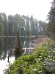
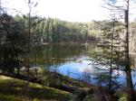
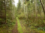
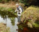
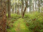
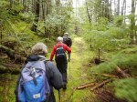
| Description | Planning three days of hiking on Cortes Island, staying at Linnaea Farm House. This is an eight bedroom rustic farmhouse, on the edge of Gunflint Lake at the gateway to many of the hiking trails on Cortes. This is still an active farm & was once the residence of the farmers who ran Lakeview Dairy, the last raw milk in B.C. I have ordered beautiful weather, allowing us to hike many of the trails, Green Mountain, Easter Bluff, Kw’as Park, Hanks Beech Forest Park, Sisken Forest Park, Carrington Trails etc. Or you can sign-up for farm chores. If you wish to bring your kayak, we can paddle the lake & beyond. A schedule of trails will be developed & presented daily with your input. I would also like to take you to the ‘Free Store’….pretty neat. Pot-luck dinners will be organized, using the kitchen at the farmhouse. You may chose to stay one/two nights……..let me know. Please check: www.linnaeafarm.org |
| Meeting Place | Cortes ferry terminal |
| Departure Time | 9:05 ferry to Cortes |
| Difficulty | easy to moderate |
| Costs | $50 per night with bed linens/ $30 per night with own sleeping bag. Ferry round trip. |
| Trip limits | When the bedrooms are full. |
| Dogs? | No. Not allowed at the farm. |
| Notes: | Car pooling will be organized. Bring food for breakfast, & lunch and pot-luck dinners. Hope you can make this trip before we get out into the garden. |
Author Archives: qioutdoorclub
Trip Report – B&B Trail Loop – 3 Feb 2016
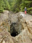
Despite the gloomy forecast for a blustery rainy day, five hikers set out on the Thompson Trail from the Thompson Road trailhead, then branched off to the first marked viewpoint. Although the Coast Mountains were hidden due to the weather, there was still a good view to the east over the islands. From the viewpoint, we followed the open mossy ridge downhill to a forested trail which connected to the B&B Trail. This trail was named for two now defunct Bed and Breakfast establishments in the vicinity of Harper Graham’s corner on Hyacinthe Bay Road, where the trail begins. We turned left (south) on the B&B Trail to an unmarked junction where we branched off on a side trail to the right (north), which led us uphill to a bluff above Hyacinthe Bay Road. We climbed west to the top of the ridge (153 meters altitude which is slightly higher than the Hopespring viewpoints) over mossy open bluffs. At the top we had a panoramic ocean view to the east and southeast, and forests to the west and south, well worth the effort. We returned on the side trail to the B&B unmarked junction and turned right to carry on uphill (south). For a good part of its length, the B&B Trail overlooks a rushing stream set in a deep gully. At the Thompson Trail junction we turned left (east) and hiked back to Thompson Road. Total hiking time was approximately 2.5 hours, including time for photos and taking in the views. Hiking level moderately difficult over bluff sections.
Janis
(click on photos to view larger)
Trip Report – WalCan Rd Loop – 27 Jan 2016
The trip to Mt. Washington was cancelled because conditions were too wet, warm and windy, so four of us braved the forecast rain for a hike. We started at the Morte Lake parking lot and Janis lead us along Lower and Upper Dead Fish through lovely open forest to the rocky bluffs. We continued down Seven Sins and Ridge Trails to the Mud Lake Trail. We crossed the WalCan road and followed Yellow Mud and Jack Rabbit for the return to the parking lot. There was lots of water in the streams and a bit on the trails. The weather was more atmospheric than serious rain and we were glad we went. 6.7 km; 2 hours.
Debbie
(click on photos to view larger)
Trip Report – Shellaligan Loop – 20 Jan 2016
Seven of us, and two dogs, hiked the shorter Shellaligan loop. The weather wasn’t perfect, but it avoided the snow at the north end of the island and rain that was forecast for the afternoon. The views along Hoskyn Channel are always beautiful in any weather. After climbing back up from the beach, we made a side trip down the longer loop trail along the creek and shore to a rocky point for a great snack with Les’ smoked salmon. It’s too bad about the deteriorating aquaculture floats resulting in garbage and styrofoam beads on the shore in Village Bay. A gentle walk – 2¼ hours, 4.7 km.
(click on photos to view larger)
Hiking – B&B Trail – 3 Feb 2016
| Activity | Hiking |
| Destination | B&B Trail and beyond |
| Date | 3 February 2016, Wednesday |
| Trip Coordinator | Janis McLean |
| Contact Info | 285-3614; please contact the coordinator in advance of the trip |
| Description | This hike will be on trails, both maintained and unmaintained, and on routes. The plan is to venture beyond the trail to Eileen’s lookout, with an excellent view. The hike can be further extended depending on the group. |
| Meeting Place | Thompson trailhead |
| Departure Time | 9:30 am |
| Difficulty |
moderate |
| Costs | none |
| Trip limits | 8 |
| Dogs? | yes |
| Notes: | Be prepared for wet. Bring a snack or even lunch. |
Snow – Mt Washington – 10 Feb 2016
| Activity | Snow |
| Destination | Mt. Washington |
| Date | 10 Feb 2016, Wednesday |
| Trip Coordinator | QIOC |
| Contact Info | qioutdoorclub@gmail.com; please e-mail by Sunday night |
| Description | Activities and destination will depend on the interests of the group. |
| Meeting Place | Quadra ferry terminal to Campbell River. Car pools should be arranged in advance. |
| Departure Time | 9:00 ferry to Campbell River. Those taking cars need to be early enough to get on the 9:00 ferry. |
| Difficulty |
Up to the group. |
| Costs | Ferry and shared fuel. Snowshoe pass is $8; Cross-country ski pass is $21 or $16 over 65. |
| Trip limits | Availability of cars going up to Mt. Washington |
| Dogs? | No |
| Notes: | Bring equipment, warm clothing and lunch. |
Hiking – Maud Island – 13 Feb 2016
| Activity | Hiking |
| Destination | Maud Island |
| Date | 13 Feb 2016, Saturday |
| Trip Coordinator | Les Hand |
| Contact Info | 285-2029; Please contact the trip coordinator prior to the trip. |
| Description | Hike to Maud Island to view Seymour Narrows at 12 knot ebb tide at 11:50. We will go over Mt. Lolo going and the lower route coming back. Total distanced is about 10.5 km. |
| Meeting Place | Heriot Bay store parking lot for car pooling |
| Departure Time | 9:30 |
| Difficulty |
moderate |
| Costs | none |
| Trip limits | none |
| Dogs? | No. The narrow and steep sections of this trail make it dangerous to bring dogs. |
| Notes: | Bring a lunch to eat at the narrows. |
Hiking – Shellaligan Pass – 20 Jan 2016
| Activity | Hiking |
| Destination | Shellaligan Pass |
| Date | 20 January 2016, Wednesday |
| Trip Coordinator | Mark and Kathryn |
| Contact Info | 250-285-2103; please contact the coordinator in advance of the trip |
| Description | Due to snow at Granite Bay we will change the destination from Deepwater Bay to Shellaligan. This is a lovely walk along rocky bluffs and through forest. |
| Meeting Place | Heriot Bay grocery store |
| Departure Time | 10:00 am |
| Difficulty |
Suitable for most |
| Costs | |
| Trip limits | 10 |
| Dogs? | If well behaved |
| Notes: | Be prepared for wet. Bring a snack. |
Trip Report – Mt. Washington – 6 Jan 2016
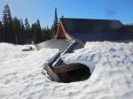
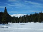
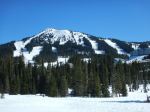
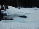
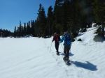
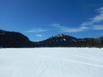
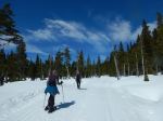
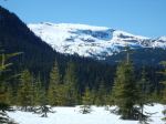
Four of us snow shoed at Mt. Washington, starting at Raven Lodge. We had mostly misty clouds and quite warm temperatures. We followed Rossiter’s Rise trail untracked, all to ourselves, and then looped back to the Lodge for lunch. In the afternoon we followed Tree Beard’s Trail, Crooked Creek, and part of Old Cabin Loop. There was lots of snow and the accumulated snow on the trees made imaginative shapes. 8.4 km; about four hours.
Debbie
(click on photos to view larger)
Trip Report – Blindman’s Bluff – 30 Dec 2015
Five of us took advantage of the cold (for here anyway), crisp weather to hike up to the Blindman’s Bluff viewpoints. There was a bit of crunchy snow beneath our feet and blue skies above our heads. The walk started from the collapsed culvert and took about 1.5 hours, 3.3 km total.
Norris
- Frosty Oregon Grape
(click on photos to view larger)