| Activity | Hiking |
| Destination | Hope Spring-Thompson Trail loop |
| Date | 27 Feb 2019, Wednesday |
| Trip Coordinator | Julie Mellanby |
| Contact Info | 3978 |
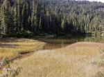
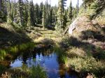
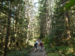
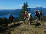
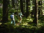
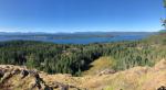
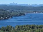
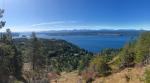
| Description | We will begin the loop at the Hope Spring trailhead and hike clockwise. This is a classic loop on official trails, with lots of variety: creeks, old growth Douglas fir, and some wetlands.. The hike will be about two hours. |
| Meeting Place | Hope Spring trailhead |
| Departure Time | 10:00 |
| Difficulty |
Fairly short and undulating |
| Costs | none |
| Trip limits | none |
| Dogs? | Okay if they don’t run through the group. |
| Notes: | Bring a snack or lunch and poles if you use them. |
Category Archives: day-trip
Hiking – Strathcona Park – 16 Sept 2019
| Activity | Hiking |
| Destination | Forbidden Plateau, Strathcona Park |
| Date | 16 Sept 2019, Monday |
| Trip Coordinator | Norris Weimer |
| Contact Information | norris.weimer@ualberta.ca or 3710 |
| Description | Weather permitting, a ramble through Paradise Meadows in Strathcona Park to admire fall colours and any late flowers. Bring lunch and water. |
| Meeting Place | QCove ferry terminal |
| Departure Time | 9:00 ferry; be early if you are driving as this will be a busy sailing |
| Difficulty |
Moderate |
| Costs | Ferry costs and shared fuel |
| Trip limits | none |
| Dogs? | Must be on leash in Paradise Meadows |
| Notes: | Please contact the coordinator by Saturday night in order to arrange carpooling. Bring lunch and gear appropriate for the weather. The trip will be postponed if serious rain is forecast. |
Trip Report – Hyacinthe and Open Bays – 8 Sept 2019
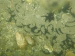
After a dark and stormy night, we prevaricated about getting out on the water in the face of an uncertain forecast. However, the lazy kayaker doesn’t get the first wave, or something like that, so three of us scrambled and were on the water by 10:16. Skies were overcast but the rain stayed away, the winds were calm, and the sun even peeped out occasionally. We meandered around Hyacinthe Bay, admiring both the variety of architecture, and the extensive pillow-lava formations. The incoming tide even allowed us to go around Heriot Island, where we were astonished to see large outcrops of sand dollars in the shallow, warmer waters. From there we enjoyed a calm crossing over to the Bretons and Hoskyn Channel. A few seals greeted us, but two were more interested in their squabbling than us. In the Breton Islets, oystercatchers, scoters, and dunlins were busy exploring the intertidal. We noted the number of boats still plying the waters around the Islands, we could see a kayaker launching from one large yacht that was hanging around Open Bay.
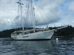
Our game plan was to land in the small beach beside the van Veen’s house, but a surprising amount of southerly swell generating wave action on the rocky beach made us decide to land on the sand/gravel of Big Beach and walk over to our house for our break. After lunch in the sun on our deck we were back on the water by 2 pm. An elegant two-masted schooner that has been anchored in Open Bay captured our interest, an internet search later revealed that it is for sale. We then had the pleasure of meeting the kayaker from the large motor yacht, a delightful American lady who travels the west coast in her yacht every summer. She was accompanied by her two dogs lounging on the deck of her kayak, resplendent in their doggie PFDs. She said she usually has her cat with her as well on her daily paddle. We were off the water by 3 pm. after a very pleasant, easy-going paddle. 13.7 km or 7.4 NM; 3½ hours, without the lunch break.
Valerie van Veen
(click on photos to view larger)
- Pillow lava
- Behind Heriot Island
- Sand dollars
- Harbour seal
- Schooner Jan Van Gent
Reconnaissance Report – Mt. Beadnell – 6 Sept 2019 & update 1 Nov 2020
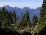
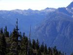
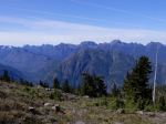
As the end of summer’s good weather was approaching, we took an exploratory adventure to check out a possible new trip for the Club. Mt. Beadnell on Rodger’s Ridge is nearby and was said to have excellent views. True, it’s nearby, you can see it from Quadra, but the access is on logging roads which vary from wide, flat and dusty, to narrow, rocky, and steep. And with unmarked junctions. That was an adventure, but now we know the way.
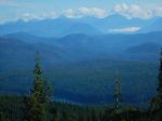
The trail itself varies from a well-worn foot path to no path and little flagging. It starts out steep and in forest, but it quickly emerges onto the ridge with fantastic views to the mountains beyond Buttle Lake and the mainland including Mt. Waddington. The trail is a steady climb (made slower by excellent blueberries and huckleberries) all the way to the flat, wide-open Mt. Beadnell summit. And the summit does indeed have amazing views all around. The Ridge provides the opportunity for relatively easy further exploration. This would be a good day-hike or backpack when the flowers are in bloom. 9.5km; 580m elevation gain; and 6 hours, without the drive.
Norris
Thanks to Norris and Diana for the photos
(click on photos to enlarge)
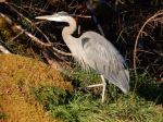
- Great Blue Heron at the ferry terminal
- Upper Quinsam Lake
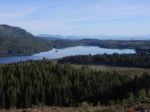
- Rambler Peak
- Looking northwest
- Marble Meadows
- Looking west
- Beadnell and smaller lakes
- Buttle Lake
- Mt. Victoria, Crown Mtn & Campbell Lake
- Mt. Beadnell
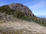
- Sedum
- Mt. Alexandra
- View toward Mt. Washington
- Mt. Alexandra & Mt. Adrian
- Mt. McBride with Golden Hinde beyond
- Amanita
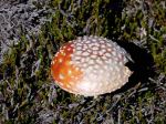
- Fall colour
Update for the reconnaissance report: We had hoped to have a scheduled trip to Mt. Beadnell, but that never happened. At the last minute, we went on an impulsive outing on November 1. The weather was very similar to the previous trip, but the drive up was altogether different. The upper logging road had been ditched in the last year so the last 9 km took us an hour to drive even in high clearance, 4-wheel-drive vehicles. That was more than absolutely necessary, since we got out and looked at most of the ditches on the way up. The drive down took 38 minutes.
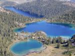
But Roger’s Ridge was every bit as special as before. The quick access from the logging road to the sub-alpine, the ponds and tarns along the way, the easy walking on a good trail and open rock, the spectacular views in all directions make this an amazing trip. With the slow drive and early sunset we didn’t have time for the Mt. Beadnell summit or other exploring, but the Ridge was fabulous. 8.5km; 530m elevation gain; and 5 hours, without the drive.
- Roger’s Ridge on the right-hand skyline
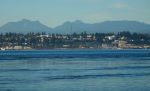
- Uppler Quinsam Lake
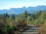
- Mt. McBride
- Mt. Albert Edward, Alexandra and Adrian
- Mt. Beadnell
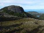
- Beadnell & other lakes
- Upper Quinsam Lake
- Roger’s Ridge on the way home
Trip Report – Nugedzi Lakes and Views – 4 Sept 2019
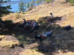
Our group of eight and two dogs hiked up to the Nugedzi Lakes, beginning the hike on the fairly steep old logging road. Near the end of the logging road we stopped at a viewpoint toward the northeast to enjoy the view and cool off in the shade. The day was clear, sunny, and quite warm. We continued on, deciding to take the side trip to the lily pond and the viewpoint to the southeast. We then followed the undulating trail through the forest up to the Lakes. Most of the forest along the way is mature with a few old cedars and lovely, open understory. We stopped for lunch on the rocky point on Nugedzi Lake and some of the group swam in the not quite warm water. Again the group chose to carry on to the viewpoint to the west over Discovery Passage and views of Vancouver Island. On the way back we made the small extension to visit Little Nugedzi Lake before hiking back down the steep, eroded logging road. 10.8 km and 5½ hours.
Debbie
(click on photos to enlarge)
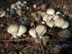
- Puff balls
- Looking northeast
- Penstemon
- The lily pond
- Farrah in the lily pond
- Looking southeast over Rebecca Spit
- Nugedzi Lake
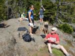
- Lunch break
- The western viewpoint
- View of Discovery Passage
Trip Report – Sayward Area Caves- 25 June 2019
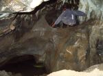
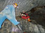
On Tuesday, June 25th, nine of us went caving with Bill West-Sells to the White River caves in the Sayward area. We hiked for approximately half an hour to a series of four caves. We did quite a bit of bridging to avoid getting wet feet. There were many shelves and a few upper holes which we climbed through. Everyone enjoyed their time exploring the various caves, the impressive karst environment, and the forest trails between.
Cyndy
Thanks to Bill for the photos
(click on photos to enlarge)
Kayaking – Hyacinthe & Open Bays – 8 Sept 2019
| Activity | Kayaking |
| Destination | Hyacinthe and Open Bays |
| Date | 8 Sept 2019, Sunday |
| Trip Coordinator | Valerie van Veen |
| Contact Info | 250 285 2329; vvv@qisland.ca |
| Description | Summer-end Sunday Social … a gentle paddle to explore Hyacinthe Bay, then over to Open Bay, possibly check on intertidal and seals in the Bretons. Land on beach beside our house for coffee, tea, goodies provided to accompany your lunch/snack at our place. Paddle back to Len Road beach around 2 pm in time for high(er) tide. |
| Meeting Place | Len Road beach |
| Departure Time | 9:30 , on water by 10 |
| Difficulty |
Easy |
| Costs | none |
| Trip limits | none |
| Dogs? | no |
| Notes: | Bring your own lunch. Kayaks will be put up on driftwood on our beach while we enjoy the break up at our house. Forecast is for possibly showers in afternoon, little wind. Must email/call by Friday night to confirm participation. Kayaks must be ocean kayaks and conform to all Transport Canada requirements. |
Trip Report – Eagle Ridge & Blindman’s Bluff – 28 Aug 2019
Six people drove up the hill at the end of Leishmans Road to a spot past the bridge. From there we hiked to the beaver pond which was low and covered with lily pads. We turned left and proceeded up Eagle Ridge. It was a clear day so there were splendid views of the passage. Mt. Victoria really stood out with the blue sky background.
After a short break we backtracked the same route and went up to Blindman’s Bluff. Hiking it counterclockwise, we stopped for lunch before we ran out of shade as it was getting hot. That area has great views of Gowlland Harbour. After lunch we did the open rocks and back down to the vehicles. On the way out we stopped to admire the old growth fir at the entrance. 5.7 km and 3 hours
Les
Thanks to Les the photos
(click on photos to enlarge)
- Wetlands
- Wetlands
- View west to Discovery Passage
- Discovery Passage & Mt. Victoria
- Discovery Passage & Vancouver Island
- Shady lunch break
- Gowlland Harbour
- Old-growth Douglas Fir
Hiking – Eagle Ridge & Blindman’s Bluff – 28 August 2019
| Activity | Hiking |
| Destination | Eagle Ridge and Blindman’s Bluff |
| Date | 28 Aug 2019, Wednesday |
| Trip Coordinator | Les Hand |
| Contact Info | 285-2029 or leshand@gicable.com. |
| Description | Eagle Ridge trail has wetlands as well as rocky bluffs for views of Discovery Passage. We will then go to Blindman’s Bluff for more open views. |
| Meeting Place | Heriot Bay store parking lot. |
| Departure Time | 9:00 |
| Difficulty |
Moderate |
| Costs | none |
| Trip limits | none |
| Dogs? | Yes, but no back and forth through group |
| Notes: | Please contact the trip coordinator prior to the trip. |
Trip Report – Newton Lake and Waiatt Bay – 14 Aug 2019
There were eight hikers and two dogs for this highly varied walk to Newton Lake, Small Inlet and Waiatt Bay. It was a warm and sunny day for a hike and a swim. We hiked up the old, eroded logging road to the lake and enjoyed the view and the quiet for a while before continuing along the creek and down the switchbacks to Small Inlet. The Inlet was beautiful and serene, with no boats at anchor, but we decided to go to Waiatt Bay for lunch. It was a very low tide, with quite a lot of boats in the bay, and few people on the trail hiking up to the lake. We returned to Small Inlet by the portage trail and the bubbling spring before hiking back up the hill to Newton Lake. By this time, there were quite a few swimmers at the lake, but we had the rock bluff on the north side to ourselves for a wonderfully refreshing splash in the lake, before returning down the logging road to the vehicles. 14.4 km; 6 hours.
– Julie and Debbie
Click on the photos to enlarge
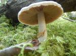
- Turkey tail fungus
- Farrah at Newton Lake
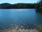
- Newton Lake
- Fungus
- Small Inlet
- Waiatt Bay
- Small Inlet
- Swimming at Newton Lake
- Old Man’s Beard Lichen