| Activity | Hiking |
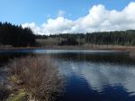
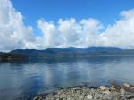
| Destination | Mine Lake Bluff |
| Date | 9 May 2018, Wednesday |
| Trip Coordinator | Julie Mellanby |
| Contact Info | phone 3978. Please contact the coordinator in advance. |
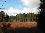
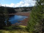
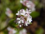
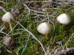
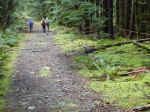
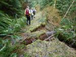
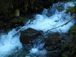
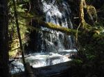
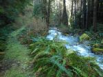
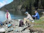
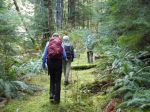
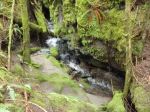
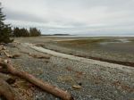
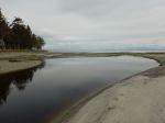
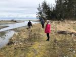
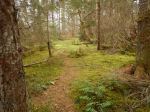
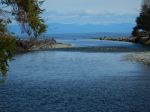
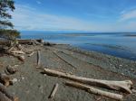
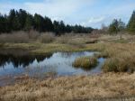
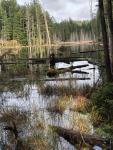
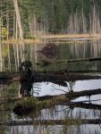
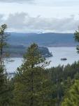
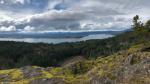
| Description | We will park near the Mine Lake boat access and walk to Camp Homewood. From there the route ascends the bluff to the north of Mine Lake with great views. The trail going up the bluff can feel a bit exposed. This is a hike, not a climb, but do have good footwear and be careful. The trail down is a regular trail and it loops back underneath the bluffs to the start of the steep bit. |
| Meeting Place | Heriot Bay Tru Value parking lot for car pooling |
| Departure Time | TBD |
| Difficulty | Moderate, for very steep section |
| Costs | none |
| Trip limits | none |
| Dogs? | |
| Notes: | Bring lunch. |
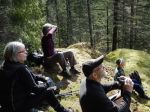
Category Archives: day-trip
Trip Report – Stramberg Old Growth – 18 April 2018
We had a perfect hiking day for this walk through varied forest to see some of Quadra’s biggest old growth trees. The first part of the hike skirts Vic’s Marsh through open forest and passes meadows with fruit tree, nettles, Vic’s barn-like house and old fencing. We stopped briefly at the bluff overlooking the open water part of the marsh to enjoy the view and watch huge numbers of geese heading north. The next section follows a narrow, flagged trail which undulates, often along a creek or below bluffs and heads into Main Lake Provincial Park. After the T-junction with the logging road, the right turn leads more or less north with a gradual grade and wide allowance, though very wet at this time of year. The trees are plastered with lichen and moss making it an enchanted forest. After crossing a small creek, the trail ascends to the glade with old growth Douglas fir and cedar. But there are big trees along the whole walk.
The flagging is in good condition, and the trail is not too bad except for the fallen trees which you have to climb under or over or go around, and long sections of sword fern where you never see the ground or your feet. 12.1 km round trip, 5⅓ hours.
Debbie
- Vic’s Marsh
- Salmonberry blosssom
- Fungus
- Vic’s Marsh
- Watching geese
- Canada Geese
- Really, really small flower
- Vic’s Marsh
- Devil’s Club
- Alder pollen
- Burnt cedar stump
- Open, mossy forest
- Queen of the grove
- Old growth bark
- Frog in the mud
- Sword fern walk
- Old Man’s Beard lichen
- Mushroom
(click on photos to view larger)
Kayaking – Gowlland Harbour – 2 May 2018
| Activity | Kayaking |
| Destination | Gowlland Harbour |
| Date | 2 May 2018, Wednesday |
| Trip Coordinator | Margot Wood |
| Contact Info | 250-285-2393 |
| Description | We will meet, help each other to launch from Gowlland Harbour Resort. We will kayak the islands to see the beautiful wild flowers. Kayak to May Island for our lunch. Visiting the islands in Gowlland Harbour. Returning to the launch area at approximately 2 p.m. |
| Meeting Place | Gowlland Harbour Resort boat launch, 823 Gowlland Harbour Rd. |
| Departure Time | 10:30 (unload and prepare at 10:00) |
| Difficulty |
easy |
| Costs | none |
| Trip limits | none |
| Dogs? | no |
| Notes: | This trip is dependent on weather. Bring your ocean kayak, paddle plus safety equipment. Bring your own lunch and water. I will meet you at the launch site at 10:00. We help each other with kayak launch. Gowlland Harbour Resort has kindly granted us permission to use their boat launch for this trip. This is not a public access. |
Trip Report – Deepwater Bay – 12 Apr 2018
Because the weather forecast was poor, we saved the planned view trip for another day when we would have a view, and chose another destination below cloud level. We also postponed it a day to avoid the worst weather. As luck would have it, we had a beautiful sunny day for a hike down to Deepwater Bay and back.
The first part of the hike was an unexpected detour through the forest around work to renew the old road for future logging operations. Trees alongside of the roadway had been neatly felled onto the logging road and not yet cleaned up. Beyond that, the walking was good except for a bit of erosion and a landslide on the north bank of the creek, which swept trees across to the south bank and the trail. The whitewater stream was impressive with recent rains and there were several waterfalls. We had lunch at the Bay in warm sunshine and returned uphill to the vehicle. 4.4 km; 2½ hours.
As the hike was fairly short, we made a side trip to some of the nearby karst sinkholes. There was a report that the creek had re-routed. However, there was some water in the insurgent and resurgent creek, though not as much might be expected with recent rain.
– Norris
(click on photos to view larger)
- The road with trees on it
- Some winter erosion
- Salmonberry blossom
- Waterfall
- Emerging sword fern
- Waterfall
- Deepwater Bay and Discovery Passage
- Flower rock
- Turkey tail fungus
- Waterfall
- Salmonberry blossom
- Resurgent creek
Trip Report – Campbell River Ramble – 4 April 2018
On April 4, in cool and drizzly weather, five adventurers set out to explore the hinterlands of Campbell River. We walked from the ferry terminal to the north ERT trailhead at the corner of Maple and Homewood . From there it was gradually uphill on the wide paved trail, which was surprisingly deserted, through mixed deciduous, past a few old homesteads and some signs of future development. Crossing Evergreen Rd, a short walk brought us to the Beaver Lodge Forest lands where we met many more walkers as well as mountain bikers in this beautiful forest. The wide Rail Trail led through coniferous second growth, graced with a few old specimens. Branching off on a bike trail took us to the underpass and out onto Rockland Rd, crossing over we followed the paved trail past the Willow Point Sportsplex, winding our way down to the waterfront to a very welcome lunch stop in Willow Point . Refreshed, the Quadra Island crowd walked briskly back along the waterfront, in plenty of time for the 3:30 ferry. A very long pleasant walk, disappointingly few wildflowers, but nice to see the salmonberries and huckleberries beginning to bloom, as well as a little group of Glory of the Snow (Chionodoxa) gone wild, and cultivated spring blossoms. 19.3 km; 5⅔ hours, including lunch.
Valerie & Darcy
(click on photos to view larger)
- Salmonberry
- Catkins
- Beaver Lodge trail
- Glory of the Snow
- Skunk Cabbage
- Forsythia
- Daffodil
- Heather
- Oregon Grape
- Rhododendron emerging
- Cherry
Trip Report – Miracle Beach & Salmon Pt – 28 March 2018
Seven of us took the 10:00 ferry and drove to Miracle Beach. There is a provincial park here as well as a large picnic area and many small trails. There are huge sand flats when the tide is out. Although not many birds while we were there, this can be a great place for bird viewing. We walked along the beach to Black Creek. Then followed it up to the campground and back to the vehicles. 2.5 km and about 45 minutes.
We then drove up to the Salmon Point Restaurant and Pub for a delicious lunch. After we walked the ocean side trail to Oyster River Nature Park. We made a loop through it and back to Salmon Point. There were quite a few birds on this trail and a pair of bald eagles perched on the light tower at Salmon Point. 6.5 km and about 1 hour and 35 minutes.
Les
Thanks to Norris and Les for the photos
(click on photos to view larger)
- Miracle Beach with the tide out
- Black Creek
- Bald Eagles
- Fawn Lily leaves
- Trilium
- Oyster River
- Mouth of the Oyster River
- The delta at the mouth of the Oyster River
- Wetlands near Salmon Pt
Trip Report – High Bluff-Heriot Ridge Trail Loop – 21 March 2018
Six hikers and one dog enjoyed a three hour hike on Heriot Ridge. The weather was cloudy and threatened rain but none materialized, and we were even treated to occasional weak sun behind the clouds. Starting at the Hopespring trailhead, we walked up to the height of land, then headed south off-trail along the bluffs of Heriot Ridge. Our first stop was the location of the new North Island communication tower. From there we dropped off the south end of the ridge and proceeded through the woods to High Bluff viewpoint where we stopped for a break and snack. The Vancouver Island mountains were hidden from view, but we had closer views of Gowlland Harbour and Georgia Strait to the west and south. We returned north along the ridge’s open bluffs at a lower elevation, stopping to admire a rare grand old Douglas fir tree and wonder about a large pile of feathers, probably belonging to an unfortunate grouse. Back at Hopespring Trail, we headed north along Heriot Ridge Trail, and were treated to a frog chorus at a small wetland along the way. We connected to the Thompson Trail and proceeded down the trail to Thompson Road.
Janis
Trip Report – Blindman’s Bluff and Eagle Ridge – 14 March 2018
Six hikers went to the end of Leishman Road and up the woodlot road to a spot by the bridge to park. There is large, gnarled, old growth fir near here that is worth looking at. We hiked up the old road to where it joins the official trail at the beaver pond. The beaver lodge shows well this time of year. We turned right and went up to Blindman’s Bluff trail. The trail is in good shape but one needs to watch as to not wander off it. There has not been much traffic on it so moss has grown on much of it. It was a mixed cloud and sun day so the views were spectacular over Gowlland Harbour and south. The wind was chilly though so we sat out of the open to have lunch.
After lunch we continued back to Eagle Ridge Trail and up to the top of it. There were great views over Discovery Passage. We then returned via the same route to the vehicles.
Les
(click on photos to view larger)
- Old Douglas Fir
- Looking South
- Views of Discovery Passage
Hiking – Campbell River River Loop – 25 April 2018
| Activity | Hiking |
| Destination | Campbell River River Loop |
| Date | 25 April 2018, Wednesday |
| Trip Coordinator | Debbie Quigg |
| Contact Info | 285-3710 or debbie.quigg@ualberta.ca. Please contact the coordinator in advance of the trip in order to arrange carpools. |
| Description | The plan is to hike the full loop beginning at the logging bridge across the Campbell River. We will hike along the north shore of the River (hopefully there will still be trillium and fawn lilies in bloom), across the Canyon View Bridge, up to the Elk Falls viewing area, Moose and Deer Falls, before heading back down on the south side of the River. This will depend on weather and construction. About 12 km and 5 hours, if we do the full loop. |
| Meeting Place | Q Cove Ferry terminal. Drivers will need to be early enough to be on the ferry. |
| Departure Time | 9:00 ferry |
| Difficulty |
A few steep places, but mostly reasonable walking on good trails. |
| Costs | Shared ferry costs |
| Trip limits | None |
| Dogs? | |
| Notes: | Bring lunch and gear for weather. |
Hiking – Stramberg Old Growth Grove- 18 April 2018
| Activity | Hiking |
| Destination | Stramberg Old Growth Grove |
| Date | 18 April 2018, Wednesday |
| Trip Coordinator | Debbie Quigg |
| Contact Info | debbie.quigg@ualberta.ca or 285-3710. Please contact the trip coordinator prior to the trip. |
| Description | This trail begins near Village Bay Lake and follows open meadows leading into and through the forest on old, unmaintained logging roads. The reward at the end of the hike is a grove of old growth firs. This is not an official trail. Expect blow-down and brush. About 13 km; 5 hours or more. |
| Meeting Place | Heriot Bay store parking lot, to arrange carpools |
| Departure Time | 09:30 |
| Difficulty |
moderate, due to unmaintained trail and quite long |
| Costs | none |
| Trip limits | none |
| Dogs? | okay if under control |
| Notes: | Bring lunch and water. |


