| Activity | Hiking |
| Destination | Shellaligan Pass loop |
| Date | 12 Oct, Wednesday |
| Trip Coordinator | Les Hand |
| Contact Info | lhquadra@gmail.com or 285-2029 |
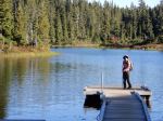
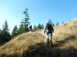
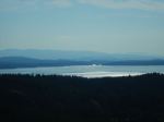
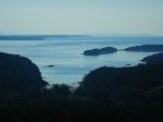
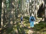
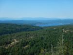
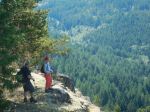
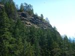
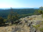
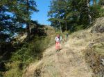
| Description | We will do the shorter loop but go down to the oyster lease. We may see some whales from the rocks at the entrance to Village Bay as some have been in the area. Trip will take 2-3 hours depending on lunch. |
| Meeting Place | Heriot Bay Store |
| Departure Time | 10:00 |
| Difficulty |
Moderate, with rocky and steep sections |
| Costs | None |
| Trip limits | 10 |
| Dogs? | Yes, but under control |
| Notes: | Dress for weather and bring a lunch. |
Category Archives: moderate
Trip Report – Forbidden Plateau – 21 Sept 2022
Four enthusiastic hikers enjoyed an absolutely perfect Fall Equinox Day as we hiked in Paradise Meadows/Forbidden Plateau. Our ultimate destination was Kwai Lake, via the circle route through Paradise Meadows and past Lake Helen Mackenzie. Taking the 8 am ferry, we were on the trail by 9:20 am.
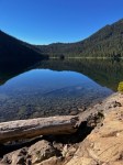
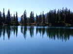
We enjoyed a pleasant break at Lake Helen Mackenzie with stunningly beautiful reflections of the surrounding hills. Debbie had wisely suggested we go counter-clockwise, as we always seem to go clockwise when hiking in this area. Even though this meant going uphill on the dreaded “Helen Mackenzie headwall”, it was still better than stumbling down the steep, rooty, eroded trail at the end of a long hike.
We were not the only ones enjoying the early autumn sunshine, as the number of cars in the parking lot attested. We encountered several backpackers on their way out, two school groups camping in the backcountry group camps, and many day-hikers like ourselves. At Kwai Lake we found a quiet grassy area on the southwest shore for lunch, away from a large school group taking their break on the rocky outcropping on the opposite shore. After lunch, we completed the circle, passing Croteau, Lady, Kooso and Battleship Lakes. Some sections of this circle route are boardwalk, protecting wetlands and tree roots, the rest varies from pleasant forest paths to very eroded, rooty trails. About 6½ hours, approximately 17 km.
Valerie van Veen
Thanks to Valerie and Norris for the photos
(click on photos to enlarge)
- Mt. Albert Edward
- Paradise Meadows
- Lake Helen Mackenzie
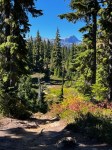
- Sub-alpine on Forbidden Plateau
- Kwai Lake
- Castlecrag and Mt. Frink
- View across Croteau Lake
- Battleship Lake
- Battleship Lake
- Dock at Battleship Lake
Kayaking – Maud Island; Morte Lake Stream Outlet – 25 Oct 2022
Cancelled due to weather
| Activity | Kayaking/ Indigenous history focus |
| Destination | Maud Island; Morte Lake Stream Outlet |
| Date | 25 Oct, Tuesday |
| Trip Coordinator | Vic Gladish |
| Contact Info | vicgladish@gmail.com; 250-287-0459 text; or phone 250-285-2111. |
| Description | According to Joy Inglis’s “Petroglyphs of Quadra Island” there are several petroglyphs located along Quadra’s west shore at the outflow of Morte Lake Stream just east of Maud Island. We will put in at the Lieshmans Rd shore access by 1000 am and paddle north towards Maude Island. It is about a 1 hr paddle to the old village site of Kawstin at the outflow of Morte Lake Stream. Depending on the amount of time spent here we may or may not paddle another 30 minutes into Maud Island and perhaps hike to the Seymour Narrows view point. |
| Meeting Place | 0930 at Lieshmans Road Shore Access (Whalebone Cove) |
| Departure Time | On the water by 1000 hrs |
| Difficulty |
Moderate depending on weather. Currents will be a factor. |
| Costs | Vehicle fuel |
| Trip limits | 8 |
| Dogs? | No |
| Notes: | The tides/currents will be a factor. In order to view the petroglyphs I am planning our arrival for low tide with less attention to what the current will be doing. Poor weather and/or wind will mean this trip will be cancelled. All participants must be equipped for ocean paddling in cooler weather – required equipment as per club guidelines (https://qioutdoorclub.org/wp-content/uploads/2018/07/paddling-guidelines-aug2018.pdf) and appropriate clothing. I will email to each participant the petroglyph information relevant to the location. Bring lunch, hot drinks, extra warm layers and something to sit on. |
Trip Report – QCove to Smiths Rd – 15 Sept 2022
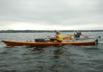
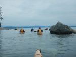
With just a few days remaining of summer ’22, seven kayaks set out from Quathiaski Cove to complete a “Round the Cape” adventure. With the help of non-paddling spouses, we managed the shuttling of vehicles between Q-Cove and the Shore Access at the end of Smiths Road that made it possible to do this trip.
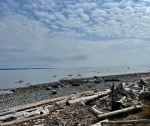
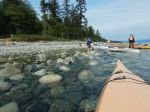
By 8:50 we were on the water just as the ferry was docking – one less thing to worry about. Weather, tides and currents were all in our favour as we rounded Whiskey Point and headed south to Cape Mudge. We passed by the Village and the campground and then rounded the Cape. The often turbulent waters were very calm, due to our timing, and we headed into the boulder strewn shallows of the south shoreline. By this time we were looking for a reasonable place to pull out for a “rest” and stretch. A cobbly beach was the best we could do.
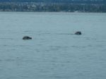
We were treated to a good showing of sea birds throughout the trip and numerous seals and sea lions and/or dolphins quite a ways offshore. No doubt they were after salmon which were seen jumping near our kayaks.
The rest stop ended up being a little longer and some snacked enough that we put off our lunch stop until the takeout. Back on the water and the sun appeared, warming things up even more as we cruised northward from Francisco Pt to our destination at Smiths Road. Once ashore, lunch and beverages were enjoyed on the beach.
List of bird sightings – at least two dozen Common Loons (very vocal), many Harlequin ducks, Common Mergansers, Bonaparte’s, Glaucous-winged, and Mew Gulls, Cormorants, Great Blue Heron, geese, Bald Eagles, Vultures, Horned Grebes,
About 3.5 hours of paddling; Distance – 15.3 km
Vic Gladish
Thanks to Jan and Norris for the photos
(click on photos to enlarge)
- Launching at QCove
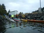
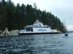
- The Powell River Queen
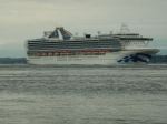
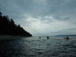
- Other boats in Discovery Passage
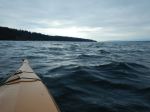
- Along the west shore
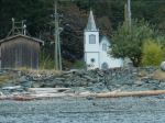
- Church at the Village
- Cape Mudge lighthouse
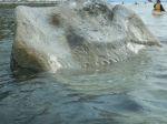
- Petroglyphs in the tide
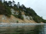
- Cape Mudge bluffs
- The long snack break
- Curious Harbour Seals
- Along the east shore
- Arriving at Smiths Rd
Hiking – Strathcona Park – 21 Sept 2021
| Activity | Hiking |
| Destination | Strathcona Park |
| Date | 21 Sept, Wednesday |
| Trip Coordinator | Valerie Van Veen |
| Contact Info | 250 285 2329 vvv@qisland.ca |
| Description | Celebrate the fall equinox on the beautiful Forbidden Plateau, Strathcona Park. Starting from Raven Lodge we will aim for Kwai Lake following well-established trails. A full day – about 20 km return. Maybe a group dinner in CR? Weather dependent. |
| Meeting Place | QCove ferry terminal to arrange carpools as desired |
| Departure Time | 8:00 am ferry |
| Difficulty |
Moderate to challenging due to length |
| Costs | Ferry |
| Trip limits | 10 |
| Dogs? | Must be on leash in the Park |
| Notes: | This trip is weather dependent. Must contact coordinator by Monday evening, Sept. 19. |
Hiking – Shellaligan Pass Loop – 7 Sept 2022
Change of destination to Rebecca Spit due to wind.
| Activity | Hiking |
| Destination | Shellaligan Pass long loop |
| Date | 7 Sept, Wednesday |
| Trip Coordinator | Valerie Van Veen |
| Contact Info | 250 285 2329 vvv@qisland.ca |
| Description | A classic Quadra Island hike, we will take the long loop, weather permitting. We will stop early in the hike to look for whales from the rocky bluffs. We’ve been luck on every recent hike/kayak in Shellaligan. |
| Meeting Place | Heriot Bay Store parking lot or logging road turnoff on Valdes Road |
| Departure Time | 10 am: meet at Heriot Bay store parking lot to carpool (see notes); 10:20 meet at turn off to logging road on Valdes Road |
| Difficulty |
Moderate |
| Costs | None |
| Trip limits | 10 |
| Dogs? | Must not run through group; must be under control; dogs and owners will go ahead of group. |
| Notes: | About 3 hours. Dress for the weather, bring lunch, snacks. MUST contact coordinator by Monday evening, Sept. 5. |
Kayaking – Village Bay Beach – 31 Aug 2022
Postponed.
| Activity | Kayaking |
| Destination | Village Bay Beach |
| Date | 31 Aug, Wednesday |
| Trip Coordinator | Valerie Van Veen |
| Contact Info | 250 285 2329 vvv@qisland.ca |
| Description | Forecast warm day with light winds; high tide just around launch time (yay!), not a huge tidal change that day. We will meander to Village Bay, enjoying maybe the last of summer kayaking weather. Swim at VB if desired, then home. We can go by the lava tunnels at Valdes Beach if anyone hasn’t already seen them. |
| Meeting Place | Len Road launch |
| Departure Time | 9 am meet, on water by 9:40 |
| Difficulty |
Moderate |
| Costs | None |
| Trip limits | 8 kayaks |
| Dogs? | Experienced kayak dogs only |
| Notes: | This is a pleasant paddle, usually seals, maybe the last of the orcas and humpies, migrating birds??? MUST confirm with organizer by Monday eve Aug 29. Must comply with Club paddling guidelines and Coast Guard requirements. |
Trip Report – Alternate Chinese Mountain Loop – 24 Aug 2022
It was forecast to be another scorching hot day, so we moved the start time an hour earlier. Instead of taking the usual hiking trail up South Chinese Mountain, the four of us took a climbers’ path, which goes steeply up to the base of the rock wall. From there the path is less steep and goes up a swale between the south peak and a minor southeast bluff. We took a side trail which goes up that bluff for excellent viewpoints, a rest and a snack. We continued on the path back down to meet the main trail at the “mud hole”. Coming back down the regular trail we took the new “scenic route” trail which avoids a badly eroded section of the original trail. Then we took another scenic route, which avoids another part of the main trail which is more stream bed than trail. The second scenic section is not marked or flagged, but it is a very nice alternative route. It rejoins the main south bluff trail near a viewpoint. 3.4 km; 2½ hours; 220 m elevation gain.
(click on photos to enlarge)
- Golden Hinde in heat haze
- View east
- Rebecca Spit and beyond
- Morte Lake and view northwest
- looking west
- South Chinese Mtn viewpoint
- View southwest
Kayaking – QCove to Smiths Rd- 15 Sept 2022
| Activity | Paddling |
| Destination | QCove to Smiths Road Shore Access |
| Date | 15 Sept, Thursday |
| Trip Coordinator | Vic Gladish |
| Contact Info | vicgladish@gmail.com; 250-287-0459 text; or phone 250-285-2111. |
| Description | End of Summer – around the Cape; This paddle will involve a shuttle which will require an earlier start in order to be ready for a 0930 put in. We will put in at the Q Cove boat launch and leave the Cove just before the current changes (slack) to ebb and enter the back eddy as we head south to the lighthouse. We will round Cape Mudge and head north along QI’s east coast as far as the Shore Access off Smiths Road. |
| Meeting Place | QCove boat launch |
| Departure Time | Meet at put in at 0800; Shuttle vehicles to take out; On the water by 0930 |
| Difficulty |
Easy to moderate depending on the weather. Currents will be a factor. |
| Costs | None |
| Trip limits | 8 |
| Dogs? | No |
| Notes: | The shuttle will be the first challenge of the day. Try to arrange your own shuttle if a spouse or friend is willing to help. Otherwise we will do something like this: All meet at QCove and unload kayaks. All cars will go to Smiths Road (I will stay with the kayaks and gear); As few cars as necessary will drive back to QCove with all paddlers. We should probably meet at 0800, unload, shuttle and plan to put in at 0900. Be sure to read our paddling guidelines and make sure you are properly outfitted. |
Trip Report – Kanish Bay Paddle – 17 Aug 2022
Six paddlers got an early start – 9:15 – from the Granite Bay boat launch on a beautiful summer day, with the forecasted northwesterly looking very manageable. Taking a counter clockwise route this time we headed to Orchard Bay for a quick pit stop and a stretch. We headed along the north side of Kanish Bay for a couple of kilometers and then decided it was time to head across to the Chained Islands in case the wind got any stronger. We encountered some chop coming nearly broadside and then some interesting waves as we got close to the second last island. Circling this island we arrived at the campsite in a sheltered bay and had a leisurely lunch in the shade. As the day was getting much warmer a couple of us attempted a swim in the very chilly water.
Getting back on the water we cruised in the shelter of the islands along the south side of Kanish Bay. Several salmon were spotted jumping and a flock of mergansers were working hard to keep ahead of us. With the day getting much hotter it was a good time to head to the take out and go in search of cold beverages. 12.0 km; 4 hours.
Vic Gladish
(click on photos to enlarge)
- Leaving Granite Bay
- Entering Kanish Bay
- Approaching Orchard Bay
- Checking out the crossing
- Approaching the Chained Islets
- Arriving at the lunch beach