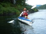
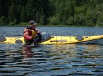
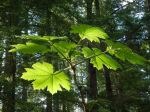
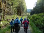
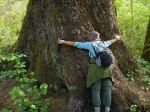
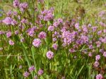
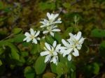
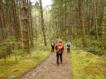
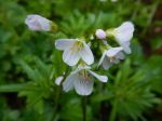
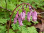
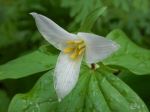
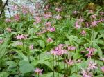
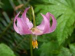
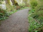
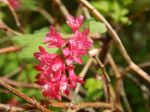
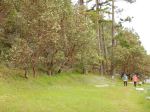
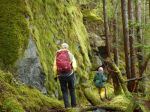
Day 1: Eight energetic hikers left for four hiking days on Cortes Island. On arrival at Cortes we drove to Carrington Trails. We took the main trail to the lagoon, which is an old dirt road. At the lagoon it was a delight to see purple star fish. On the trails there were lots of beautiful wild flowers. We walked on to Grandmothers’ Grove, ate our lunch and then continued through the mature forests. (10.5 km; 3½ hour) The Forest Trust for the children of Cortes Island has been formed to protect these forestlands. Our group donated $60 at the end of our trip to the Forest Trust for the children of Cortes.
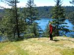
We packed our baggage into the Linnaea Farm House and chose our rooms. We then drove to Hank’s Beach for a short walk through the forest to a secluded wide sandy beach, overlooking Twin Islands. Beautiful rock formations, all enjoyed a good climb. Unfortunately it was pretty windy. (2.9 km; 1 hour) Returned to Linnaea Farm. Team 1 prepared a delicious dinner along with wine and active communication. Had a wonderful log fire in the room at the farmhouse.
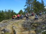
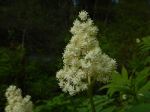
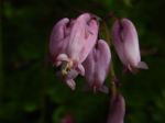
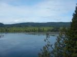
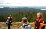
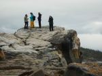
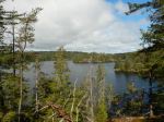
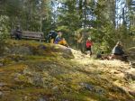
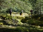
Day 2: After breakfast, we put on our hiking boots. A beautiful day filled with sunshine. Janis led the group into Kw’as Park, we vowed to spend the entire day in the park because we had never walked all its wonderful trails. 173 acre park, 20% of the park is still virgin old growth and the rest is mature second growth forest. The trails led through a number of rugged areas, many steep areas overlooking Gunflint and Hague Lakes. Magnificent old growth groves. We climbed ladders, held onto ropes to enable us to reach the high manzanita covered bluffs. We ate lunch overlooking Gunflint Lake and then upward and onward to the Summit. This was a superb day and returned to the farm house filled up with its beauty. (14.2 km; 7½ hours) Team 2 prepared another delicious dinner, some joined Janis in needed yoga moves. All ready for a good nights sleep.
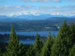
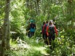
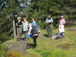
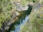
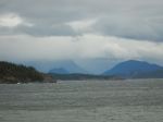
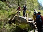
Day 3: Breakfast. We took the cars and drove to near Squirrel Cove to take the trail to Von Donop Marine Park. Debbie and Norris led us on this trail. The first part of the trail was well maintained and marked. Later we came across wind-fallen trees and all managed bush whacking over and around trees. Again, a lovely forested area, we took the trail that led to Mud Bay. This bay is a beauty, lovely warm coloured rocks, small inlets, a boaters paradise. Enjoyed eating our lunch and taking in the surrounding beauty. Returned to the trail and hiked back to the trail head. (12.1 km; 5 hours) Returned to Linnaea Farm. Five of us hiked up to Easter Bluff. This trail is steep and rocky in many places, a really good work-out. Gorgeous views at the top overlooking the south and west end of Cortes Island and the snow covered mountains. A lovely clear afternoon allowing us to see over to Powell River and beyond. (5.9 km; 2½ hours) We treated ourselves to pizza for dinner followed by dessert. Julie led a few of us in a crazy board game. Norris lit and kept an amazing fire going in the room.
Day 4: Packed our bags, ate breakfast. Moved our baggage out to the cars. We drove to Green Mountain trailhead. The trail was a steep trek and part of the trail looked like a streambed. The view at the top of Green Mountain is spectacular, overlooking Gorge Harbour, Marina Island, Quadra and to the mountains beyond. Beautiful rock ledges, old growth, manzanita covered slopes with huge arbutus. We hiked the loop and then continued on to Nutshell Lake. A small lake which the locals use for skating in the winter. Beautiful wild flowers along the edge of the lake. Ate our lunches on a warm rocky slope. Picked up a newly made biking trail and returned to the trailhead. (7.2 km; 3¼ hours) We then drove to the ferry and returned to Quadra with our memories of Cortes.
This was four packed days of hiking, seeing and experiencing the beauty of Cortes, great food, laughter, wonderful company with eight wonderful hikers from Quadra. A truly beautiful happening.
Margot
(click on photos to view larger)
-
-
-
Borden homestead clearing
-
-
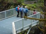
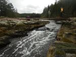
Bridge over lagoon outlet
-
-
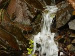
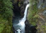
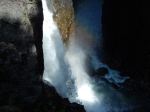
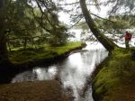
James Creek at the lagoon
-
-
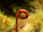
Emerging fern
-
-
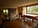
Linnaea Farmhouse living room
-
-
Looking NE from Hank’s Beach
-
-
-
Arbutus at Hank’s Beach
-
-
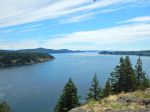
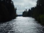
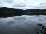
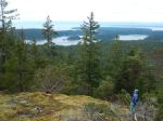
Gunflint Lake
-
-
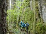
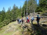
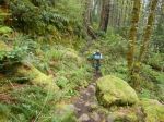
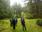
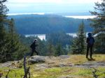
Trail to Kw’as Park
-
-
Hague Lake from Pierre de Trail
-
-
-
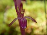
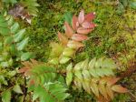
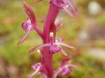
Coralroot orchid
-
-
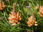
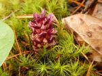
Vancouver groundcone
-
-
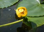
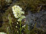
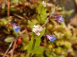
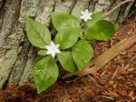
Starflower
-
-
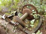
Steam donkey in Kw’as Park
-

-
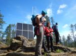
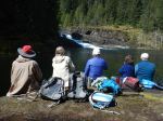
Lunch at Gunflint
-
-
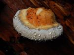
Oyster mushrooms on alder
-
-
-
-
Bridge over stream between Gunflint & Hague
-
-
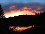
Sunset over Gunflint Lake
-
-
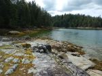
Von Donop inner harbour
-
-
Mud Bay
-

-
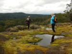
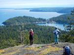
Looking west from Easter Bluff
-
-
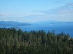
Cortes Bay and beyond
-
-
Looking toward Desolation Sound
-
-
The view south
-
-
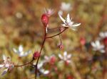
Saxifrage
-
-
Looking west
-
-
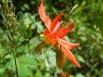
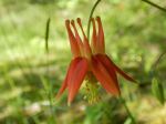
Red columbine
-
-
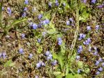
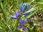
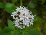
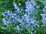
Bluebells
-
-
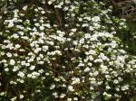
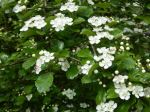
Apple Blossoms
-
-
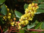
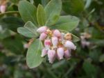
Manzanita blossoms
-
-
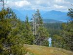
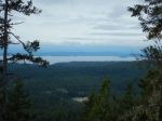
Looking west from Green Mtn
-
-
Gorge Harbour
-
-
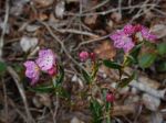
Bog Laurel
-
-
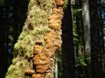
Tree bracket
-
-
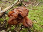
False Morel
Multi-day Hiking – Cortes Island – 15-18 May 2017