This was my fifth trip to the marble Meadows – Mt. McBride area. Not having the opportunity to complete the round trip up to Mt. McBride on earlier trips, I returned this time with the main goal of summiting the peak. This was a solo trip.
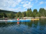
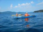
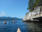
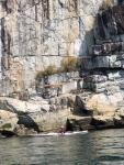
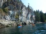
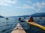
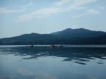
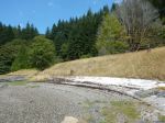
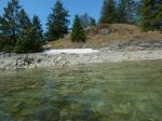
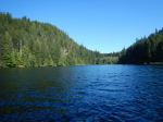
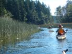
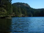
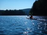
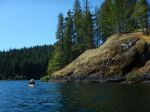
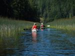
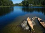
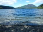
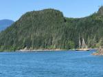
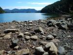
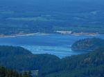
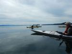
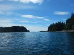
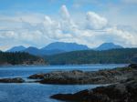
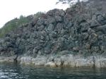
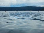
Provision must be made for crossing Buttle Lake from the Augerpoint picnic area, where cars can be left, to Phillips Creek Marine Campsite, where canoes, and kayaks can be stashed. I left my kayak half hidden in the bushes and cable locked it to a tree. Most people don’t bother with this precaution. It must be mentioned that in the summer, with a stabilized high, winds can whitecap the lake after 1 pm. Canoeists must be comfortable with this or wait for calmer conditions.
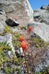
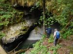
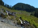
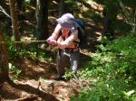
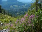
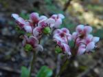
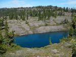
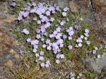
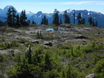
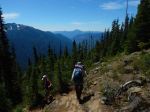
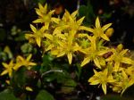
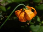
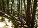
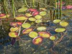
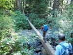
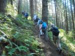
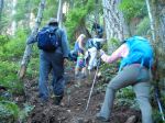
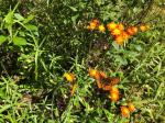
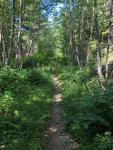
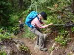
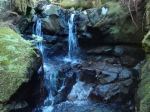
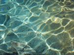
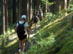
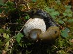
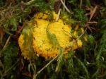
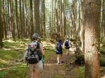
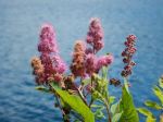
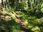
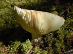
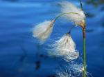
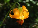
I headed up the well worn trail at roughly 5 pm from an elevation of 250 meters. After 3.2 km., water is reached at the 840 meter mark. This was about 1½ hours in. The trail crisscrosses a steep pitch at about 1200 meters, where there are a few blow downs. Nothing insurmountable, but one does have to leave the trail to bypass them. Easier on the descent. As this trail’s traffic is much less than Bedwell or Flower Ridge, trail repairs sometime take years. This section had the most flower activity, with rhododendron, tiger lily, mountain valerian, columbine and lupins in abundance. Flower activity was finished, largely, up in the meadows. The Marble Meadows lakes area was reached after 3½ hours, at just over 1400 meters. This is where I camped for the evening. Bugs were bad, and a net hat comes in very handy.
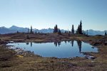
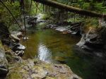
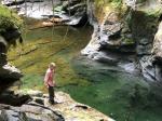
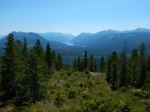
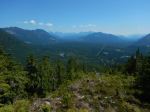
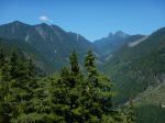
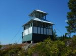
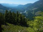
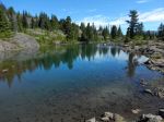
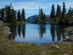
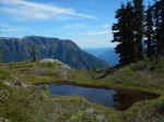
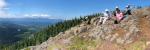
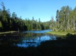
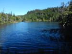
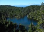
I left camp the next morning at around 8 am, for the almost leisurely 1¼ hour walk to the Wheaton Hut. This is a beautiful subalpine route past incredible tarns with Marble Mtn. looming from above. As one looks down on the first lake, the lower trail to Wheaton is evident. This is much more enjoyable than the higher treed route that parallels to the north. Stay down in the open, as this is where the scenery is.
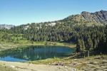
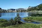
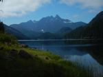
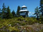
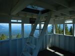
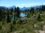
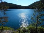
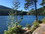
As I was planning to have an easy day in advance of the next day’s all-day trip to McBride, I set up camp down at Wheaton Lake, below the hut. Someone has put a mosquito net in the door of the hut, to provide relief for some, but I decided the gorgeous setting of the lake, with Morrison Spire as a backdrop, was a far superior spot.
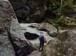
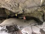
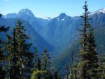
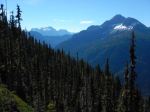
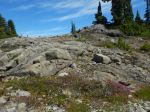
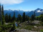
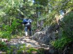
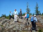
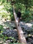
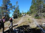
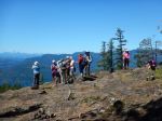
The next morning, I was on the trail at 7:45 for the 10 hour return trip up Mt. McBride. This is a long commitment, and an equally pleasing shorter alternative trip is Morrison Spire. This trip is far less gruelling regarding both distance and route finding, and provides a great ”above all” vantage point of the area. From Wheaton, one continues west along the side of the ridge behind the hut. This is a well worn route until it descends a small valley prior to ascending over the limestone band before the ascent up the summit ridge, where one can head south to Morrison Spire or north to McBride. The route through the limestone band is marked with cairns, but a GPS or compass and map, are handy for getting the general direction to the logical ascent to the summit Ridge. At this point, one is still on the Philips Watershed Route. There were only smaller patches of snow, but lots of water sources before climbing up to the ridge. There was some melting snow on the ridge, but this will lessen, as it was now only mid summer. Remember to look for fossils in the limestone area, as it was under the ocean some 250 million years ago. Quite striking when you compare this to its present alpine state.
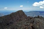
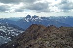
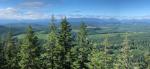
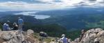
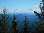
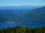
I headed north on the ridge towards McBride. At one point as the ridge meets the base of McBride, one loses some altitude. At this point I maintained this elevation on a worn route that skirts the mountain towards the north side with the objective of hiking up the north snowfield. Since the snowfields were well melted and separated by rock bands, I started heading up hill at the last visible rock band that had been visible when I first started traversing the mountain. I started heading up on rock and eventually arrived just below some false summits on the southwest ridge of McBride. Traversing around to the north at this point brought me to the south summit at 2081 meters. This is not technical, but can require some scrambling with use of hands. The reward was a breathtaking 360 view and direct view at the northeast aspect of the Golden Hinde. As I was lunching, a helicopter circled around, eventually landing below the approach ridge. My curiosity was piqued, as no landings are permitted without a permit or an emergency. It took me 5½ hours to reach the peak from Wheaton (and 4 ¼ hours to descend).
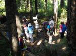
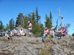
On the way down the ridge, I couldn’t believe my ears: a marmot whistle the first I have ever heard in this area! Then I ran into one of the marmot researchers who had choppered in. They had set up a camp on the edge of the limestone area and were radio tagging the marmots. These had been introduced into the area, with the addition of another individual, several years later, to help the growth of the population. Very cool! I continued my 4 hour plus hike back down.
That night, back down at Wheaton Lake, I had another reward repeated for a second night: “Mars shine”. I was close enough to the end of the month where Mars was the closest to earth it has been for 15 years (when I had previously seen the spectacle while camping on Catala Island, on the west coast). Mars was very orange red and big enough to produce a ray of orange light on Wheaton Lake.
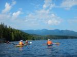
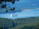
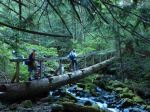
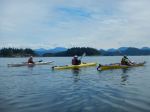
Next day, I left in the late morning for a 3 hour hike back down to my kayak, and the Buttle Lake crossing.
Brent Henry
Please note, this was not an official trip and the report is provided for information.
(click on photos to view larger)