| Activity | Hiking |
| Destination | Elk Falls Loop |
| Date | 24 April, Monday |
| Trip Coordinator | Debbie Quigg |
| Contact Info | 285-3710 or dmquigg@gmail.com. Please contact the coordinator by Saturday night. |
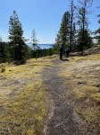
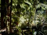
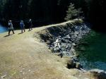
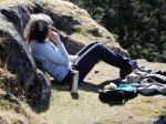
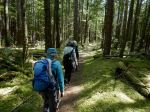
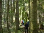
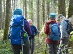
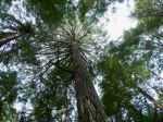
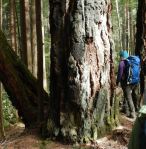
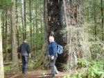
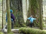
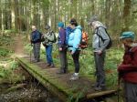
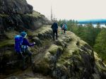
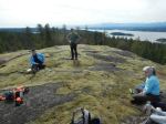
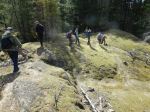
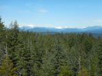
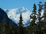
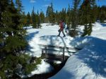
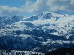
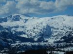
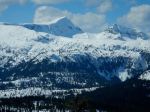
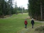
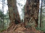
| Description | The plan is to hike the full loop beginning at the logging bridge across the Campbell River. We will hike along the north shore of the River (hopefully there will be trillium and fawn lilies in bloom), across the Canyon View Bridge, up to the Elk Falls viewing area, Moose and Deer Falls, before heading back down on the south side of the River. About 12 km and 5 hours. |
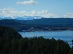
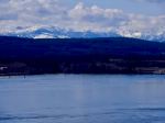
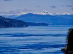
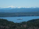
| Meeting Place | Q Cove Ferry terminal. Drivers need to be early for this busy sailing. |
| Departure Time | 9:00 ferry |
| Difficulty |
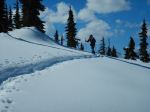
A few steep places, but mostly reasonable walking on good trails. |
| Costs | Shared ferry costs |
| Trip limits | 12 |
| Dogs? | No |
| Notes: | Bring lunch and gear for weather. |
Trip Report – Maud Island – 4 April 2023
Four of us set out on this gorgeous sunny day from the Maud Island parking area. On the way to the view point situated on Maud Island which overlooks the Seymour Narrows we took the route over the bluffs via Mt Lolo. This is a tricky part of the hike requiring caution on some of the descents. We enjoyed the sunshine and spectacular views while we ate our lunch at the viewpoint and were entertained by four or more sea lions frolicking close to the shore in the rapids. On the way back to the vehicles we took the lower trail and stopped at the salt water lagoon to check it out. The hike including lunch was close to 4 hours and was 10 km.
Vikki
Thanks to Vikki and Norris for the photos.
- Bones
- Cross Mt. Lolo bluff
- Hanging moss
- Causeway to Maud Island
- Seymour Narrows
- Discovery Passage
- View toward Vancouver Island
- View north toward mainland Mountains
- Lunch with a view
- Sealion
- Currents in Seymour Narrows
- Whirlpools at the edge
- Saltwater lagoon
Trip Report – Heriot Ridge Loop – 29 Mar 2023
On a bright and sunny spring day, eight people started out to hike the Heriot Ridge Loop with some side attractions. After climbing up to the ridge on Hopespring Trail, we descended down the other side, turning right on Gowlland Harbour Trail and on to the first small bridge. From there we sidetracked a few hundred yards to look at the stand of 19 old growth trees that managed to survive the big fire of 1925. We then progressed on to look at the Three Sisters, that are some of the largest old growth trees on the Island. A short way down the path we turned left to go into a small creek valley, where there is another stand of old-growth trees. Back on the main path, we continued on to the turn off to Rousseau Ridge. We hiked to there to have a lunch while taking in the magnificent scenery. With our lunches, we enjoyed an appetizer of crackers, cream cheese, and smoked sockeye salmon.
After lunch, we hiked back to Thompson Trail and continued down it to the turn off for the Heriot Ridge Route. There is more open bluff hiking as you head up the ridge to the overlook where a bench has been placed. We paused to enjoy the view before hiking on back to our vehicles. (8.1 km, 4½ hours)
Les
Thanks to Les and Norris for the photos.
- Hopespring Trail
- Amongst the 19
- With the Three Sisters
- In the old growth grove
- Approaching Rousseau Ridge
- View of Vancouver Island
- Lunch on Rousseau Ridge
- Victoria Peak and Discovery Passage
- On Heriot Ridge Route
- View north from Heriot Ridge
Hiking – Carrington Bay and Forest – 1 May 2023
Rescheduled from March 6th.
| Activity | Hiking |
| Destination | Carrington Bay and Forest, Cortes Island |
| Date | 1 May 2023, Monday |
| Trip Coordinator | Debbie Quigg |
| Contact Info | dmquigg@gmail.com or 3710. Please contact the coordinator well in advance of the trip, so that car pools can be arranged. |
| Description | After the ferry crossing we will drive to the Carrington trailhead and follow the trails to Carrington Bay and lagoon. We will have lunch at Carrington Bay and continue on to Grandmother’s Grove following the stream. We plan to return on the 3:50 pm ferry. |
| Meeting Place | Cortes ferry line-up. |
| Departure Time | 9:05 am ferry; vehicles need to be in the ferry line-up not later than 8:15 am for this busy sailing. |
| Difficulty |
Easy to moderate. |
| Costs | Ferry travel costs; bring your experience card and ID |
| Trip limits | 12 |
| Dogs? | no |
| Notes: | Bring lunch and gear for weather. Please arrange carpools in advance. |
Trip Report – Mt. Washington & Mt. Elma – 22 Mar 2023
Except for one thing. The trail to Lake Helen Mackenzie crosses a stream on a bridge. The bridge was packed with snow, up to about a metre above the hand rail. It was well packed, but too narrow for snowshoes. And there was no way to avoid it since the stream was open. We crossed it, but once was enough, so we came back the Battleship Lake route. It also has a stream crossing with a snow-packed bridge. That one felt much safer, but it looked as if it might collapse sooner or later.
Norris
(click on photos to view larger)
- Ferry to Vancouver Island
- Mt. Albert Edward
- Frost crystals
- Crossing the sketchy bridge
- Lake Helen Mackenzie
- Coming out on the Mt. Elma ridge
- Mt. Albert Edward & Regan
- Mt Frink
- Mt Elma ridge
- Comox Glacier
- Castlecrag and Mt. Frink
- Mt Frink and ridge
- Mt. Albert Edward and Regan
Hiking – Trout Creek Falls – 12 Apr 2023
The date for this hike was changed from April 10th to 12th.
| Activity | Hiking |
| Destination | Trout Creek Falls |
| Date | 12 April, Wednesday |
| Trip Coordinator | Norris Weimer |
| Contact Info | norris.weimer@ualberta.ca; 250-285-3710. Please contact the coordinator by Monday evening. |
| Description | We will drive out Menzies Main a short distance to the trailhead for Trout Creek. This undulating and varied trail passes by three falls, each very different and scenic. The trail is basic and it may be a bit muddy, rooty and rocky. There are a few steep sections, but it’s quite short overall. It can be made into a loop by returning on a logging road. About 5km; 2½ hours. |
| Meeting Place | QCove ferry terminal |
| Departure Time | 10:00 |
| Difficulty |
Moderate |
| Costs | Ferry |
| Trip limits | 10 |
| Dogs? | No |
| Notes: | Bring gear for the weather and lunch. |
Trip Report – Haskins Farm-Fir Crest Loop – 15 Mar 2023
On March 15, 2023 a small group joined the Haskins Farm and Fir Crest walk. It was an easy walk which took approximately an hour and fifteen minutes. We began at the head of the Haskins Farm trail and at the first intersection took a left and walked through the forest, and through the new growth area over to the golf course where we walked along the cart path, past the Fir Crest trail parking and onto the start of the Fir Crest trail continuing down behind the houses of the subdivision to the bottom of the trail where we began the Fir Crest to Haskins Farm trail along the ridge. Deciding to skip the trail down to the beach, we took the trail back through Haskins Farm up to the vehicles.. The whole way is very lovely with a mixture of forest, new growth, and open fairways, while the ridge is particularly beautiful with the moss covered trees and ocean views. (5.9 km)
Vikki
(click on photos to enlarge)
- Fairway walk
- Big Douglas fir
Snow – Mt. Washington Area – 22 Mar 2023
| Activity | Snowshoeing |
| Destination | Mt. Washington area |
| Date | 22 Mar, Wednesday |
| Trip Coordinator | Norris Weimer |
| Contact Info | norris.weimer@ualberta.ca or 3710. Please contact the coordinator by Monday night. |
| Description | We will either go Paradise Meadows or to Ramparts Hill, depending on the conditions and the group. |
| Meeting Place | QI Ferry terminal |
| Departure Time | 9:00 ferry |
| Difficulty |
Easy to moderate |
| Costs | Transportation costs and trail pass if we go to Paradise Meadows (Adult $13) |
| Trip limits | None |
| Dogs? | No |
| Notes: | Bring lunch as we may not eat at Raven lodge. Have reliable equipment and winter gear. |
Kayaking – Maud Island and petroglyph at mouth of Morte Creek – 20 Apr 2023
This trip has been postponed.
| Activity | Kayaking |
| Destination | Maud Island and petroglyph at mouth of Morte Creek |
| Date | 20 Apr 2023, Thursday |
| Trip Coordinator | Vic Gladish |
| Contact Info | 250-285-2111; or 250-287-0459 text |
| Description | According to Joy Inglis’s “Petroglyphs of Quadra Island” there are several petroglyphs located along Quadra’s west shore at the outflow of Morte Lake creek just east of Maud Island. We will put in at the Leishmans Rd shore access by 0900 am and paddle north towards Maud Island. It is about a 1 hr paddle to the old village site of Kawstin at the outflow of Morte Lake creek. Depending on the amount of time spent here we may or may not paddle another 30 minutes into Maud Island and perhaps hike to the Seymour Narrows view point. |
| Meeting Place | Shore access at Leishmans Rd |
| Departure Time | 0930 on the water; meet at 0900 |
| Difficulty |
Moderate depending on weather and currents. |
| Costs | None |
| Trip limits | 8 |
| Dogs? | No |
| Notes: | The tides/currents will be a factor. In order to view the petroglyphs I am planning our arrival for low tide with less attention to what the current will be doing. Poor weather and/or wind will mean this trip will be cancelled. All participants must be equipped for ocean paddling in cooler weather – required equipment as per club guidelines (https://qioutdoorclub.org/wp-content/uploads/2018/07/paddling-guidelines-aug2018.pdf) and appropriate clothing. I will email to each participant the petroglyph information relevant to the location. Bring lunch, hot drinks, extra warm layers and something to sit on. |
Hiking – Maud Island – 4 April 2023
This trip was originally scheduled for March 13th
| Activity | Hiking |
| Destination | Maud Island |
| Date | 4 Apr 2023, Tuesday |
| Trip Coordinator | Vikki O’Brien |
| Contact Info | resvo2004@yahoo.com, 250-938-2864 |
| Description | Maud Island is situated beside Seymour Narrows and has a spectacular view of the narrows and it is a scenic walk in many areas. We will begin the trail from the far end of Morte lake at the Maud Island parking area. This hike is easy walking overall except for a section where it climbs up the bluffs at the base of Mt Lolo and there is a hill to get to the lookout. It is good to have your poles for the bluffs. On the return we will not take the bluffs, but rather will take the shoreline route. Maud Island has a beautiful lookout area where we will have lunch. This is approximately 4 – 4 1/2 hours including the lunch break. |
| Meeting Place | Heriot Bay store parking lot |
| Departure Time | 10:00 |
| Difficulty | Moderate |
| Costs | Nil |
| Trip limits | 12 |
| Dogs? | Yes, if under control. |
| Notes | Bring lunch, water, good footwear and walking poles. This hike is approximately 10 km. |


