| Activity | Kayaking |
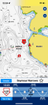
| Destination | Gowlland Harbour |
| Date: | 10 May 2023, Wednesday |
| Trip Coordinator | Les Hand |
| Contact Info | 250-285-2029 or lhquadra@gmail.com |
| Description | We will paddle around all of Gowlland Harbour, checking out the many small islands and the wonderful spring flowers. This will possibly take about four hours. Course will depend on weather. Be sure and sign up one day early so that I may contact you if things change. May stop at my house for appys and beverages. |
| Meeting Place | 823 Gowlland Harbour Road |
| Departure Time | 9:30 (unload and prepare at 9:00) |
| Difficulty |
Moderate |
| Costs | None |
| Trip limits | 10 |
| Dogs? | No |
| Notes: | Bring your kayak and all necessary safety equipment as per transport Canada safety rules. Bring a lunch and spray skirt as it might be needed. Only two vehicles can unload at the beach at one time, so please be on time. Gowlland Harbour resort has kindly granted us permission to use their boat launch for this trip. This is not a public access. Many thanks to Gowland Harbour Resort. |
Trip Report – Elk Falls Loop – 24 Apr 2023
Five of us hiked the loop from the logging bridge on the Campbell River up to Moose Falls and back. This is an excellent hike with many points of interest along the way, but it is particularly special in the spring with the wildflowers in bloom. We parked on the north side and followed the path upstream. The timing was perfect and there were pink and white fawn lilies, trillium, and wild bleeding heart all along the way.
We admired the Canyon View and continued up to the Millennium Trail. We took an unmarked side path to a lovely mossy bluff with an excellent view of Elk Falls and stopped for elevenses. We continued by some big old growth Douglas fir trees to the Elk Falls viewing platform and suspension bridge. There was not much water in the falls, but it is always beautiful
We took the gradually ascending Old Growth trail followed by the very steep descent to the rocky viewpoint for Moose Falls and the Dolphin Pool, where we stopped for lunch. We returned along the river, passing more old growth trees and Deer Falls. We crossed at Station View, with its totem poles and interpretive information about the generating station, and continued on the south bank, with more wildflowers, back to the vehicles. The weather was perfect for this hike and it was a great way to end the “winter” schedule. (11.8 km; 4½ hours)
Debbie
(click on photos to view larger)
- Daffodils on ferry terminal shore
- White and pink Fawn Lilies
- Trillium
- Salmonberry
- Fawn Lily grove
- Angled Bittercress
- Emerging Sword Fern
- The Campbell River
- Wild Bleeding Heart
- Skunk Cabbage
- The Canyon View Bridge
- The break on the bluff
- Elk Falls
- Suspension bridge
- Viewing platform
- Elk Falls
- Pool below Deer Falls
- Garter Snake
- Trillium grove
- Trillium
- Pink Fawn Lily
- Fawn Lily grove
Hiking – Hyacinthe Bay at Low Tide – 8 May 2023
| Activity | Hiking |
| Destination | Hyacinthe Bay low tide walk |
| Date | 8 May 2023, Monday |
| Trip Coordinator | Debbie Quigg |
| Contact Info | dmquigg@gmail.com or 3710. Please contact the coordinator by Saturday night |
| Description | We have very kindly been invited to Chauntaluf Farm. This will be an afternoon walk to take advantage of the 0.5m low tide at 14:22. After walking through the farm to Hyacinthe Bay, we will explore the tidal flats for their history and ecology. Gradually moving to the east, we will arrive at the property donated to the SRD, where we plan to return on old (and unmaintained) trails through the forest. |
| Meeting Place | Heriot Bay store parking lot |
| Departure Time | 13:30 |
| Difficulty | Very easy unless the trail is in poor condition |
| Costs | None |
| Trip limits | 12 |
| Dogs? | No |
| Notes | Bring a lunch, gear for the weather |
Kayaking – Maud Island and Morte Creek petroglyphs – 18 May 2023
This trip was previously scheduled for May 24th.
| Activity | Kayaking |
| Destination | Maud Island and Morte Creek petroglyphs |
| Date | 18 May 2023, Thursday |
| Trip Coordinator | Vic Gladish |
| Contact Info | 250-285-2111; or 250-287-0459 text |
| Description | According to Joy Inglis’s “Petroglyphs of Quadra Island” there are several petroglyphs located along Quadra’s west shore at the outflow of Morte Lake creek just east of Maud Island. We will put in at the Leishmans Rd shore access by 0930 am and paddle north to Maud Island, likely bucking some current as we will want to stay close to shore to avoid any hazardous turbulence. Lunch at Maud Island and then backtrack to the mouth of Morte Creek to the old village site of Kawstin to find and view the petroglyphs. Then return to Whalebone Cove and the takeout. |
| Meeting Place | Shore access at Leishmans Rd |
| Departure Time | 0900 on the water; meet at 0830 |
| Difficulty |
Moderate to difficult depending on weather and currents. |
| Costs | None |
| Trip limits | 8 |
| Dogs? | No |
| Notes: | The tides/currents will be a factor. In order to view the petroglyphs I am planning our arrival for low tide with less attention to what the current will be doing. Poor weather and/or wind will mean this trip will be cancelled. All participants must be equipped for ocean paddling in cooler weather – required equipment as per club guidelines (https://qioutdoorclub.org/wp-content/uploads/2018/07/paddling-guidelines-aug2018.pdf) and appropriate clothing. I will email to each participant the petroglyph information relevant to the location. Bring lunch, hot drinks, extra warm layers and something to sit on. |
Trip Report – Trout Creek Falls Trail – 12 April 2023
Five of us took advantage of the perfect weather (recently very rare) to hike the Trout Creek Falls loop, which for some historical reason is on Mohun Creek. The trail was dry and in good condition, with evident clean-up after winter and some new ropes since we visited last. It goes uphill, as you might expect for waterfalls. Multiple waterfalls. There are three main ones and a cascade. The first is near the trail head and is impressive. The second is bigger and higher and even more impressive. The third is beyond impressive, though the height of the drop is less than the second falls. This last falls drops into a narrow gorge and the trail is just on the opposite gorge edge, as close as you would want to be. But watch your step! We had lunch on the open, mossy bluff just above the falls. There was lots of water in the falls after all the recent rain, and it was a sunny, blue day, with sunshine on all the falls. Perfect.
After lunch we visited the calm pool in the creek just above the falls, then hiked on upstream to where the trail joins the Mary Lake (forestry) Road, which we followed back down, with a short stop at Mary Lake. Mary Lake is a beautiful lake, but somewhat spoiled by slobs who leave garbage, shotgun shells and bits of fluorescent orange shotgun targets everywhere on the otherwise lovely mossy bluff. (7km, 3 hours)
- Leaving Quathiaski Cove
- View toward Vancouver Island
- Crossing Discovery Passage
- Trout Creek Falls
- The Middle Falls
- Skunk Cabbage
- Third Falls
- Garter Snake
- Mary Lake
Hiking – Elk Falls Loop – 24 April 2023
| Activity | Hiking |
| Destination | Elk Falls Loop |
| Date | 24 April, Monday |
| Trip Coordinator | Debbie Quigg |
| Contact Info | 285-3710 or dmquigg@gmail.com. Please contact the coordinator by Saturday night. |
| Description | The plan is to hike the full loop beginning at the logging bridge across the Campbell River. We will hike along the north shore of the River (hopefully there will be trillium and fawn lilies in bloom), across the Canyon View Bridge, up to the Elk Falls viewing area, Moose and Deer Falls, before heading back down on the south side of the River. About 12 km and 5 hours. |
| Meeting Place | Q Cove Ferry terminal. Drivers need to be early for this busy sailing. |
| Departure Time | 9:00 ferry |
| Difficulty |
A few steep places, but mostly reasonable walking on good trails. |
| Costs | Shared ferry costs |
| Trip limits | 12 |
| Dogs? | No |
| Notes: | Bring lunch and gear for weather. |
Trip Report – Maud Island – 4 April 2023
Four of us set out on this gorgeous sunny day from the Maud Island parking area. On the way to the view point situated on Maud Island which overlooks the Seymour Narrows we took the route over the bluffs via Mt Lolo. This is a tricky part of the hike requiring caution on some of the descents. We enjoyed the sunshine and spectacular views while we ate our lunch at the viewpoint and were entertained by four or more sea lions frolicking close to the shore in the rapids. On the way back to the vehicles we took the lower trail and stopped at the salt water lagoon to check it out. The hike including lunch was close to 4 hours and was 10 km.
Vikki
Thanks to Vikki and Norris for the photos.
- Bones
- Cross Mt. Lolo bluff
- Hanging moss
- Causeway to Maud Island
- Seymour Narrows
- Discovery Passage
- View toward Vancouver Island
- View north toward mainland Mountains
- Lunch with a view
- Sealion
- Currents in Seymour Narrows
- Whirlpools at the edge
- Saltwater lagoon
Trip Report – Heriot Ridge Loop – 29 Mar 2023
On a bright and sunny spring day, eight people started out to hike the Heriot Ridge Loop with some side attractions. After climbing up to the ridge on Hopespring Trail, we descended down the other side, turning right on Gowlland Harbour Trail and on to the first small bridge. From there we sidetracked a few hundred yards to look at the stand of 19 old growth trees that managed to survive the big fire of 1925. We then progressed on to look at the Three Sisters, that are some of the largest old growth trees on the Island. A short way down the path we turned left to go into a small creek valley, where there is another stand of old-growth trees. Back on the main path, we continued on to the turn off to Rousseau Ridge. We hiked to there to have a lunch while taking in the magnificent scenery. With our lunches, we enjoyed an appetizer of crackers, cream cheese, and smoked sockeye salmon.
After lunch, we hiked back to Thompson Trail and continued down it to the turn off for the Heriot Ridge Route. There is more open bluff hiking as you head up the ridge to the overlook where a bench has been placed. We paused to enjoy the view before hiking on back to our vehicles. (8.1 km, 4½ hours)
Les
Thanks to Les and Norris for the photos.
- Hopespring Trail
- Amongst the 19
- With the Three Sisters
- In the old growth grove
- Approaching Rousseau Ridge
- View of Vancouver Island
- Lunch on Rousseau Ridge
- Victoria Peak and Discovery Passage
- On Heriot Ridge Route
- View north from Heriot Ridge
Hiking – Carrington Bay and Forest – 1 May 2023
Rescheduled from March 6th.
| Activity | Hiking |
| Destination | Carrington Bay and Forest, Cortes Island |
| Date | 1 May 2023, Monday |
| Trip Coordinator | Debbie Quigg |
| Contact Info | dmquigg@gmail.com or 3710. Please contact the coordinator well in advance of the trip, so that car pools can be arranged. |
| Description | After the ferry crossing we will drive to the Carrington trailhead and follow the trails to Carrington Bay and lagoon. We will have lunch at Carrington Bay and continue on to Grandmother’s Grove following the stream. We plan to return on the 3:50 pm ferry. |
| Meeting Place | Cortes ferry line-up. |
| Departure Time | 9:05 am ferry; vehicles need to be in the ferry line-up not later than 8:15 am for this busy sailing. |
| Difficulty |
Easy to moderate. |
| Costs | Ferry travel costs; bring your experience card and ID |
| Trip limits | 12 |
| Dogs? | no |
| Notes: | Bring lunch and gear for weather. Please arrange carpools in advance. |
Trip Report – Mt. Washington & Mt. Elma – 22 Mar 2023
Except for one thing. The trail to Lake Helen Mackenzie crosses a stream on a bridge. The bridge was packed with snow, up to about a metre above the hand rail. It was well packed, but too narrow for snowshoes. And there was no way to avoid it since the stream was open. We crossed it, but once was enough, so we came back the Battleship Lake route. It also has a stream crossing with a snow-packed bridge. That one felt much safer, but it looked as if it might collapse sooner or later.
Norris
(click on photos to view larger)
- Ferry to Vancouver Island
- Mt. Albert Edward
- Frost crystals
- Crossing the sketchy bridge
- Lake Helen Mackenzie
- Coming out on the Mt. Elma ridge
- Mt. Albert Edward & Regan
- Mt Frink
- Mt Elma ridge
- Comox Glacier
- Castlecrag and Mt. Frink
- Mt Frink and ridge
- Mt. Albert Edward and Regan


