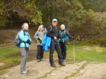
None of the 10 of us had spent much time in Cowichan Valley so this trip was exploratory. The weather was marginal, but we were lucky enough to never get wet. Some in the group had injuries, so not everyone was able to participate in the outings. We could see the evidence of the hugely destructive storm that hit the area in December 2018, but every trail we hiked had been well maintained. Spring was blooming out all over and the wildflowers were excellent.
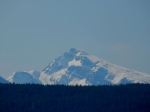
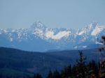
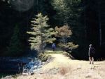
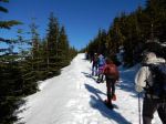
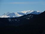
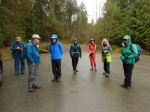
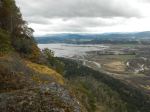
Sunday – We met at the Duncan Market around noon before continuing to the vacation rental on Shawnigan Lake, where most of us were staying. After settling in, we went for a hike at Cobble Hill mountain. We hiked a loop (Squirrel, Frog, Buck, and Turtle) up to the summit ridge with great views in nearly all directions. It was a good introduction to the area with views of the Saanich Peninsula, Cowichan Bay, Mt. Tzouhalem, and the agricultural land in the Valley. 5.4 km; 2¼ hours. Back at the house, we had a great meal, celebrated a birthday, and sang to the accompaniment of guitars.
(click on photos to view larger)
-

- Living room
-

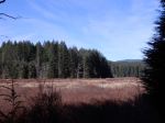
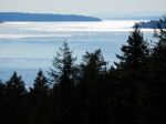
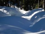
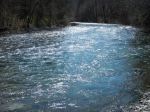
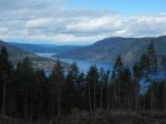
- Shawnigan Lake

-
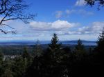
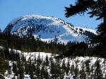
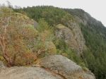
- View east from Cobble Hill
-
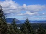
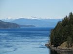
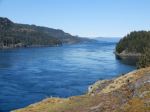
- View toward Salt Spring Island
-
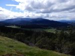
- View west from Cobble Hill
-
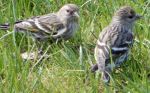
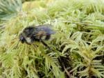
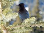
- Pine Siskins
-
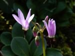
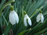
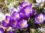
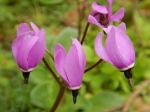
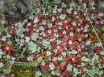
- Shooting Star
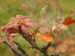
-
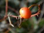
- Arbutus

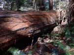
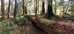
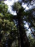
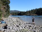
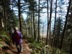
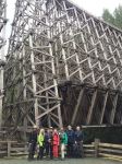
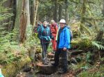
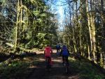
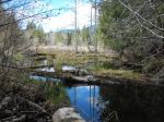
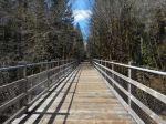
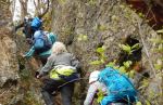
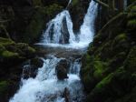
Monday – The weather was less promising as we set out from the rather obscure trailhead to Fern Grotto. We started on an old logging road that segued to a quite new trail through open forest with lots of maples, moss, and ferns. We reached the impressive Kinsol Trestle and had lunch before hiking out and back on the Jack Fleetwood trail. The Koksilah River and the fawn lilies were lovely. The group preferred to hike back to the house along the Cowichan Valley Trail, rather than retrace our route to the vehicles. We narrowly escaped heavy rain, returning to the vacation rental just in time. 14.7 km; 4¾ hours. We had another wonderful meal followed by games and reading.
-

- Shawnigan Lake
-

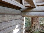
- The vacation rental house
-
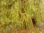
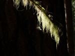
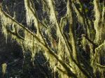
- Hanging moss
-
- Elkhorn Lichen
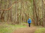
-
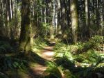
- Fern Grotto trail
-
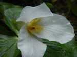
- Trillium
-
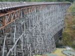
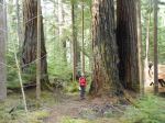
- Kinsol Trestle
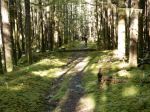
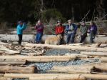
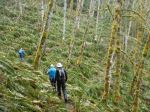
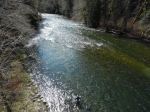
Tuesday – We had a sunny day for our bike trip on the Cowichan Valley Trail/Great Trail from Glenora to the end of the trail toward Cowichan Lake and back. Les opted to hike the Cowichan River Footpath nearby. Those who didn’t own bikes rented e-bikes, which was entertaining and easy. We later learned that this is the roughest section of the Cowichan Valley Trail, so we spent more time looking where the tire was headed than at the scenery. The forest was lovely and open, with creeks, wetlands (even a turtle) and, of course, trestles and the Cowichan River. 46.0 km; 5¼ hours. We had yet another great dinner and more music.
-
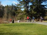
- Setting out from Glenora
-
- Cowichan Valley Trail
-
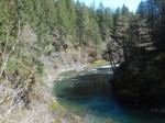
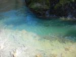
- Cowichan River
-
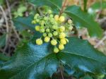
- Oregon Grape
-
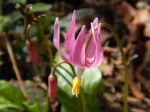
- Pink Fawn Lily

-
- Trestle bridge
-
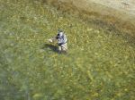
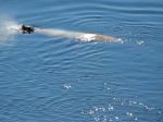
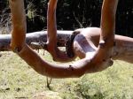
- Fly fishing
-
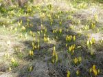
- Skunk Cabbage
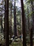
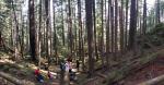
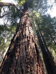
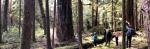
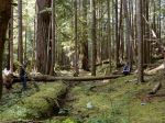
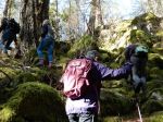
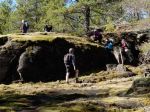
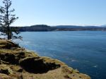
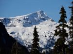
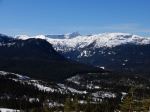
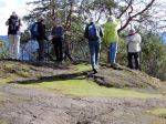
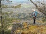
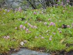
Wednesday – The weather improved through the day. We hiked at Mt. Tzouhalem starting at the Kaspa parking lot and following the view trails at the edge of the escarpment. The meadows of shooting star wildflowers were a treat, as were the views of the Cowichan Valley. We stopped for lunch near the cross and then continued along the cliffs to the edge of the reserve before following logging roads, with a view of Salt Spring Island and Samson Narrows, back to the car. This area is a complex web of unmarked paths, and it’s good to go with a map, GPS or app to avoid getting lost. 9.9 km; 4¼ hours. Although rather late in the day, a few people opted to continue on to the Koksilah Ancient Forest Reserve. After a bit of trouble finding the trailhead, the blue flagging got us to the grove of fine old trees along the river. We would have liked to have spent more time there. 4.3 km; 1 hour. For our last night, we went out to dinner at the Village Chippery, which was very popular with locals and very good.
-
- Shooting Star
-
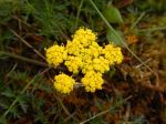
- Spring Gold, common lomatium
-
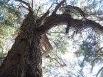
- Garry Oak
-

- Shooting Star
-
- Arbutus forest
-
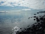
- Cowichan Bay
-
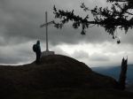
- At the cross
-
- The cliffs at Mt. Tzouhalem
-
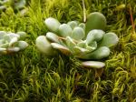
- Succulents in moss
-
- Samson Narrows
-
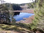
- Koksilah Ancient Forest Reserve
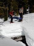
Thursday – The dark skies only produced drizzle on the hike near Cedar, taking the Cable Bay Trail to Joan Point and Dodd Narrows. This is a popular trail with locals. It’s wide and smooth and trends down to the ocean. The trail along the coast is lovely with great views of the sandstone shoreline typical of the southern Gulf Islands. The spring flowers were excellent with lots of fawn lilies. The current was not running strongly in Dodd Narrows, but the low tide provided inter-tidal viewing. 6.5 km; 1¾ hours.
-
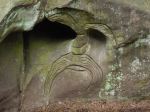
- Modern petroglyph
-
- Sea blush
-

- Sandstone shoreline
-
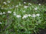
- Fawn lilies
-
- Creeping sedum
-
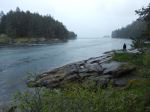
- Dodd Narrows
-
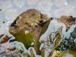
- Sea anemone
-
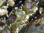
- Sea anemone
-
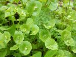
- Miner’s lettuce
-
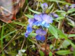
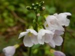
- Blue-eyed Mary
-
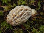
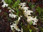
- Morel mushroom
-

- Calypso orchid
-
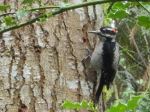
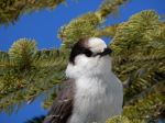
- Yellow-bellied Sap Sucker
Debbie