Trip Report – Deepwater Bay – 12 Apr 2018

Because the weather forecast was poor, we saved the planned view trip for another day when we would have a view, and chose another destination below cloud level.  We also postponed it a day to avoid the worst weather.  As luck would have it, we had a beautiful sunny day for a hike down to Deepwater Bay and back.

The first part of the hike was an unexpected detour through the forest around work to renew the old road for future logging operations.  Trees alongside of the roadway had been neatly felled onto the logging road and not yet cleaned up.  Beyond that, the walking was good except for a bit of erosion and a landslide on the north bank of the creek, which swept trees across to the south bank and the trail.  The whitewater stream was impressive with recent rains and there were several waterfalls.  We had lunch at the Bay in warm sunshine and returned uphill to the vehicle. 4.4 km; 2½ hours.  

As the hike was fairly short, we made a side trip to some of the nearby karst sinkholes.  There was a report that the creek had re-routed.  However, there was some water in the insurgent and resurgent creek, though not as much might be expected with recent rain.

– Norris

(click on photos to view larger)


Trip Report – Miracle Beach & Salmon Pt – 28 March 2018

Seven of us took the 10:00 ferry and drove to Miracle Beach. There is a provincial park here as well as a large picnic area and many small trails. There are huge sand flats when the tide is out. Although not many birds while we were there, this can be a great place for bird viewing. We walked along the beach to Black Creek. Then followed it up to the campground and back to the vehicles. 2.5 km and about 45 minutes.

We then drove up to the Salmon Point Restaurant and Pub for a delicious lunch. After we walked the ocean side trail to Oyster River Nature Park. We made a loop through it and back to Salmon Point. There were quite a few birds on this trail and a pair of bald eagles perched on the light tower at Salmon Point. 6.5 km and about 1 hour and 35 minutes.

Les

Thanks to Norris and Les for the photos

(click on photos to view larger)

Hiking – Miracle Beach & Salmon Pt – 28 March 2018

Trip Report – Hikes from Open Bay Main – 28 Feb 2018

The weather forecast was not good. Bad actually: heavy rain and high winds.  But seven hikers ventured out anyway.  First we walked a trail along Open Bay Creek, a nice salmon stream, and walked back on a logging road.  There had been quite a lot of logging east of the road since our last trip here. 3.2 km; 1 hour.

There was snow on the trail and it was slippery, so for the second act we hiked to Stramberg Lake instead of the planned Crikey Creek mountain bike trails. The mountain bike trails were steep and the route to Stramberg was flat, but the snow was a bit deep in places.  We stopped for lunch out of the wind and then took the old logging road into Main Lakes Park.  We followed the side trail down to Stramberg Lake for the wintery view and then returned. 4.5 km; 1½ hours.

There were some wet feet from the snow. On the plus side, we were quite sheltered in these forests from the wind, and it didn’t start raining hard until we got back.  There were lots of huge wolf prints in the snow.

– Norris

(click on photos to view larger)

Thanks to Norris and Les for the photos

Hiking – Hikes from Open Bay Main- 28 Feb 2018

Trip Report – Hopespring – Thompson Trail loop – 21 Feb 2018

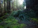
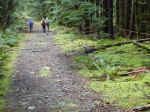
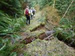
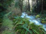
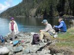
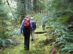
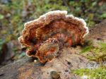
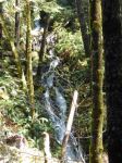
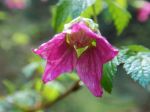
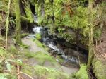
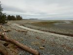
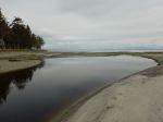
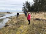
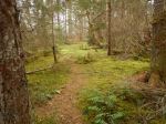
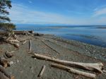
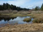
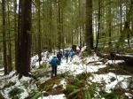
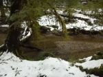
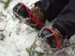
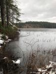
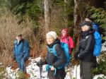
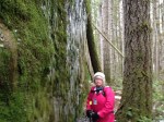
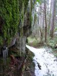
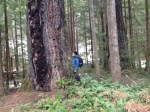
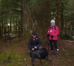
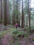
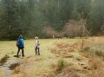
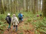
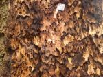
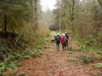
Three hikers and one dog enjoyed a lovely 2½ walk in the woods. Because Daphne wanted to add lots of steps on her FitBit, the coordinator ensured this would happen by going the wrong way, not once, but twice. We began at the Hopespring entrance, continued past the three sisters on to the grove of old growth. We then headed up the trail, supposedly toward the Thompson trail, which actually took us close to Rousseau Ridge, adding about half an hour to the total trip. According to the FitBit we took about 14,000 steps.

Sandra

Thanks to Sandra and Vic for the photos.

Hiking – Hopespring-Thompson Loop – 21 Feb 2018

Hiking – Miracle Beach & Salmon Point – 28 March 2018

Activity Hiking
Destination Miracle Beach and Salmon Point
Date 28 March 2018, Wednesday
Trip Coordinator Les Hand
Contact Info 285-2029.  Please contact coordinator 2 days ahead as schedule may change.
Description We will drive to Miracle Beach and walk along the ocean to Black Creek. This is a short 3.5 km walk up the creek and thru the campground. We will then drive to Salmon Point and have lunch.
Afterward we will do the 7 km walk along the ocean to Oyster River and back. This goes by a Ducks Unlimited area so is good for bird watching.
Meeting Place Quathiaski ferry terminal
Departure Time Early enough for 10:00 ferry car-pooling
Difficulty
Easy
Costs The shared ferry, fuel cost and your lunch. Their menu is online.
Trip limits none
Dogs? Must be on a leash due to the birds.
Notes: This is along the ocean so not a good walk for heavy wind and/or rain.

Trip Report – Haskins Farm Loop – 31 Jan 2018

The seven of us went on this short, easy hike on one of the better official trails.  We started out on the trail through forest and meadow, and descended the steep switchbacks to the water.  After admiring the rather wintry view, we followed the short trail to the north along the shore, past some fine old growth trees, then returned back up the hill.  We turned north again and followed the logging road.  We took the short side trip to the Todd Scharf memorial trail and then followed the logging road west, back to the cars, beating the start of the rain. This is a short, classic hike with lots of variety in the forest and views.  4.5 km; 1⅔ hours.

Debbie

(click on photos to view larger)

Hiking – Haskin’s Farm Loop – 31 Jan 2018

Hiking – Crikey and Open Bay Creeks – 28 Feb 2018

Activity Hiking
Destination Crikey and Open Bay Creeks
Date 28 Feb 2018, Wednesday
Trip Coordinator Norris Weimer
Contact Info 285-3710 or norris.weimer@ualberta.ca.  Please contact the coordinator in advance of the trip.
Description We plan to walk a figure-of-eight loop starting on the trail along the Open Bay Creek, then circling back on a logging road.  After a short walk down Open Bay Main we will hike up the Rio mountain bike trail and down Crikey Creek.  The first part is flat, the second part has a hill.
Meeting Place Heriot Bay Store parking lot for car pooling
Departure Time 10:00
Difficulty
Fairly easy, unless there is winter deadfall
Costs none
Trip limits none
Dogs?
Notes: Bring a lunch and gear for the weather.

Trip Report – Mud Lake-Morte Lake Loop – 17 Jan 2018

Because of a big winter storm, we substituted this short hike for the previously planned trip to Mt. Washington. Five stalwart and cheerful hikers, undeterred by the weather, came out in a gale. We started at the pull off just past Mud Lake on the Walcan Road. After crossing the creek, we hiked up the South Bluff trail over the bluff to Morte Lake. The trail is quite steep, the bluff is open and covered with moss and lichen. We followed the old logging road down to Morte Lake. No one wanted to turn back so soon, so we continued on to the viewpoint, which was relatively sheltered from the southeast wind. We took the Tripod Connector trail back to the trail along Mud Lake. Again, no one was ready to head for the car, so we took the trail west to the Mud Lake trailhead at the Walcan Road. Finally we turned back to the car. The trail was quite wet in places and no one went home dry.  6.1 km; 2 hours.

Debbie

(click on photos to view larger)

Hiking – Mud Lake to Morte Lake Loop – 17 Jan 2018

Hiking – Morte Lake to Mud Lake loop – 17 Jan 2018

Activity Hiking
Destination Mud Lake to Morte Lake loop
Date 17 Jan 2018, Wednesday
Trip Coordinator Debbie Quigg
Contact Info debbie.quigg@ualberta.ca or 3710.  Please contact the coordinator prior to the trip.
Description This is a substitute trip.  It will be a short hike over a bluff from Mud Lake to Morte Lake.  We will make it a loop by returning via Tripod.  This is a short hike with lots of variety.
Meeting Place Heriot Bay Store for car pooling
Departure Time 10:00
Difficulty
Easy, but there’s a hill
Costs none
Trip limits none
Dogs?
Notes: The weather will be appalling so dress for it.  We won’t stop for lunch.

Trip Report – Surge Narrows logging roads – 10 Jan 2018

Ten of us took advantage of the brief break in the rainy weather to explore another part of the island.  We started from near Mine Lake. After a short steep section, the old logging road is pretty flat and open, going through a section of the woodlot in which the re-planted trees are growing nicely.  The forest is quite diverse and some of it is mature with open understory.  We took a short side trip to a trailhead on the Bold Point Road, then had lunch in a nice clearing.  After lunch we bushwhacked a bit and climbed a little bluff with good views all around and continued south to rejoin the Surge Narrows Road, which we walked back to the starting point.   8.3 km; 3½ hours.

– Norris

(click on photos to view larger)

Hiking – Surge Narrows logging roads – 10 Jan 2018