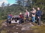
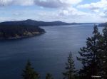
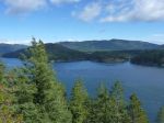
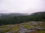
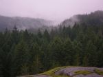
Hike Wood Duck Lake & Old Mine Trail 19 June 2014

Activity Hiking
Destination Wood Duck Lake off North Gowlland (log dump) Rd
Date Thursday, 19 June 2014
Trip Coordinator Heather and Rolf Kellerhals
Contact Info 250 285-3570
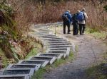
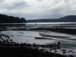
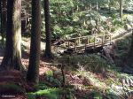
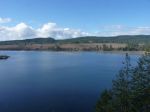
Description Hike to lake along foot trail and along route built by mountain bikers to abandoned mine site.
Meeting Place Heriot Bay Store parking lot for car pooling at 9:45 or directly to the corner of Hyacinth Bay Road and North Gowlland  Road. Be aware of possible logging trucks turning in.
Departure Time 10:00 A.M. at corner of Hyacinth Bay Road and North Gowlland Road.
Difficulty easy
Costs nothing
Trip limits none
Dogs? No
Notes: The lake outlet has an interesting and active beaver dam that broke recently and sent down a flood that managed to pass through the highway culvert but took out the road going to our place for several weeks.


Hike Main Lake from Surge Narrow Rd. 14 June 2014

POSTPONED

Activity Hiking
Destination Main Lake from Surge Narrow Rd
Date Saturday, 14 June 2014 TBA
Trip Coordinator John Brears
Contact Info 250 285 3853.  Please confirm no later than one week ahead (by June 7) if you will be participating.  Leave a message with your phone number if no answer.
Description The trip will follow a flagged route from Surge Narrows Rd to the east end of Main Lake.  The walk to the Lake has attractive features, including some large old growth timber, the first lake and Main Lake, a small waterfall, two beaver dams, beautiful moss-covered terrain.  The walk involves tricky navigation through a lot of deadfall, blowdown, and confusing gullies. There is no established trail for about 50% of the trip. The route crosses a few small wet areas. Depending on the return route there may be some disgusting salal bashing.  People should be fully prepared for the above, with proper footware etc. and prepared to stick with the group for the whole trip. It is easy to get disoriented. Hiking time about 4 hours.
Meeting Place Heriot Bay Store for car pooling
Departure Time 9:00 A.M.
Difficulty
Costs none
Trip limits none
Dogs? You know your dog best.
Notes: Bring lunch and bug repellant.  Not on if the weather is foul/wet.


Hike Morte Lake Loop – 21 May 2014

Activity Hiking
Destination Morte Lake loop with variations
Date Wednesday  21 May 2014
Trip Coordinator Debbie Quigg
Contact Info 285-3710;  Please contact the coordinator not later than Sunday, May 18th
Description Circumnavigate Morte Lake using George’s flagged route up to and along the southern ridge, mountain bike trails to Dead Fish, and the main trail around the west and north sides of the lake.  Allow four hours or more.
Meeting Place Heriot Bay Store for car pooling
Departure Time 10:00 A.M.
Difficulty
moderate
Costs none
Trip limits none
Dogs? Okay on leash – we may encounter bikes or animals
Notes: Bring lunch.  Expect some steep sections, wet sections, flagged routes, mountain bike trails, sandy beaches and great views.  If the weather is horrible, we’ll re-schedule.

(map coming soon)


Trip Photos – Deepwater Bay – 1 May 2014

Started off the month of May with great weather and an adventurous hike. We were headed to Deepwater Bay via the old logging road but decided to take time out to look for the old logging train trestle. Debbie, Norris and Les had looked for this before but to no avail. It seemed that everyone we had talked to had not been there in a few years back and you know how memories are. This time though we found it, much to our pleasure. There is not much left but sure leaves you with a great appreciation for old engineering skills. It was quite a feat to cross that canyon and the old pilings give you an idea of the immense size.

We then walked down the old part of the logging road to Deepwater Bay. There are old remnants of a land based fish farm there. We had lunch by a small creek and enjoyed the sun. The hike back up was harder but it is not far and well worth the time.

(click on photos to view larger)

Hike Deepwater Bay 1 May 2014

Hike Deepwater Bay 2 May 2014

NOTE DATE CHANGE

Activity Hiking
Destination Deepwater Bay
Date Friday, 2 May 1 May 2014
Trip Coordinator Les Hand
Contact Info 285-2029
Description Hike on old logging road from end of new logging road to Deepwater Bay. This path follows a lovely stream to the ocean.
Meeting Place Heriot Bay Store for car pooling
Departure Time 10:00 A.M.
Difficulty
easy
Costs none
Trip limits none
Dogs? Are welcome as long as they will stay by you
Notes: Please let me know at least two days prior if you are going.  Bring water and a lunch.  We will eat where the stream goes into the ocean. This is only 2.5 kilometers one way but 275 meters up on the way back. Including lunch and driving the trip will take about 3.5 hours.


Google Maps of the hike


Trip Photos – Maud Island 31 Mar 2014

The weather could not have been more perfect for our hike to Maud Island. It was a beautiful spring day with plenty of sunshine. We reached Seymour Narrows just before a maximum current of 14.1 knots. It was like a roaring river, complete with whirlpools and back eddies that sea-lions were playing in.

On the return trip we went over Mt. Lolo. This proved to be a bit of an adventure as the trail is not marked as well from that direction. We were rewarded with bright sunny views though.

(click on photos to view larger)

Hiking Maud Island 31 Mar 2014

Trip Photos – Ripple Rock – 19 March 2014

Although the day dawned dark and rainy, the weather was great by the time we started down the trail around 11:00.  The group enjoyed the walk on this well constructed, undulating trail including stairs and a swinging suspension bridge.  Points of interest along the way include a few excellent old growth trees, lush mosses and ferns, an old corduroy road, a few creeks, the view point over Menzies Bay from a rocky bluff, the sandy beach at Nymphe Cove and budding fawn lilies.  After the final push up the hill and stairs to Wilfred Point, the group was rewarded with great views of Discovery Passage and a warm and sunny lunch stop.   There were sea lions and seagulls feeding in the current. The area is steeped in the history of early logging and the major efforts made to blow up Ripple Rock in Seymour Narrows to improve the safety of navigation through those waters.  When we arrived the ebb was running about 7 knots.  Although it can run more than double that speed, the turbulence was quite impressive.  The hike, round trip, is 8 kilometres.

(click on photos to view larger)

Hiking – Ripple Rock 19 Mar 2014

The Ripple Rock explosion was 9:31 a.m. on 5 April 1958.  The Museum at Campbell River is offering a hike to this lookout to commemorate the 56th anniversary of the explosion on April 5, 2014.  Cost is $20, register with the museum at 250-287-3103.


Trip Photos – Stramberg Trees 12 Feb 2014

The weather was great for the walk to the Stramberg big trees.  The forest in general, and the old growth trees in particular, were a pleasure.  It’s a long, but rewarding walk, as long as you don’t mind full forest, minimal trail and serious route finding.  Allow at least two hours each way and allow some extra time for getting lost.  13 km round trip.

The trail can be divided into three sections.  From the start, the small parking area on the left just before Village Bay Lake, take the path which starts along the stream; don’t take the gravel road which goes uphill to a gate. The hike begins on a good trail along the edge of a very open forest with marshes and ponds on the left. There was good sunlight with the maple leaves gone.  Keep going past an abandoned cabin with old fencing.  At the end of this section the path gets smaller and passes by a mossy rock overlook of a pond.

Section two. From here the path gradually turns north and enters into Main Lakes Provincial Park.  The trail is flagged except for some parts where a flat, wet area is full of fallen trees. For those taking it in the summer, it might be hard to find because of salal growth.   There is one trail junction.  Left is flagged and might lead to Stramberg Lake after a stream crossing. Right, the trail follows the east side of a stream, but on a bank or old roadbed which keeps it out of the wet.  For us, the trail had some snow cover.  The trail is a bit overgrown in places, until it becomes heavy bush and it is no longer possible to follow the old road.  At this point we had lunch at a sunny opening at a creek.

Section three. Where the trail seems to end, look left for an easy place to jump over the stream.  There was no flagging for this turn.  The trail then goes up the hill a bit to a more open forest and the big trees.  For a trail that has not been maintained in some time, there is less brush and blow-down than you might expect. The route is mostly well flagged, but there are a number of places where it would be easy to get lost.  GPS and map highly recommended, preferably already loaded with a route to follow.

Hiking Stramberg Trees 12 Feb 2014

(click on photos to view larger)

Hiking – Ripple Rock 19 Mar 2014

Activity hiking
Destination Ripple Rock Trail, Campbell River
Date Wednesday, 19 March 2014
Trip Coordinator Margot Wood
Contact Info Margot @ 250.285.2393. margotw@uniserve.com

Please contact the coordinator in advance.

Description Ripple Rock Trail near Campbell River is a 1½ to 2 hour walk (one way) leading to the Seymour Narrows lookout and views across to Quadra and Maud Islands.

The marked trailhead is 15.5 km north of Campbell River with a parking pull-off on the east side of the highway

Meeting Place Quadra Ferry Line-Up/Parking Area
Departure Time 10:00 AM ferry
Difficulty
I can do it, you can do it.
Costs Ferry Cost/Car-pool cost.
Trip limits none
Dogs? Yes
Notes: 4 hours.  Bring lunch to be eaten on the bluff.

Be aware that it is important to lock your vehicle & not leave valuable items in your vehicle.

The trail is 8 km long, with an easy to moderate grade to Menzies Bay and a steep section to Wilfred Point. It passes through areas that were logged about 70 years ago and now have Douglas fir, red alder, broadleaf maple and western hemlock.

On the east side of Menzies Creek the trail passes through two small patches of old growth with 300-year-old Sitka spruce and Douglas-fir. There are good viewpoints along the trail and a nice sandy beach at Nymphe Cove.

Midway between the lookout and Maud Island is the site of the infamous Ripple Rock, two menacing rock pinnacles whose summits used to provide only a few metres clearance at low tide.

This notorious marine hazard wrecked dozens of ships and claimed 114 lives, resulting in a project to destroy Ripple Rock by blowing it to pieces. In 1958, the largest man-made, non-nuclear explosion in history reduced the rock by 370,000 tonnes to create a clearance of 13 m.

Trip Photos – Rousseau Ridge – 1 Jan 2014

Not every trip has fantastic weather, but often it’s worth going anyway.  This trip did not have a predetermined destination.  The decision in the parking lot was to go to Rousseau Ridge from the North Gowlland Road side.  This is a short walk to a rocky bluff with great views of Discovery Passage, when it’s clear.  There is a bit of scrambling to get to the top.  It didn’t even rain.

Hiking Quadra 1 Jan 2014

(click on photos to view larger)
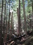
Here’s a link to a nice photo on a nicer day (5 Jan 2011)
http://www.pbase.com/henryimages/image/131627675

Here’s a link to a trail description
http://www.trailpeak.com/trail-Heriots-Ridge-near-Campbell-River-BC-3072