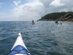
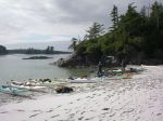
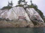
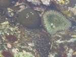
| Activity | Kayaking |
| Destination | Open Bay |
| Date | 6 June 2016, Monday |
| Trip Coordinator | Valerie |
| Contact Info | 250-285-2329 or vvv@qisland.ca. Please contact the coordinator prior to the trip. |
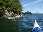
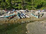
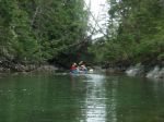
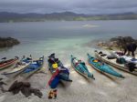
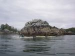
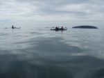
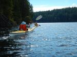
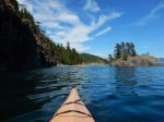
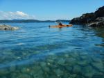
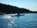
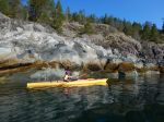
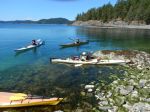
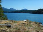
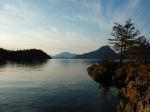
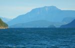
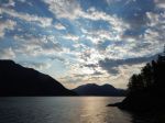
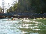
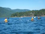
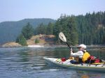
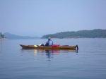
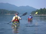
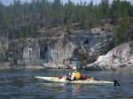
| Description | This will be an intermediate paddle. Depending on currents, weather, we could paddle to/around the Bretons, Moulds Bay, Village Bay, into Hoskyn Channel. Lunch stop to be determined enroute. |
| Meeting Place | Launch site, Breton Rd, Open Bay |
| Departure Time | 10:00 (arrive around 9:30 to prepare) |
| Difficulty |
intermediate, strong winds and currents possible |
| Costs | none |
| Trip limits | none |
| Dogs? | no |
| Notes: | Participants must be prepared for wind and strong currents; kayaks must be ocean kayaks equipped for ocean conditions. If access road is wet we will have to carry/trundle kayaks down a short hill to the beach. Meet at launch site (end of Breton Road) after 9:30 to be on water by 10 am. |
Category Archives: Paddling
Trip Report – Gowlland Harbour – 2 May 2016
Thirteen members left Gowlland Harbour Resort on a bright, sunny, calm day for a tour around North and South Gowlland Harbour. Many thanks to resort manager Carmen for allowing us to launch there. We paddled north first toward the log dump and sorting area. There was a lone buck on one of the islands and two otters playing on a dock for entertainment. Some members had not realized how much activity goes on in the log sort. We then paddled to the old shipwreck off May Island and had lunch on the island. The snow-capped peaks of Strathcona Park were stunning against the blue sky.
Next we went to Vigilant Island and watched many seals playing. From here we traveled down the east side of Gowlland Island to the narrow opening into April Point Bay. A few of us tried our skills in the current and found it can be hard in cross current. A word of caution to anyone that does not know this area, the current is not always running the same way as it is outside in Discovery Passage and can be quite fast.
We then paddled around the south end of Gowlland Harbour and up by Stag and Fawn Island. The Sea Blush bloom was early this year, but some flowers were still to be seen. We arrived back at launch site about four hours and 6.5 nautical miles after having left. All and all, it was a stunning day.
Les
Note: Special thanks from all of the participants to Les for the delicious prawns, smoked salmon, cheese and wine contribution to our picnic lunch.
Here is the bird list for the day:
Horned Grebe
Glaucous-winged Gull
Bonaparte’s Gull
California Gull
Double-crested Cormorant
Pelagic Cormorant
Great Blue Heron
Canada Goose
Mallard Duck
Bufflehead
Common Merganser
Pigeon Guillemot
Marbled Murrelet
Bald Eagle
Belted Kingfisher
Northwest Crow
Common Raven
Pacific Wren
American Robin
Spotted Towee
Townsend’s Warbler
- Buck
- The wreck underwater
- Lunch on May Island
- Sea blush
- Vigilant Island
- Bay at the north of Gowlland Island
(click on photos to view larger)
Kayaking – Gowlland Harbour – 2 May 2016
| Activity | Kayaking |
| Destination | Gowlland Harbour and small islands within |
| Date | 2 May 2016, Monday |
| Trip Coordinator | Les Hand |
| Contact Info | 250-202-4455 or leshand@gicable.com. Please contact the coordinator by April 29 |
| Description | We will circumnavigate Gowland Harbour exploring some of the small islands as we go. We will stop on May Island for lunch. There should be a beautiful display of flowers this time of year. |
| Meeting Place | Gowlland Harbour Resort parking lot, 823 Gowlland Harbour Rd. |
| Departure Time | 10:00 A.M. (unload and prepare at 9:30) |
| Difficulty |
easy to moderate |
| Costs | none |
| Trip limits | limited by parking to 10 vehicles |
| Dogs? | no |
| Notes: | Bring your kayak and all necessary safety equipment. If you have not completed your 2016-17 membership, please come prepared to sign papers and pay the membership fee. Only 2 vehicles can unload at beach at one time so please be on time. We will paddle South Gowlland and North Gowlland, about 4 hours weather permitting. Bring a lunch. If pouring rain or high wind, e-mail will be sent out by 8 am postponing trip. Gowlland Harbour Resort has kindly granted us permission to use their boat launch for this trip. This is not a public access. |
Trip Report – Mine & Main Lakes – 9 Sept 2015
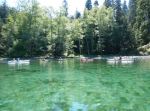
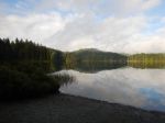
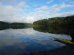
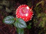
Six club members enjoyed a relaxed day at the Lakes. We launched from the Mine Lake boat ramp at 10:00 and paddled around the Main Lake islands, landing at the sandy beach at the east end of the lake about 11:45. After lunch, most of the group walked the trail to Yeatman Bay, picking mushroom along the way. We returned to the boat ramp at 2:30. On this calm, mainly sunny day, we had the lakes almost to ourselves. It was a very pleasant early fall outing (with a small bonus of chanterelles…).
Darcy Mitchell, coordinator
- Mine Lake
- Mine Lake
- Amanita
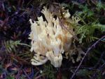
- Coral mushroom
- trail to Yeatman
(click on photos to view larger)
Kayaking – Open Bay & Hoskyn Channel – 12 Sept 2015
CANCELLED DUE TO WEATHER
| Activity | Kayaking |
| Destination | Open Bay and Hoskyn Channel |
| Date | 12 September 2015, Saturday |
| Trip Coordinator | Valerie van Veen |
| Contact Info | vvv@qisland.ca, 250 285 2329; Please contact the coordinator not later than Thursday. |
| Description | Paddle to explore the islands/islets in Hoskyn Channel: the Bretons and King Islets |
| Meeting Place | End of Breton Road, Open Bay to determine which launch site to use, alt is end of Valdez |
| Departure Time | Meet at 10:00 am |
| Difficulty |
Easy to moderate, depending on wind/weather. Go/nogo will be made after 4:30pm marine forecast on Sept 11. |
| Costs | none |
| Trip limits | none |
| Dogs? | no |
| Notes: | Plan to be back at launch by 4 pm at latest. Bring lunch, snacks. Lunch might be early on in trip due to lack of beaches beyond the Bretons |
Kayaking – Main Lake Provincial Park – 9 Sept 2015
| Activity | Kayaking |
| Destination | Main Lake Provincial Park |
| Date | 9 Sept 2015, Wednesday |
| Trip Coordinator | Darcy Mitchell |
| Contact Info | darcm@telus.net or 285-2739. Please contact Darcy by Monday if you plan to go. |
| Description | A relaxed paddle/picnic/swim/hike at the Lakes |
| Meeting Place | Boat launch, Mine Lake |
| Departure Time | 10:00 am |
| Difficulty |
easy |
| Costs | none |
| Trip limits | none |
| Dogs? | no |
| Notes: | We’ll plan to be back at the boat launch by 3:00 p.m. Bring lunch and snacks. |
Trip Report – Circumnavigate Read Island – 10-13 August 2015
Monday, August 10
Our group of six (Debbie, Norris, Val, Sheelagh, Lonn and Darcy) launched mid-morning from Discovery Islands Lodge at Surge Narrows in sunny weather with light NW winds. (Thanks to Ralph and Lannie for permission to launch, and to leave our vehicles at the Lodge.) Paddling south toward Viner Point, we took a short lunch break on the north side of the middle King Islet – a rough ‘oyster’ beach, but some potential as a campsite. About 3 p.m. we reached our planned campsite, an abandoned homestead in the second last bay before the Point. As it was still early, some of the group suggested we continue to Lake Bay to check out possibilities there. There is a nice looking campsite at the head of the bay, but as it was occupied, we looked a little further north, then returned to the Viner Point site about 5 p.m. On the way back, we could see humpback whales spouting along the east shore of Quadra Island.
The Viner site has space for 5 or 6 tents in a grove of alders with a couple of small areas on the beach. During supper and through the night, we were entertained (or kept awake….) by fish jumping in the bay, and humpbacks spouting and breaching further off shore. 19 kilometres paddled.
Tuesday
After the early morning humpback show, breakfast, and breaking camp, we launched at 9 a.m. for a beautiful low-tide paddle along the steep shores north of Viner Point. As the wind was forecast to rise to 10-20 by noon with a strong wind warning for late in the day, we took only a short lunch break at Frederic Point (a beautiful site but awkward landing on most tides). It was windy and choppy through Whale Passage, but settled down as we turned the corner and headed north along the east shore of Read Island. Crossing to South Rendezvous Island, we discovered that our hoped for campsite was occupied by a large commercial group. After some discussion, we decided to check out the site on the north end of the island (where some of us had camped in 2014) although landing is difficult except at lower tides. As we arrived at high tide with a northeast wind and rough-ish water, we landed on various ledges and hauled the kayaks well up on the rocks. The main part of the site is a rocky point open to both the east and west – scenic, but exposed. There is also space for tents at the head of the small bay in a dark but sheltered forest. The point has space for 4-5 tents, but ideally 2-3. After a calm evening, the promised wind finally arrived after dark, with most of us scrambling out of tents to batten down the hatches (and save anything hanging out to dry.) Those inclined to wake in the night reported beautiful phosphorescence in the breaking waves. 23 kilometres paddled.
Wednesday
The wind was still blowing on Wednesday a.m. With the challenge of launching boats into the waves and wind, most of us elected to spend the day ashore. Lonn decided to head home, leaving about 9:30. Debbie and Norris, who had landed in a slightly more sheltered spot, took an afternoon paddle around the Rendezvous group, while Val, Sheelagh and Darcy read, snoozed, snacked and chatted until the tide rose sufficiently to move boats around to the head of the bay for launching in the morning.
Thursday
After hauling gear over the rocks, and carrying kayaks over logs and slippery boulders, we launched at 10 a.m. en route to White Rock passage. Sunny, winds light NW. Uneventful paddle back to the Lodge apart from some lively currents near Beazley Passage. Landed at 12:45. 13 kilometres paddled.
Total trip length – 55 kilometres.
Overall, it was a great trip with excellent weather and wildlife viewing. The main challenge is the scarcity of campsites in the area, which makes it difficult to plan an optimal day’s paddle.
Darcy Mitchell, coordinator
- Discovery Islands Lodge
- Heading south in Hoskyn’s Channel
- Read Island Provincial Park
- Approaching Viner Point campsite
- Frederic Point at low tide
- Frederic Point lunch stop
- Harbour seals
- Sunset from campsite at N end of S Rendezvous Island
- Not so “Calm Channel” on Wednesday morning
- North Rendezvous Island
- Drew Passage
- The west end of Whiterock Passage
(click on photos to view larger)
Kayaking in the Hakai Conservancy – July 2015
(scroll down for photos)
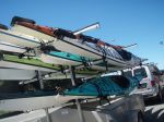
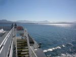
Access for kayakers wanting to paddle in the central coast has recently become more difficult. BC Ferries used to let kayakers wet launch at several places along its route on the central coast, but the new ferry is not equipped for that. However, BC Ferries still provides kayak transport to McLoughlin Bay near Bella Bella and there is a convenient beach launch site right at the ferry terminal.
For background information about kayaking in this region, see these articles:
http://www.wavelengthmagazine.com/1996/jj96ferry.html
http://www.wavelengthmagazine.com/PaddleBCCentralCoast.html
http://www.coastandkayak.com/2003/jj03central.html
The target kayaking region is from Calvert Island to Bella Bella, with lots of little islands to explore. It is part of the Hakai Lúxvbálís Conservancy and the Great Bear Rainforest.
After looking into the region and the problems of getting there with all our gear, organizing the food, and general safety issues, we decided to go with a commercial kayak tour. There are very few of those to this region and one of them happens to be Quadra based. Spirit of the West (kayakingtours.com) ran two trips to Great-Bear-Rainforest-Outer-Islands this summer, and we went with their first one ever. Seven of us from the Quadra Outdoor Club, two excellent guides (Graham and Sam) and three other women, making 12 paddlers and 10 kayaks in total. The trip was eight days long and we paddled about 20 km each day.
The new ferry is very upscale and provides great buffet meals in the restaurant. Two problems. One, the ferry leaves early in the morning and returns late at night, so it works best to overnight in Port Hardy at the beginning and the end, but every room in Port Hardy books way in advance. Solution: there are inexpensive hostels, but you still need to book in advance. Two, it leaves early in the morning and they want you at the ferry at 5 a.m. and it’s a half hour drive out of town. No solution; it takes them a long time to load.
We loaded the gear into the kayaks at McLoughlin Bay and it was blazing hot with no breeze. By the time we got on the water it was after 16:00, we had a fair headwind and we were never too hot again. We didn’t paddle far before we stopped for the night at a small lagoon just north of the junction of Lama and Hunter Channel. Space was limited for the eight tents, but we were very protected.
The next day was windy and rainy. We crossed Lama Passage and paddled southwest, against the wind, along the Campbell Island shore. We explored wonderful inlets and channels along the way. The weather had improved by the time we reached our campsite on island “49”, a cozy, protected midden beach.
On day three we paddled through some amazing narrow channels and then on through the Admiral and Tribal group of islands to the McMullin Group. We meandered through the shallow waters between islets and then camped on a spectacular, white sandy beach with great views.
On day four we continued through the McMullin islands and then crossed to the north end of Goose Island. We were fortunate to have only a bit of wind and not a lot of swell for this 45-minute crossing. This area is both exposed and shallow and would not have been possible in many conditions. We had lunch and explored the long sandy beach with cabins once used by the Heiltsuk rediscovery camp. We continued to paddle along the east side of Goose Island, against some wind and current, to Gosling and Snipe Islands. This area also has extensive shallow sandy areas, which connect the islands at a low tide. We camped on Snipe, with beaches on both sides.
On day five, we made the big crossing over Queen Sound to the Simonds and McNaughton Group. We got an early start in order to reach protected waters before the forecast strong afternoon winds. In the McNaughton Group, we paddled along very narrow channels admiring the intertidal life and camped on another sandy beach on Hunter Island near Cultus Sound. This site had a short walk through very impressive old growth forest to another beach.
The following day, we continued south to Triquet Island. Although we were mostly protected from the fairly strong southwest winds by islets and channels, the crossing south of Superstition Point was quite bouncy with refracted waves. We paddled through Spitfire Channel and Spider Anchorage. We camped on Triquet for two nights, enjoying more leisurely day paddles, beach-time and walks on the seventh day.
On the last day the water taxi picked us up, returning paddlers, kayaks and gear to the ferry dock. In the early evening we boarded the ferry back to Port Hardy. We saw humpback whales in Lama Passage and Fitz Hugh Sound.
We expected northwest winds; we got southeast and southwest winds. The unusually hot summer weather changed just before our trip. For a drought, we had quite a bit of rain. However, we cannot complain about the weather. This area is extremely exposed, so we were lucky we had good weather for the big crossings we made. We hoped to also cross notorious Hakai Passage to Calvert Island, but conditions were not favourable. Thanks to satellite technology, we were not forced to make that crossing. The guides used an inReach SE so that they could send text messages via satellite to the water taxi so they could pick us up wherever we happened to end up on the last day.
Other trips would have other weather and interests and take other routes. It’s a big area with lots to see. Incredible white sandy beaches, amazing sculptured granite cliffs along the shore, sea otters, sea lions, big trees, sand hill cranes and more than 20 other birds. Some sun, some rain, some wind, some calm, some swell, some waves, no fog. We saw a few fishing and cruising boats, but very few other kayakers. It’s a great place.
Thanks to the guides for all their hard work watching out for us, the great food, and arranging everything.
Photos by K. Manry, V. van Veen, M. Wood and N. Weimer.
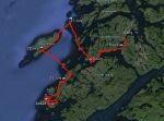
- GPS track
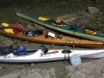
- kayaks
- Lama Passage
- First night on Denny Island
- The guides: Graham & Sam
- Campsite at Island 49
- Beach at McMullins
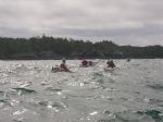
- Crossing from McMullins to Goose
- Beach at north Goose
- Heiltsuk cabin
- Goose shoreline
- Campsite at Snipe
- Rock Bluffs in the Simonds Group
- Anemone
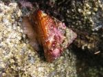
- Turban snail
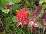
- Paintbrush
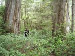
- Old growth forest
- South of Superstition Pt
- Kelp
- Looking SE from Triquet
- Waterways near Triquet
- Sunset from Triquet
- Water taxi
- Humpback
(click on photos to view larger)

Trip Report – Granite Bay – 8 July 2015
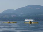
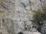
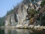
A group of six paddlers enjoyed perfect conditions for a tour around Kanish Bay on July 8th. The smokey atmosphere had cleared and we could enjoy the view across the Inside Passage. We made our way out through Chain Islands, then cut across the calm waters of the bay to Granite Point – a destination you can only attempt in such ideal weather. We poked around the point to take a look into Okisollo Passage, then moseyed back along the north shore of Kanish Bay. We had heard that there were pictographs somewhere along the cliffs, and happily we were able to spot a couple of sketchy images in red pigment. Lunch was on a rocky point part way along the shore, followed by a swim at Orchard Bay. It felt like a pretty mellow day, but we covered 18 km in our circuit around Kanish Bay.
- Cruise ship in Discovery Passage
- Faint pictograph
- Curious mink
- Approaching Orchard Bay
- Swimming at Orchard Bay
- Tiny, colorful foot-chewing crabs
(click on photos to view larger)
Kayaking – Around Read Island – 10-13 August 2015
| Activity | Multi-day paddling |
| Destination | Circumnavigate Read Island |
| Date | 10-13 August 2015, Monday-Thursday |
| Trip Coordinator | Darcy Mitchell |
| Contact Info | darcm@telus.net or 285-2739 |
| Description | A three-night paddling/camping trip. Depending on weather conditions, we will launch from either the Hyacinthe Bay area or Discovery Islands Lodge (near Surge Narrows). |
| Meeting Place | TBA |
| Departure Time | TBA |
| Difficulty |
Moderate to difficult. We should expect to paddle between 15 and 20 kilometres per day. |
| Costs | Launching fee if trip starts at Discovery Islands Lodge. |
| Trip limits | 6 people |
| Dogs? | no |
| Notes: | Please contact the trip coordinator no later than July 31 if you’re interested in this trip. Once we know who will be going, we’ll discuss details. |