| Activity | Kayaking |
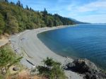
| Destination | Granite Bay/Small Inlet or Granite Point |
| Date | 23 Sept, Thursday |
| Trip Coordinator | Darcy Mitchell |
| Contact Info | mitchelldarcy51@gmail.com (preferred); 250 923 5540 |
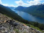
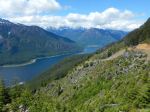
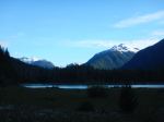
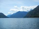
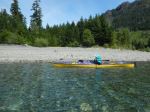
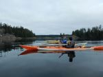
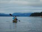
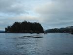
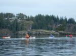
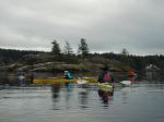
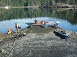
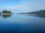
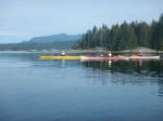
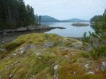
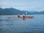
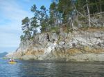
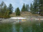
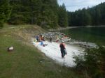
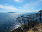
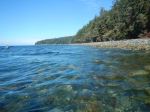
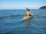
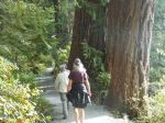
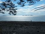
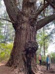
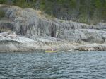
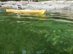
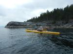
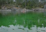
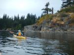
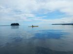
| Description | Depending on conditions, we’ll paddle from Granite Bay to the Chained Islets and to Granite Point, returning via Orchard Bay, or to Small Inlet, with a hike through to Waiatt Bay. We will be back at the boat launch by 3:00 |
| Meeting Place | Granite Bay boat launch |
| Departure Time | 9:30 a.m. for 10:00 a.m. launch |
| Difficulty |
Easy/moderate depending on conditions |
| Costs | Parking/launch at Granite Bay ($5.00) |
| Trip limits | 6 |
| Dogs? | No |
| Notes: | Please contact the Trip Coordinator 48 hours before the trip to confirm your attendance. A go/no go decision that reflects the weather forecast will be made by noon the day preceding the trip date. Must have equipment that meets club and coast guard regulations. Bring lunch and gear for the weather. |
Category Archives: Paddling
Trip Report – Village Bay Beach – 18 July 2021
Four of us set off on an almost perfect paddling day from the Rebecca Spit boat launch. While this is a very easy launch, regardless of tides, it does have its challenges regarding motor boat use, which was constant, and negotiating the ferry crossing both ways. However, we were off to an early start, on the water by 9:40. In calm seas and no wind, we enjoyed a leisurely paddle to the Breton Islets, taking the opportunity to survey intertidal damage from the recent heat dome event. Dead mussels were all too apparent, and the tide level did not allow for easy observations of the presence or absence of sea stars or other intertidal life. The usual oystercatchers were nowhere to be seen. The resident seal colony seemed content, and it was nice to see that they no longer flee their perches in panic as kayaks approach.
We continued on to Moulds Bay, enjoying a short break on the beach. The old oyster lease seems to have been relinquished and the Clay Cabin has been restored. The rising tide allowed us to scoot through the Shellaligan passage, then past the Shellaligan rocks and on to Village Bay where we stopped for lunch. Content with our paddle so far, we opted to return via the same route to the Spit.
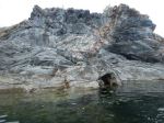
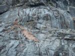
On the way, we stopped to admire the amazing geological formations at the south end of Valdes Beach which include a lava tunnel. This unique feature alone is well worth the paddle to this area.
We waited briefly for the ferry to pass in front of us, returning to Rebecca Spit by 3 pm. 18.0 km; 5¾ hours.
Valerie
(click on photos to enlarge)
- Passing Rebecca Spit
- Harbour Seal
- Arriving at Village Bay
- Shallows at Shellaligan Pass
- Lava tube
- Back in Drew Harbour
Kayaking – Village Bay Beach – 18 July 2021
| Activity | Kayaking |
| Destination | Village Bay Beach |
| Date | 18 July; Sunday |
| Trip Coordinator | Valerie Van Veen |
| Contact Info | 250 285 2329 vvv@qisland.ca |
| Description | A club favourite, out through Moulds Bay, Shellaligan Pass, to Village Bay Beach. If time, energy, interest, weather, we can paddle further around Bold Point. THREE possible dates (Friday, Saturday, or Sunday) as rain and wind is still forecast for Friday. Let me know by WEDNESDAY (14th) evening your preference. I will confirm day with all registered paddlers on Thursday at the latest. Kayaks must be ocean- going craft with all required Transport Canada Safety equipment. If you have any questions call coordinator, 2329. Bring lunch, water, snacks. |
| Meeting Place | Rebecca Spit boat launch |
| Departure Time | 9 am meet, on water by 9:40 |
| Difficulty |
Easy – moderate |
| Costs | None |
| Trip limits | 8 kayaks |
| Dogs? | No |
| Notes: | Our launch window allows for the Cortes ferry. We will time return for the ferry. |
Kayaking – Granite Bay – 16 Aug 2021
Postponed due to high winds
| Activity | Kayaking |
| Destination | Granite Bay/Small Inlet or Granite Point |
| Date | |
| Trip Coordinator | Darcy Mitchell |
| Contact Info | mitchelldarcy51@gmail.com (preferred); 250 923 5540 |
| Description | Depending on conditions, we’ll paddle from Granite Bay to the Chained Islets and to Granite Point, returning via Orchard Bay, or to Small Inlet, with a hike through to Waiatt Bay. |
| Meeting Place | Granite Bay boat launch |
| Departure Time | 9:30 a.m. for 10:00 a.m. launch |
| Difficulty |
Easy/moderate depending on conditions |
| Costs | Parking/launch at Granite Bay ($5.00) |
| Trip limits | 6 |
| Dogs? | No |
| Notes: | Please contact the Trip Coordinator 48 hours before the trip to confirm your attendance. A go/no go decision that reflects the weather forecast will be made by noon the day preceding the trip date. Must have equipment that meets club and coast guard regulations. Bring lunch and gear for the weather. |
Multi-day Kayaking – Jedediah Island – 7-11 Sept 2021
| Activity | Multi-day kayaking |
| Destination | Jedediah Island via Texada Island |
| Date | 7 to 11 Sept 2021, Tuesday to Saturday |
| Trip Coordinator | Vic Gladish |
| Contact Info | vicgladish@gmail.com; 250-285-2111 |
| Description | Three days on the water; one travel day to get there and one to get home; Camp on Texada on day 1 with the crossing to Jedediah early on day 2. Return to Texada on day 5 and on to ferries and home. Details will be posted soon. |
| Meeting Place | Quathiaski Cove ferry lineup at 0630 |
| Departure Time | 0705 ferry Quathiaski Cove |
| Difficulty |
A 2km crossing from Texada to Jedediah makes this, depending on weather, a more difficult trip. |
| Cost | About $200 for ferries and camping fees |
| Trip limits | 6 |
| Dogs? | No |
| Notes: |
Sept 7 – Travel day; Meet at Q-Cove Ferry by 6:30 AM; to Little River to board 0955 ferry to Powell River; hopefully onto the next ferry to Texada Island; Drive to Shingle Beach Campsite
Sept 8 – Paddle to Jedediah Is
Sept 9/10 – hiking/paddling Jedediah/Lasqueti/ etc
Sept 11 – Paddle back to Shingle Beach; ferries to Powell River (330 pm)/ Comox (510 pm)/ Quadra (??)
This itinerary could easily be shortened by a day for whatever reason. However, it does not allow any time to visit the Townsite Brew Pub
.Please take the time to read the club’s paddling guidelines – https://qioutdoorclub.org/wp-content/uploads/2018/07/paddling-guidelines-aug2018.pdf
If the weather forecast for the week looks windy/wet on Sunday, Sept 5 we will communicate re cancellation.
Plan to be self-sufficient for camping. NOTE: there is no drinking water on Jedediah so bring enough water for 4 days.
Feel free to email, text (250-287-0459), or call Vic Gladish
|
Trip Report – Strathcona Park-Ralph River – 15-18 June 2021
When the kayak trip to Bligh Island unraveled, the remnants of that trip booked into the Ralph River campground at the last minute. This was not a carefully scripted trip; we mostly made it up as we went along.
Day 1 – After a late start and a ferry overload wait, we arrived at 3:00 at the campground, set up the tent amongst the amazing old growth trees in the Ralph River campground, and left to begin hiking at 4:00. Given the time available, we explored some of the trailheads in that area: the Auger Point Traverse (steep), Shepherd Creek route (impressive canyon), Flower Ridge, and Price Creek (river views, then follows an old level road for a while).
(click to enlarge photos)
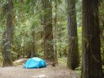
- Ralph River campsite
- Rain in the valley
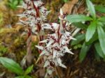
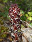
- Candy Stick (Allotropa)
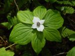
- Bunchberry
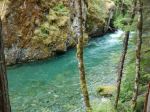
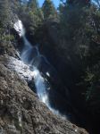
- Shepherd Creek Canyon
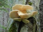
- Oyster mushroom
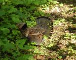
- Rugffled Grouse
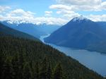
Day 2 – We hiked up the Buttle Bluffs and Park Main logging roads from the Western Mine road. These are steep, gated roads surrounded by clear-cuts, but they provide excellent views and a rapid approach to higher elevation destinations. The spring flowers were still quite good, the geology was fascinating, and there is an excellent water falls at 5 km. The views of the Buttle Lake valley are really exceptional. We continued about 7.5 km and 840 meters elevation gain, until we crossed a high point in the road and could see into the next valley surrounded by high mountains.
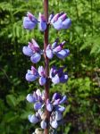
- Lupin
- Indian Paint Brush
- 5 Km Falls
- Buttle Lake looking south
- Quartz intrusions
- Buttle Lake looking north
- Alexandra Peak
- Buttle Lake & Mt. Phillips
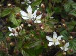
- Trailing blackberry
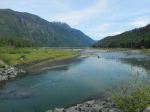
Day 3 – We planned to kayak on Jim Mitchell Lake, but that didn’t work out because the condition of the Jim Mitchell Road changes from 2-wheel drive to 4-wheel drive at the Bedwell trailhead. We didn’t have the right vehicles, so we walked up the road to see the Lake. We returned part way down the road and then followed the Bedwell Trail out through a beautiful old forest to Thelwood Creek and the suspension bridge for lunch. After lunch we drove just a bit further and walked the short approach to Lower Myra Falls. This is always a beautiful falls, with great rock ledges and pools. There was lots of water coming through the falls with the spring run-off. The final short hike of the day was the Shepherd Creek loop, which leaves from the Ralph River bridge. This short trail has a lot of variety with the river, some big trees, a mossy bluff, a wetland, and interesting saprophytes and fungus. We still had time to explore the campground which is nestled in a beautiful forest between the Ralph River and Buttle Lake with lots of shoreline and views. There were other folks from Quadra so the evenings were very social.
- South end of Buttle Lake
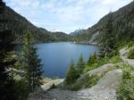
- Jim Mitchell Lake
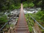
- Bridge over Thelwood Creek
- On the Bedwell Trail
- Bracket fungus
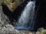
- Lower Myra Falls
- Lower Myra Falls
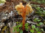
- Candy Stick (Allotropa)
- Monotropa saprophyte
- Fallen old-growth danger tree
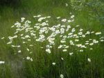
- Daisies on the shore
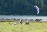
- Neville’s kite
- Mt. Myra at evening
Day 4 – We packed up the camping gear and drove to the Buttle Lake boat launch to kayak on the Lake. We crossed to Rainbow Island in a freshening breeze. At the moment it’s not an island because the water level in Buttle Lake is quite low. We paddled to the south, sheltered side, explored a bit and had lunch. There was a racing shell boat practicing in the lake. After lunch we poked around some cliffs and an island to the south before returning to the boat launch. Further exploration would be great, but more water and less wind would have been ideal.
- Buttle Lake
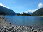
- Looking south in Buttle Lake
This is an exceptionally beautiful area with access to amazing hiking at the Lake level or in the surrounding mountains. The combination of the fjord-like lakes, the mature forests and the numerous mountains makes this a wonderful base for hiking and boating.
Debbie

Trip Report – Cortes Island – May 2021
Day 1 – With Dr. Bonnie Henry’s encouragement to go camping locally, we stayed three nights and four days on Cortes Island, using the Smelt Bay campground as our base. After taking the ferry on Monday to Cortes, setting up camp and after having a sunny, relaxed lunch on the beach at Smelt Bay, we went to Manson’s Lagoon at a very low tide so that we could walk to the little island and explore the intertidal zone. (1.5 km; 1 hour) After that we hiked to Easter Bluff, a short walk rewarded with excellent views to the south and east. (2.3 km; 2 hours)
(click to enlarge photos)
- Campsite
- View from campsite
- Smelt Bay beach
- Manson’s Lagoon low tide
- Sand dollar
- Oregon grape
- Crab
- Common Merganser
- Arbutus blossoms
- Easter Bluff
- View south
- Squirrel
- First night sunset
Day 2 – The night was quite cold, but we warmed up hiking up to the summit of Green Mountain, the highest point on Cortes Island, but still a very accessible trip. The loop around the top provided great views in most directions. (4.3 km; 2 hours) In the afternoon, one couple kayaked on Hague and Gunflint Lakes, while the rest of us kayaked from the Whaletown government dock out to Shark Spit, once again at a very low tide. The launch down the steep ramp was quite extreme. We walked around the Spit before portaging the boats over the spit and exploring the islets and coast around Uganda Passage. (9 km; 2.5 hours)
- Looking SW from Green Mountain
- Looking NW
- View north
- View south
- Lilacs
- Whaletown
- Shark Spit
- Beach at Marina Island low tide
Day 3 – Rain was forecast overnight and into Wednesday, but we really only had drizzle overnight and it was dry by morning. Still, for breakfast we took advantage of the beautiful picnic shelter at the Smelt Bay campsite, with its timber-framed structure, wood stove and picnic tables. We then set out for the long loops at Kw’as Regional Park. Starting near the Cortes Motel, we hiked the eastern side Millennium Trail out to the Swim Rock for lunch. We followed along the Rock Face trail on the Hague Lake shore and visited the amazing Survivor Fir before crossing the narrows and hiking the loop out to the bench on the Pierre de Trail. Returning by the Cedar Ridge, we re-crossed the narrows and followed the Gunflint Lake shoreline stopping at the old steam donkey and then back to the cars. (12.4 km; 5.75 hours)
- Oregon grape
- Smelt Bay picnic shelter
- Kw’as Park – views of Hague Lake
- Oyster mushroom
- The Swim Rock at Hague Lake
- Looking toward the Narrows
- Ladder down the Rock Face
- Survivor Fir
- Bridge over the Narrows
- Corral Root
- Pacific Tree Frog
- Steam Donkey remains
- Morel mushroom
- The Inca wall
- Northern Groundcone (Boschniakia)
- Third night sunset
Day 4 – Wednesday night was cool and windy, but Thursday turned into a lovely day. A few headed back on an early ferry (which it turned out didn’t run until 3:50), while the rest of us hiked in the morning at Hank’s beach, catching the low tide, sunny facing shore and great views. We rambled over the rocky bluffs and explored some tidal pools. (3.2 km; 1.25 hours) We then headed over to Squirrel Cove for lunch on the beach. We carried the kayaks a long way to the water and paddled into the protected anchorage, through the islands, enjoying the intertidal life. We were happy to see that the purple sea stars are returning very well. We stopped at the creek into the Squirrel Cove lagoon and walked across to the lagoon. In addition to the excellent intertidal life, there were duck and chicks in the lagoon. (7.7 km; 2.25 hours) After ice cream from the Squirrel Cove store, most of us took the last ferry home.
- Hank’s Beach
- Looking toward Desolation Sound
- Sea anemone above water
- Tha Fort
- Squirrel Cove at low tide
- Moon snail case
- Purple sea star
- Creek from the lagoon
- Seas star
- Leather star
- Sclupin
- Sea anemone above water
- Views toward the mainland
There is so much to see and do on Cortes and we packed a lot into four days. The weather was kind to us, the low tides fascinating, and the spring growth lovely. We are so fortunate to have this nearby.
Debbie
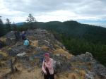
Thanks to Norris and Bonnie for the photos
Kayaking – Maud Island – 25 Nov 2020
This trip has been suspended due to additional COVID restrictions
| Activity | Kayaking |
| Destination | Maud Island |
| Date | |
| Trip Coordinator | Vic Gladish |
| Contact Info | 250-285-2111; cell 250-287-0459 |
| Description | We will put in at 1000 at the Leishman Road shore access just north of Copper Cliffs. There is parking for a few cars and a rocky beach. Staying close to shore, the plan is to paddle north to Maude Island and/or the Saltwater Lagoon. The trip is about 8 km each way (16 km round trip). The lagoon entrance is passable at certain tide levels so will be an on the spot decision whether to explore or not. |
| Meeting Place | Shore Access Copper Cliffs – Leishman Road |
| Departure Time | 1000 on the water |
| Difficulty |
Moderate – distance, currents, weather |
| Costs | None |
| Trip limits | 6 |
| Dogs? | no |
| Notes: | The tide will be against us but it is a time of neap tides so currents shouldn’t be so strong. Participants should be open to trip revision once the forecast for that week is more relevant – i.e. lets be open to a Monday, Tuesday or Thursday with better weather. All participants must be equipped for ocean paddling in November – required equipment as per club guidelines (https://qioutdoorclub.org/wp-content/uploads/2018/07/paddling-guidelines-aug2018.pdf) and appropriate clothing. Bring lunch, hot drinks, extra warm layers and something to sit on. |
Trip Report – Kanish Bay – 30 Sept 2020
We put in at low tide in Granite Bay and were ready to go by 10:00. Our group of five paddlers headed west, at a very leisurely pace, into a flat calm Kanish Bay and to the Chained Islands. As rest stop was in order by the time we reached the campsite on the next to last island of the group we had a chance to assess the site for future overnighting. As we approached the island we met up with a group of 5 kayakers from Vancouver Island who had crossed from Browns Bay on a large Zodiac for a day of paddling.
We headed north east to the north shore of the bay and worked our way east to Orchard Bay (finally!). As we approached OB a couple in a double kayak came straight for us out of Small Inlet – it was Debbie and Norris who had come out from Small Inlet and their anchored sailboat to visit. At this point we also observed 2-3 harbour porpoise circling about in the bay. Also observed while crossing Kanish Bay were a number of salmon jumping and a flock of about 30 loons that took flight as a very noisy, very fast speedboat roared down to Granite Bay and back out to Discovery Passage.
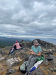
We then enjoyed a long lunch break in the sun at Orchard Bay and scouted out the area for camping potential. It was about this time that we noticed that the air was becoming somewhat smoky.
From this point we headed towards Small Inlet – decided it was taking on too much to venture in – and explored the shallows around the islands (a bit too shallow!) as we headed back to Granite Bay and the takeout at high tide. 6 NM (approx. 12km) over 5¾ hours.
Vic
Thanks to Vic, Valerie and Norris for the photos.
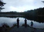
(click on photos to enlarge)
- Great Blue Heron
- Leaving Granite Bay
Kayaking – Kanish Bay – 30 Sept 2020
| Activity | Kayaking |
| Destination | Kanish Bay (Granite/Small) |
| Date | 30 Sept, Wednesday |
| Trip Coordinator | Vic Gladish |
| Contact Info | 250-285-2111; cell 250-287-0459 |
| Description | Plan A – Kanish Bay – Chained Islets to Ashlar Creek to Orchard Bay Plan B – Orchard Bay to Small Inlet and short hike to Waiatt Bay. |
| Meeting Place | Granite Bay boat launch |
| Departure Time | 10:00 on the water |
| Difficulty |
Moderate to difficult depending on weather, tides, winds, distance. |
| Costs | Use of ramp $ 5.00 |
| Trip limits | 8 kayaks |
| Dogs? | no |
| Notes: | Meet at 0930 for a 1000 departure. Must have a sea kayak and equipment that meets club and coast guard regulations. Bring lunch and be prepared for fall weather. |


.