Trip Photos – Backpacking Della Falls 9-12 Aug 2013

by Will LaVigne  (willlavigne@hotmail.com)

Is there such a thing as a perfect hike?

On any hike you can adjust to the people you are with, on any hike you can get away without eating for a couple of days but you need water constantly. This was a perfect hike for access to clean, delicious water. I used a 600 milliliter water bottle without it ever being empty even with the 33 Celsius temperatures.

Debbie, Joyce, Norris and I met on the 6:15 am ferry to confer, confirm and congratulate each other for making the ferry to get a great start to our hiking adventure. We were heading to Port Alberni then north to Great Central Lake Marina and Resort to meet up with Ben Potter of Della Falls Watertaxi Services by 9am. We were joined by Mike from Nanaimo who booked at the last minute. It turned out he was a nice guy and a perfect compliment to our group for the rest of the adventure. Ben Potter took us up to the trailhead at the other end of the lake and over the one hour boat ride he gave us some tips and some history of the Della Falls trail. As well he showed us some of the highlights of Great Central Lake. A heads up to any fish-o-dites, good fishing on this lake.

Before I go any further I want to say that there is accurate and concise info on the internet and from other hikers about this hike. As well there are other routes that can be done. The Comox Valley Mountaineering Club went to Della Falls on the Aug. 5th weekend and Ken Rodonets wrote up a report that is posted on their webpage. Ken talked to me about Della Falls a month before and two days after his hike to Della Falls. This helped me a lot as it was a 15 km hike one way with an elevation gain of “300 meters”, Norris measured it at 500 meters gain on his GPS.

So…the dock at the trailhead is about 30 ft long and the walk up to the shore has you looking at about 12 or 14 tent pads spread out. Latrines, food cache, board maps, canoe/kayak rack and picnic tables, benches were there as well. We headed out along an old logging road that was in good condition for about 2 hours to Margaret Creek Campsite and bridge. The water was fast flowing down the middle, spectacular and with small, clear, sparkling pools on the side calling out to Mike to go for a dip. He did. We had lunch and decided to continue on rather then camp here as it was 12:30pm. We knew we had 2 hrs of hiking to the cable car crossing bringing us to about 11.3 km into the hike. For me this was the hardest part as it was very hot and the trail was a steady incline to the cable car. We were able to get to water on either side of the creek at this crossing, which to me was more like a small river and shade was found on either side of the crossing. The easy availability of water helped huge on this hot day. From here we had a little over a kilometer to get to two metal bridges. The terrain was varied from packed down trail to picking your way through dry creek beds and some of the trail being overgrown. Due to having detailed intel we knew that the campground was only 1.5 hrs away from the metal bridges, getting excited to drop the pack off my back. Through most of the hike I could hear the steady stream of Drinkwater Creek tumbling over the rocks. About 1 km from the first campsite there is a fantastic sandy campsite beside the creek with room for two-three tents. There are two perfectly spaced apart trees that calls for a hammock. 3/4’s of hour later some of us arrived at the lower campsite 7 hrs after starting from the lake and were joined by the remainder of the group within a half hour. The group snagged the last spot available as the next area is about a 10-15 minute hike away with no food cache or latrine.

The next day, Aug. 10, we left for the view point of Della Falls along the Love Lake trail. It can be done within 1 1/4 hrs to 2 hrs. I thought the trail was pretty clear with about 8 blowdown trees to deal with and it was all switchbacks and steep but with a lighter pack it was good. Pole(s) or a stick works well coming back down. The view…well worth the journey and the best was yet to come. Twenty or so minutes away is Love Lake and what a surprise to see this little jewel tucked away out of sight. I was lucky enough to have it to myself for about 10 minutes, wherein I took a few dips into its cool embrace. Refreshing. Suddenly there were 13 other people arriving and a bunch headed to an 18ft boulder that was on the shoreline and proceeded to jump off it into the lake. Tres fun.

After getting back from that outing everyone went to the base of Della Falls on their own time. It is a twenty or so minute hike and you do pass the campsite that is closest to the base of the falls. Here there is a latrine and food cache. There is room for about 6 tents and worse case scenario a few more could go at the trail signage area. I did have one expectation for the base of the falls and that was to see a pool of water but instead it’s the start of Drinkwater Creek. There were wild flowers and berries. Around the campsites there were lots of huckleberries and no signs whatsoever of bears. The return trip was started between 7:30am and 8am with the group spread out. Amazingly the return was done in 5-5 1/2 hours. I think this was due to lower temperatures with overcast skies and be able to look up and around helped. Whereas going up the looking was at the ground most of the time. That was my experience. Two of the group went for swim before we took off at 3:30pm on Ben Potters boat.

Birds seen by me: two adult and two juvenile grouse, chestnut backed chickadees, whiskey jacks and American dipper. On the trail: two old separate wolf scats and one fresh wolf scat, three slugs-two small black ones and large beige one, a couple of butterflies, bees on the wildflowers, wasps throughout the hike and there were moments of no black flies and mosquitos. There were 21 of us camping at the Della Falls area and two at the sandy beach. On our way down there were 18 people heading up. Most of the 21 were heading out on Sunday. This trail is popular and with that comes the variety that is the spice of life or hike.

Weather: Friday – hot, sunny. Saturday morning was sunny, hot and by afternoon it had cooled down, overcast and short period of drizzle of rain. Sunday – foggy, overcast, cool.

Would I do this hike again? Yes
Would I go with a group again? Yes
Would I recommend it? Yes
My favorite part was the water, drinking it and swimming in Love Lake.

cheers,
Will

Will has an album of photos from this trip.  E-mail him and he will send you the link to it.

Backpacking Della Falls 9-12 Aug 2013


Kayaking Octopus Islands 21-23 Sept 2013

Activity Multi-day paddling trip
Destination Octopus Islands Marine Park
Date Saturday 21 September 2013 to Monday 23 September
Trip Coordinator Darcy Mitchell and Lonn McMartin
Contact Info darcm@telus.net  or 250 285 2739 .
Description This is a two-night camping trip to the Octopus Islands Marine Park on the northeast side of Quadra Island.  The trip needs to be timed for slack water at Beazley Passage, therefore it is important that departure times are prompt.  It is 5.5 – 6 nautical miles from the departure point to the probable camping area.  Sunday will be spent exploring the Marine Park and adjacent areas, including possible  hikes to Small Inlet or up to Newton Lake.  We should be back at Surge Narrows dock  between 2:00 and 3:00 on Monday (slack water is 1:45 p.m.).

Participants should be fairly experienced paddlers and campers.  Training at the Paddle Canada Level 1 or equivalent is strongly advised.  Ability to perform both self-rescue and assisted rescue is essential!

Participants must be paid up members of the club for this outing.

Meeting Place Surge Narrows dock/boat launch (about 45 minutes from Quathiaski Cove)
Departure Time 11:15 am
Difficulty
Intermediate
Costs None
Trip limits 10 (but no more than 6 tents)
Dogs? No
Notes: There will be a meeting of participants on the evening of Monday, September 16 at 7:30 at 533 Grouse Road to discuss arrangements for equipment sharing (radios, first aid equipment, stoves, pots), food preparation, etc.  Camping space is limited, so it is important to minimize tent sizes and numbers; sharing is good if you’re willing.

This trip is highly weather dependent.  Participants will be contacted by 9 p.m. on Thursday, September 19 if the trip is cancelled due to weather. 

octopus

Park info:
http://www.env.gov.bc.ca/bcparks/explore/parkpgs/octopus/

Proposed Communication Tower on Heriot Ridge

An application has been submitted to Ministry of Forests, Lands and Natural Resource Operations (MFLNRO) for use of a small parcel of land on Heriot Ridge for a communications tower. There are several concerns about this, including concerns about mistakes in the application and the procedure, in addition to concerns about the usage and the site chosen. There is some confusion about this, so it’s best to go through this in order of history.

Continue reading

Personal Locator Beacon (PLB)

The club has purchased a Personal Locator Beacon, or PLB for short, for use on club trips, especially those where there is no cell or VHF coverage
front_view__resqlink__flash

It is an a ResQLink PLB-375 (part number 2880), made by ACR.
http://www.acrartex.com/products/b/marine/catalog/personal-locator-beacons/resqlink-plb

Its one of those things that we hope to never have to use. Its sole purpose is to call for help from Search and Rescue by sending your GPS position to a satellite system when activated. It’s small and light and easy to use. Unclip the antenna so that it is vertical and push the ON button.

WARNING: This PLB is authorized for use only during situations of grave and imminent danger. It is only to be activated when all other means of self-rescue have been exhausted. Deliberate misuse may incur a severe penalty.

In other words, try your cell phone and/or VHF radio first if at all possible.

There were several options that the club considered.  All use a satellite system for communication; some have additional, very desirable features and higher costs.

PLB.  “SOS” feature only.  Uses the COSPAS-SARSAT satellite system
http://www.cospas-sarsat.org/en/system/systemoverview
These beacons must be registered with the government, but there is no monthly or annual usage charge. It uses a 5 Watt 406 MHz signal to send the distress signal to the satellites.

ACR makes several models and there is also the McMurdo FastFind 220.

SPOT2, SPOT3, and Delorme inReach. In addition to the SOS feature, these units also can send “I’m okay” messages to selected contacts, they can send periodic position reports so that your friends can follow your track on a map on a web page, and they can also send “send help” messages to your selected contacts instead of to search and rescue. These are desirable features, but they come at a cost of at least $100 per year, which is more than the club can afford. Both Spot and inReach use the commercial satellite phone systems. Spot uses the Globalstar satellites and inReach uses the Iridium satellites; both systems use low earth orbit satellites. The satellite system can do two-way communication, but these devices can only send pre-written messages; they cannot receive messages.

SPOT Connect and inReach Smartphone. These devices can do all of the above, plus they can be used together with an app on your smartphone. You can write a short text message on the spot and you can receive messages. This is a very nice feature, and it comes at an additional expense. The inReach SE is similar, except that it is stand-alone; it does not require a smartphone.

Two way communication will obviously dominate in the future. If you ask for help, it’s nice to say what kind of help you need. It’s nice to have confirmation that help is on the way. From the SAR’s point of view, it’s nice to know that it is not a false alarm.

Satellite Phones. These have been expensive to buy and expensive to use.
SPOT makes one now which is more affordable. Relatively speaking.
http://www.findmespot.ca/en/index.php?cid=127

Hiking Mt. Seymour 18 August 2013

Activity hiking
Destination Mt. Seymour
Date Sunday, 18 August 2013
Trip Coordinator Syd Lapan
Contact Info 285-2999.  Please contact the trip coordinator prior to the trip.
Description We will hike to the summit viewpoint with a side trip to Nugedzi Lake on the way down.
Meeting Place Heriot Bay store parking lot, to arrange carpools
Departure Time 09:00
Difficulty
moderate
Costs none
Trip limits none
Dogs? yes; owners must bring a leash
Notes: Bring lunch and water

Trip Photos – Hiking Shellaligan Trail 27 July 2013

The group hiked the longer loop, on a warm, sunny, windy afternoon.  This is a beautiful forest and coastal walk.

Hiking Shellaligan Trail 27 July 2013

Trip Photos – Kayaking Cortes 20-21 July 2013

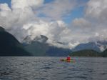
This two-day trip morphed into a three-day trip in order to avoid the worst of the ferry traffic for the Cortes Music Fest.  All three days were hot and sunny with strong northwest wind at night and mostly light and variable during the day.

On Friday the group settled into the Smelt Bay campground and then paddled from Smelt Bay around the south end of Cortes across the shoal in very shallow water for great intertidal viewing.  After reaching a small beach on the east side of the island, with great views toward Desolation Sound, we turned around and paddled back.  (5.6 nm)

On Saturday, the group kayaked from Manson’s Landing directly over to Shark Spit, then spent the afternoon exploring the Channel Rock area, walking on Shark Spit, and following the shoreline back to Manson’s Landing and into the lagoon.  The large tides provided an opportunity for seeing marine life, especially sea stars, sea cucumbers and sand dollars.  (9.1 nm including the walk)

On Sunday, the group launched at Cortes Bay and paddled out to the northeast gap between the Twin Islands and along the shore to the islets at the northwest end.  Hank’s Beach on Cortes made a convenient lunch stop and then we returned to Cortes Bay.  (6.7 nm)

As a bonus, we didn’t get caught in any of the ferry overloads!

Kayaking Cortes 20-21 July 2013

(click on photos to view larger)

Social Rebecca Spit 24 July 2013

Activity Potluck
Location Rebecca Spit
Date 24 July 2013, Rescheduled from 17 July.
Trip Coordinator Darcy Mitchell
Contact Info Call Darcy Mitchell at 285 2739 or email darcm@telus.net if you have any questions
Description Calling all QI Outdoor club members and guests to a Potluck Picnic Dinner at Rebecca Spit on Wednesday, July 24 starting at 5:00 p.m.   We’ll have a few kayaks on site, so if you’ve been wanting to try your hand at paddling, this is your chance!  Dinner starts at 6:00.  We’ll also have some short reports on club excursions to date and time to discuss your ideas and feedback on Club activities and plans.  AND – there will be a draw for a door prize, so be sure to bring family and friends!
Notes: If a postponement is needed, it will be posted here as a comment.

Trip Photos – Hiking Seymour Ridge 13 July 2013

Four intrepid hikers went for this challenging hike on a clear, warm day.  We hiked up to the Seymour summit with excellent views of Little Nugedzi Lake, the outer islands, coastal mainland and Vancouver Island.  The trail was in excellent condition after being cleared from winter damage by volunteers for the Trails Committee.  We continued on to Nugedzi Lake for lunch.  There was an amazing display of wild tiger lilies around the lakes.  The hike then followed the Nugedzi trail through the forest and past the beaver ponds, with a side trip to the viewpoint over Georgia Basin.  There has been significant wind damage in this forest over the past winter.  From this point the route followed an unmaintained track along the ridge to Beech’s Mountain.  Progress was very slow, as the wind damage was severe in this area also.  After bush whacking and climbing through fallen trees, the group reached the Beech’s Mountain with rewarding views to the east.  The wild flowers were still very good along the way.  On the descent to the Chinese Mountain parking lot we encountered a grouse with chicks.  It took us 7 1/2 hours to go the 12.2 km, with lots of breaks and stops for photos.

Hiking Seymour Ridge 13 July 2013

Trip Photos – Kayaking Hyacinthe-Open Bays 7 July 2013

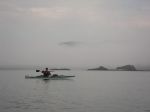
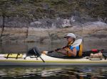
Six club members and one guest enjoyed a beautiful day for our paddle from Hyacinthe Bay to Open Bay. A light wind, gusting NW to about 12-15 knots in more exposed waters, provided some challenge, but the warm, dry weather made for a very pleasant paddle overall. The low tide at Hyacinthe Bay made for a good work out in getting launched. A river otter interrupted his fishing off the rocks to watch us warily as we paddled out into the Bay.
Our first pause was to admire the new, custom designed Toelle built, Peterson home in Hyacinthe Bay, which hugs the bluff as if grown, rather than built, there.
We skirted around seal rock, being careful to not disturb the dozen or so seals enjoying the sunshine and low, low tide.
The very low tide at Open Bay gave us plenty of beach to enjoy as we ate our lunch, and chatted with friends there with their dogs for a good beach run.
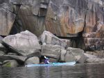
Somewhat reluctantly we left our relaxing lunch spot to tour the amazing rock formations of Open Bay. We made a note to plan a club tour with a local geologist to learn more about the fascinating geological history of this area.
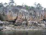
With the wind rising, we headed directly back to Hyacinthe Bay, admiring the cliffs of pillow lava as we rounded the point. Some members spotted the route they took on an earlier club hike over Hyacinthe Ridge.

Route: Hyacinthe Bay (Len Road) to Open Bay and return
Total time from put-in to return: 4.5 hours (10 am – 2:30 pm)
Number of participants: 7
Winds and Sea state: light to moderate winds, 5 – 15 knots; slight ripples to low waves
Weather: sunny, warm, 23C
Trip Coordinator: Valerie van Veen

Kayaking Hyacinthe-Open Bays 7 July 2013

(click on photos to view larger)