This was supposed to be an easy start to the camping season, spending a few days at the Main Lake Provincial Park. But the weather forecasters didn’t cooperate. Instead of early summer, we were given early spring. Looking on the bright side, there were no crowds. Actually the weather turned out better than expected. No rain at all, warm enough during the day. We did postpone the trip by two days to avoid the atmospheric river.
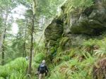
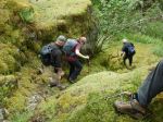
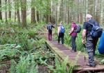
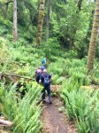
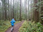
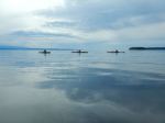
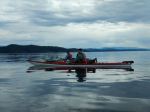
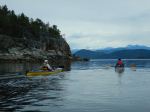
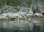
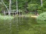
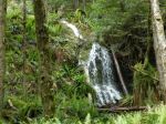
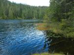
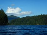
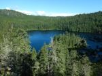
Saturday – First surprise – the lake level was far higher than expected, higher than we had seen it during the winter. It’s been a rainy spring. We paddled 40 minutes (3.4 km) to Howard’s campsite and set up the camp. We then paddled another 10 minutes (0.5 km) to the Bay campsite and changed into hiking boots. We followed the stream up from the campsite to a small lake and back (3.6 km; 3¾ hours). There are some very nice waterfalls along the way and some impressive trees. We now know that the best route on the upper section is between the stream and the canyon wall on the east. For the lower section it’s not clear what the best route through a flat boggy area is. Then a 10 minute paddle back to camp for a relaxing evening.
(click to enlarge photos)
-
-
Arriving at Howard’s with high water
-

-
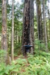
Big cedar
-
-
-
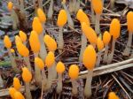
Bog beacons (mitrula paludosa)
-
-
Unnamed lake
-
-
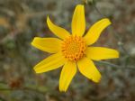
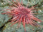
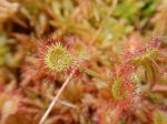
Sun dews
-
-
Canyon wall
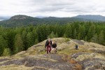
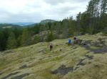
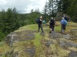
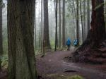
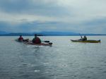
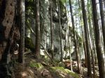
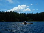
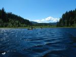
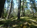
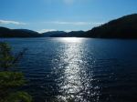
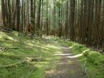
Sunday – The wind shifted to northwest. We were joined by Les for the day. We paddled over to the channel between Main Lake and Little Main Lake and through the willows. Where Stramberg Creek joins Shadow Brook Creek, we decided to land, have lunch and stretch our legs since it was windy on Little Main Lake and there were few places to get out of the kayaks. We explored where there used to be squatters.. The very high water levels made it easy to get through to Little Main after lunch. In the lake we saw a beaver swimming . We paddled back to Main Lake, parted with Les and returned to Howard. (10.5 km; 3 hours) Later in the afternoon we hiked up the ridge north of the campsite, which has steep cliffs on the east and west. This was a pleasant hike through open forest with some big trees and views. (2.0 km; 1½ hours) It was still windy through the night with a super almost-full moon.
-
-
-
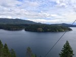
Main Lake
-

-
Channel in the willows
-

-
Submerged water lily
-
-
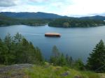
Little Main Lake
-

-
Beaver
-
-
-
Ridge above Howard’s
-

-
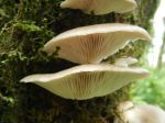
Oyster mushroom
-
-
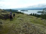
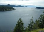
View east of Main Lake
-
-
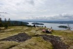
View west
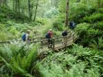
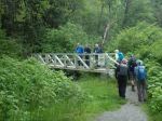
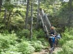
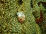
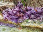
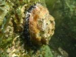
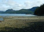
Monday – We packed up the camp and paddled to East Beach campsite. (1.3 km; 20 min) We changed to hiking boots for a hike to Yeatman Bay on Okisollo Channel. The stream was a problem to cross, so we used an old logging bridge a bit up from the campsite. At the Bay, it was a very low tide, so took the opportunity to we walk out to what is often an island and back to the campsite for lunch (3.6 km; 1½ hours), and then paddled back to the Mine Lake boat launch. (4.0 km; 1 hour). As we began to drive home, the rain started.
-
-
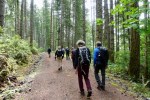
Trail to Yeatman Bay
-
-
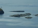
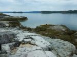
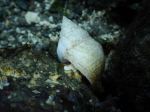
Yeatman Bay at low tide
-
-
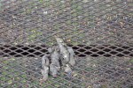
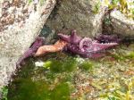
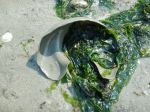
Moon snail egg case
-
-

-
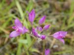
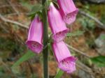
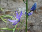
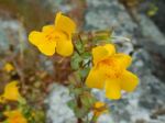
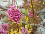
Sea blush
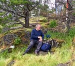
Norris
Multi-day paddling, hiking, camping – Main Lake Prov Park – 11-13 June 2022