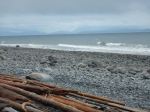
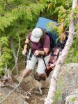
Fabulous. But first you have to get there. Everybody know that getting there is half the fun (and getting back is the other half). It’s reputation proceeded us, notably the bad road and the steep trail. The Alpine Club site said a 4×4 was required for the Marion Creek logging road, and others discussed whether high clearance was needed. The logging road in is only 10 km, but most of it is quite rough. We only expected the last part to be rough. But there are a number of steep sections, right from the start, and those are always the worst. We met a car coming out and they had parked before the last hill and walked the last 2 km. So that’s what we decided to do. As it turned out, the last 2 km were not that bad, or at least not any worse than the first part. The vehicles driving in were either 4x4s, pickups, or beaters.
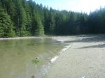
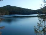
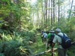
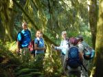
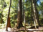
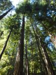
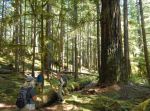
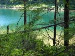
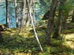
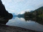
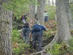
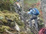
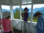
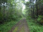
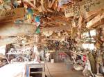
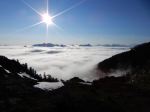
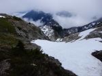
Day 1: The trail isn’t that bad — for the first 300 m, as it goes up through a logged section. After that, it’s just a path and it goes straight uphill. No switchbacks. It’s not walking. It’s more like climbing stairs and ladders, on rocks and tree roots. It’s rough, but it’s not bushwacking. It is steep. There are two short stretches where a rope aid is provided. We were climbing in the cloud and it was misty, wet and muggy. We reached Cobalt Lake, but it was shrouded in the fog. After that it was a short climb to the hut, also in the cloud. The hut is very nice. There was only our group of six the first night, so it was very spacious. It has a wood pellet stove and solar panels and LED lights. It seems to be very well insulated, so it was quite warm. Everything is very well thought out and it is extremely well equipped. Then in the evening, the surrounding peaks started to emerge and the hut popped into the sunshine, above the clouds. That’s when we switched to feeling like the Greek gods on Mt. Olympus. We had a beautiful sunset. And the stars at night! No moon, so we saw the Milky Way and everything. (driving the road – 7.5 km; walking the road – 1.7 km, ½ hour; walking the trail – 3.3 km, 700 m elevation gain, 3½ hours) (Some others can do it faster)
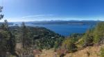
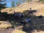
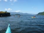
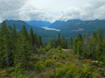
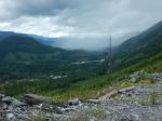
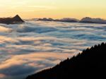
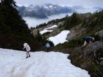
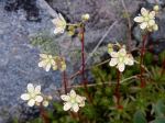
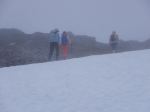
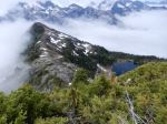
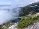
Day 2: Above the hut is some subalpine and then alpine with lots of rocky ridges to walk. We went to the top of the 5040 peak, as it was peeking in and out of the cloud and then to some minor peaks along the ridge. ( 4.1km, 344m elevation gain, 4¼ hours) The wildflowers were excellent and much ahead of schedule. The area looks great for further explorations with sufficient time. It’s quite steep in places, with some hidden cliff bands. Our walking was somewhat limited by the remaining steep snow bands and maps with insufficient contour detail. But some in our group ventured out on the ridge toward Triple Peak (2.6 km, 115 m elevation gain, 2 hours) and the short ridge beyond the outhouse (0.6 km, ¼ hour). Some returned to the summit after dinner, when the cloud level lowered and the views were clearer. (1.9 km; 220 m elevation gain, 1½ hours) The views are really impressive, with lots of nearby mountains like Nahmint and Klitsa as well as views as distant as the Golden Hinde. That afternoon two couples from Comox arrived at the hut and one of those couples got engaged on the 5040 Peak summit.
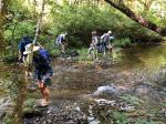
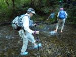
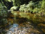
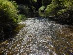
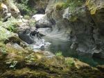
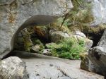
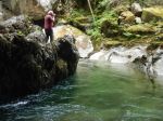
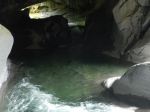
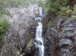
Day 3: The final day was for the descent. Nobody was really looking forward to that. Sometimes it is harder going down. We stopped at Cobalt Lake, which was beautiful in the morning light, but after that there aren’t any vistas. The trail parallels, close by, a stream with cascades, waterfalls and canyons for much of the way. The trail was slippery going down as it had been in the cloud for days. Poles are highly recommended. There is one point where the trail turns abruptly, around a big rock, and almost everybody misses that turn and continues straight down into the forest. They catch on sooner or later as the trail fades out. What you think of the trail to the hut will depend on your fitness, but Cobalt Lake, the hut and the 5040 alpine area make it all worth while.
Norris
Thanks to Norris and Stephen for the photos
(click on photos to view larger)
-
-
-
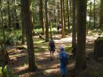
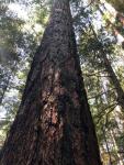
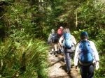
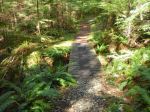
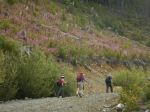
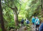
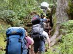
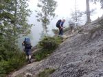
the steep trail
-
-
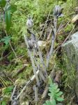
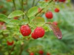
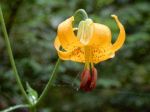
Tiger lily
-
-
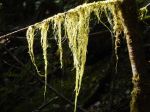
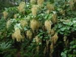
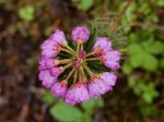
Heather
-
-
-
-
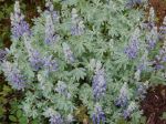
Lupine
-
-
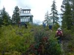
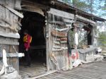
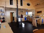
the new ACC hut
-
-
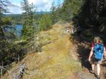
Triple Peak
-
-
-

-

-
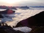
Day 2 view from hut
-
-
-

-
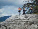
the summit group
-
-
-
-
-
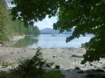
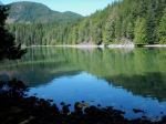
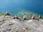
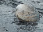
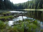
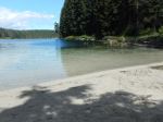
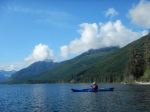
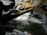
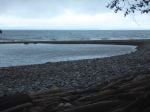
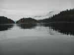
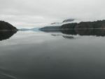
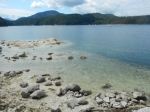
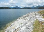
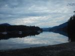
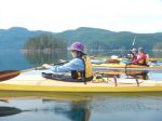
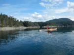
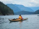
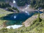
Cobalt Lake
-

-
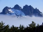
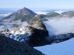
5040 Peak and the hut
-
-
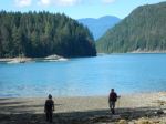
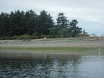
looking toward Nahmint Mtn
-
-
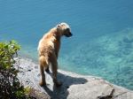
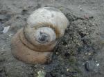
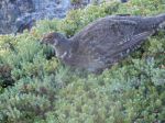
Grouse
-
-
Triple Peak
-
-
-
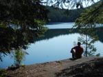
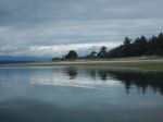
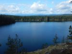
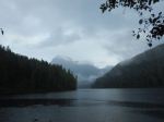
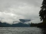
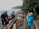
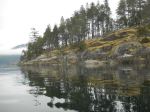
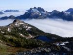
Cobalt Lake
-

Multi-day Hiking – 5040 Peak – 22-4 July 2019