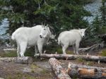
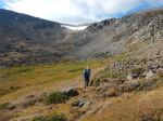
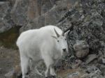
Five of us went to Cathedral Lakes Provincial Park in early September, in spite of two evacuations in August due to wildfires. When we arrived in Keremeos the back burn, right at the edge of town and close to the Cathedral Lakes access road, was very dramatic. Les went up a day early, checked into the Lodge, explored the four nearby lakes, and enjoyed the hot tub. The rest of us were driven up the steep, rough road to about 2,000m on Thursday morning. No one traveled in the famed unimog. Each day dawned fairly clear and then summer clouds developed around noon, which was consistently better than the forecast. The campground was nearly empty of people, but we saw Mountain Goats wandering through almost every morning.
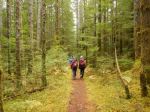
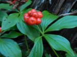
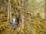
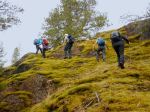
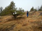
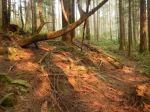
After the four of us set up camp on Thursday on the edge of Quiniscoe Lake, we hiked around Scott Mountain on the Diamond Trail. This was a great introduction to the beautiful alpine meadows, the larch groves and open alpine ridges, on a relatively easy trail. Although the vast majority of the flowers were past, there were a few persisting into September. This was our smokiest afternoon. We had close encounters with Pica and Marmot on this hike. 8.9 km; 3½ hours; 300m total elevation gain.
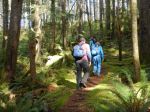
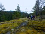
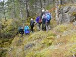
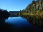
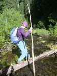
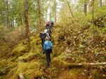
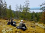
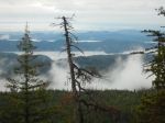
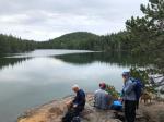
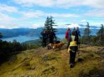
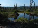
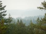
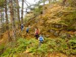
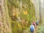
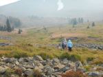
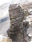
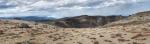
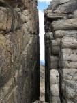
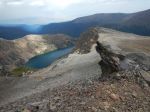
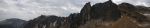
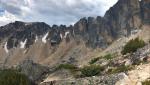
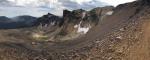
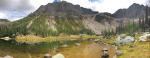
The following day, Friday, was our most ambitious hike, starting out to the beautiful, alpine Glacier Lake and then hiking up steeply to the rim. Once on the rim there are great views, although it wasn’t completely clear, and the hiking is quite easy. We could see that there were forest fires everywhere around us, but not immediately threatening. There are great geological features along the rim: the Devil’s Wood Pile of columnar lava, the Stone City with weathered and decomposing granite, and the Giant Cleft, a narrow, vertical gap in the cliff face. After visiting these, we returned to the Stone City and descended to Ladyslipper Lake. The trail down is steep, and in some places unconsolidated. Nearer to the Lake the trail passes through great boulders and larches. Ladyslipper Lake is lovely and the visitors who were fishing found it easy to catch trout there. 14.6 km; 8¼ hours; 500m elevation gain (to 2,600m), but more much total gain with undulations on the rim.
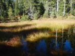
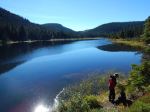
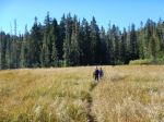
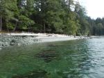
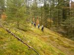
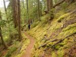
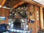
On Saturday, we had a more gentle, but extremely beautiful hike to Goat Lake. We hiked down the switchbacks to Goat Creek and then followed the trail up to the Lake. The creek and the lush vegetation along it were lovely. Goat Lake is a beautiful alpine lake surrounded by larches, with a small beach fed by a gully of decomposed granite, and backed by the cliff wall of Grimface Mountain and the rim. We all had dinner in the Lodge Saturday evening. The food, company, and fire in the fireplace were all very congenial. 12.3 km; 5 hours; 450m total elevation gain.
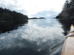
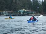
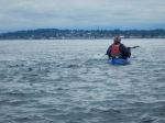
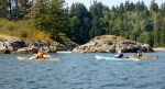
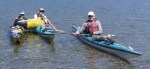
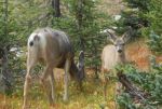
On Sunday, Les and Diana paddled on Quiniscoe Lake in the morning and hiked the lake tour to Lake of the Woods, Pyramid Lake and Glacier Lake in the afternoon. The rest of us hiked up above the waterfalls which flows into Quiniscoe Lake and up the steep, unconsolidated route to the rim. From there it was an easy hike up to Quiniscoe Mountain (2551m). It was cool and breezy, but we were entertained by a Mountain Goat wandering by. We descended to Glacier Lake, where there were some photogenic deer, before continuing on and exploring Lake of the Woods. 11.2 km; 5¼ hours; 600m total elevation gain.
The weather became very cool and rainy toward evening and we once again retreated to the Lodge for Les’ excellent fire in the fireplace. It rained quite a bit overnight, but the forecast snow didn’t materialize (just a few flakes). In the morning, the sun came out, we broke camp with wet tents, and made the trip back down the rough road to Keremeos.
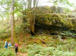
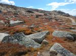
This is a spectacular area, with exceptional access to alpine scenery provided by the shuttle up the hill. It’s sad to see the devastation that the Spruce Bark Beetle has caused in this forest, but the biodiversity in the alpine meadows is wonderful. It would be lovely at a variety of seasons: earlier the flowers would be out and latter the larches would be golden.
Debbie
Thanks to Norris, Les and Diana for the photos.
(click on photos to view larger)
-
-
Backburn at Keremeos
-
-
Lodge fireplace
-
-
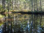
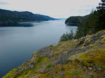
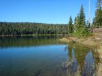
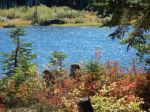
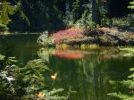
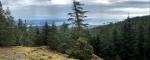
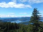
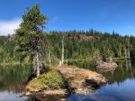
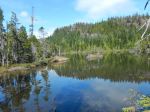
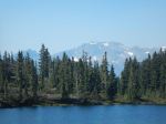
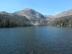
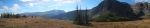
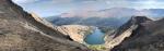
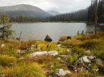
Quiniscoe Lake and Mountain
-
-
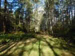
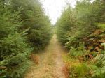
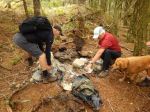
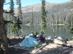
Campsite
-
-
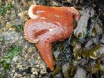
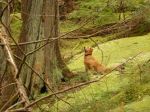
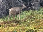
Mule deer
-
-
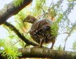
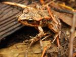
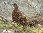
Grouse
-

-
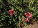
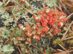
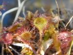
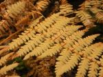
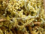
Lupin
-
-
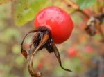
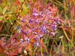
Fireweed
-
-
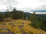
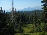
Alpine meadow in wildfire smoke
-
-
-
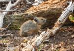
Pica
-
-
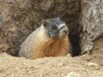
Marmot
-
-
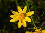
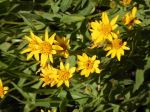
Arnica
-
-
Rim above Glacier Lake
-
-
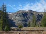
Pyramid Mountain
-
-

-
Above Glacier Lake
-

-
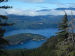
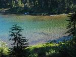
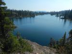
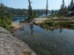
Glacier Lake
-
-
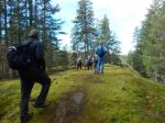
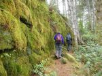
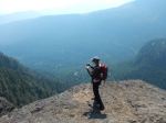
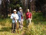
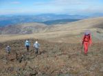
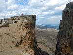
Hiking on the rim
-

-
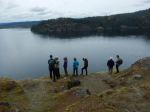
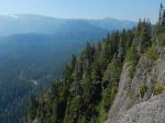
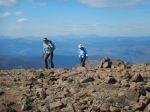
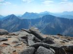
Views from the rim
-
-
-
-
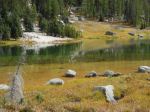
Ladyslipper Lake
-
-
Devil’s Wood Pile
-
-
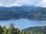
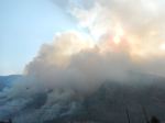
Wildfires in the distance
-
-
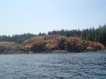
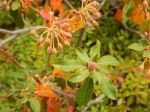
Fall colour near Stone City
-
-
-
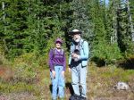
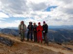
Near Smokey the Bear
-
-
Giant Cleft
-
-
Ladyslipper Lake
-
-
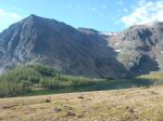
Grimface Mtn & the rim cliff
-
-
Cliff with the Cleft
-
-

-
Mountain Goats
-
-
Mountain Goats
-
-
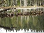
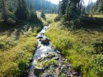
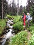
By Goat Creek
-
-
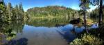
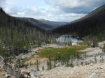
Goat Lake
-
-
Goat Lake
-
-
Goat Lake
-
-
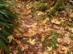
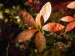
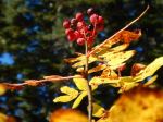
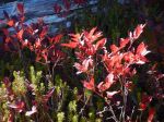
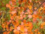
Fall colours
-
-
-
Arnica
-
-
-
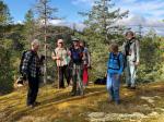
Above Quiniscoe Lake
-
-
Mountain Goat on the rim
-
-
Mule Deer near Glacier Lake
-
-
-
-
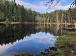
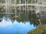
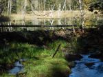
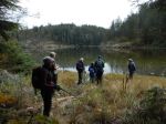
Lake of the Woods
-
-
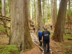
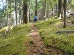
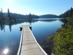
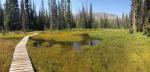
Boardwalk near Lake of the Woods
-

-
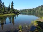
Quiniscoe Lake
-
-
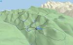
Our tracks over four days
Multi-day Hiking – Cathedral Lakes Prov Park – 6-10 Sept 2018