Trip Photos – Deepwater Bay – 1 May 2014

Started off the month of May with great weather and an adventurous hike. We were headed to Deepwater Bay via the old logging road but decided to take time out to look for the old logging train trestle. Debbie, Norris and Les had looked for this before but to no avail. It seemed that everyone we had talked to had not been there in a few years back and you know how memories are. This time though we found it, much to our pleasure. There is not much left but sure leaves you with a great appreciation for old engineering skills. It was quite a feat to cross that canyon and the old pilings give you an idea of the immense size.

We then walked down the old part of the logging road to Deepwater Bay. There are old remnants of a land based fish farm there. We had lunch by a small creek and enjoyed the sun. The hike back up was harder but it is not far and well worth the time.

(click on photos to view larger)

Hike Deepwater Bay 1 May 2014

Trip Photos – Maud Island 31 Mar 2014

The weather could not have been more perfect for our hike to Maud Island. It was a beautiful spring day with plenty of sunshine. We reached Seymour Narrows just before a maximum current of 14.1 knots. It was like a roaring river, complete with whirlpools and back eddies that sea-lions were playing in.

On the return trip we went over Mt. Lolo. This proved to be a bit of an adventure as the trail is not marked as well from that direction. We were rewarded with bright sunny views though.

(click on photos to view larger)

Hiking Maud Island 31 Mar 2014

Trip Photos – Ripple Rock – 19 March 2014

Although the day dawned dark and rainy, the weather was great by the time we started down the trail around 11:00.  The group enjoyed the walk on this well constructed, undulating trail including stairs and a swinging suspension bridge.  Points of interest along the way include a few excellent old growth trees, lush mosses and ferns, an old corduroy road, a few creeks, the view point over Menzies Bay from a rocky bluff, the sandy beach at Nymphe Cove and budding fawn lilies.  After the final push up the hill and stairs to Wilfred Point, the group was rewarded with great views of Discovery Passage and a warm and sunny lunch stop.   There were sea lions and seagulls feeding in the current. The area is steeped in the history of early logging and the major efforts made to blow up Ripple Rock in Seymour Narrows to improve the safety of navigation through those waters.  When we arrived the ebb was running about 7 knots.  Although it can run more than double that speed, the turbulence was quite impressive.  The hike, round trip, is 8 kilometres.

(click on photos to view larger)

Hiking – Ripple Rock 19 Mar 2014

The Ripple Rock explosion was 9:31 a.m. on 5 April 1958.  The Museum at Campbell River is offering a hike to this lookout to commemorate the 56th anniversary of the explosion on April 5, 2014.  Cost is $20, register with the museum at 250-287-3103.


Trip Photos – Stramberg Trees 12 Feb 2014

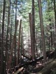
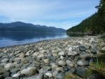
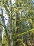
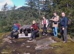
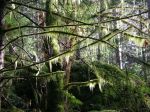
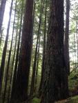
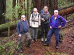
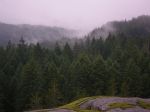
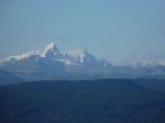
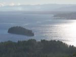
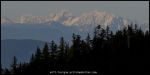
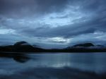
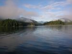
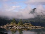
The weather was great for the walk to the Stramberg big trees.  The forest in general, and the old growth trees in particular, were a pleasure.  It’s a long, but rewarding walk, as long as you don’t mind full forest, minimal trail and serious route finding.  Allow at least two hours each way and allow some extra time for getting lost.  13 km round trip.

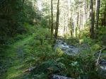
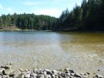
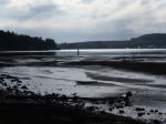
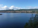
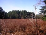
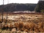
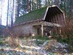
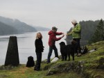
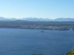
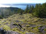
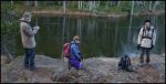
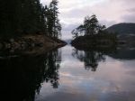
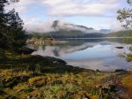
The trail can be divided into three sections.  From the start, the small parking area on the left just before Village Bay Lake, take the path which starts along the stream; don’t take the gravel road which goes uphill to a gate. The hike begins on a good trail along the edge of a very open forest with marshes and ponds on the left. There was good sunlight with the maple leaves gone.  Keep going past an abandoned cabin with old fencing.  At the end of this section the path gets smaller and passes by a mossy rock overlook of a pond.

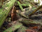
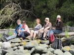
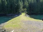
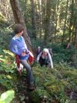
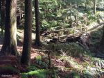
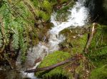
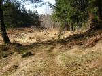
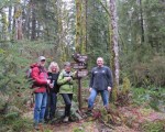
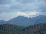
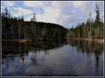
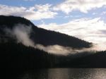
Section two. From here the path gradually turns north and enters into Main Lakes Provincial Park.  The trail is flagged except for some parts where a flat, wet area is full of fallen trees. For those taking it in the summer, it might be hard to find because of salal growth.   There is one trail junction.  Left is flagged and might lead to Stramberg Lake after a stream crossing. Right, the trail follows the east side of a stream, but on a bank or old roadbed which keeps it out of the wet.  For us, the trail had some snow cover.  The trail is a bit overgrown in places, until it becomes heavy bush and it is no longer possible to follow the old road.  At this point we had lunch at a sunny opening at a creek.

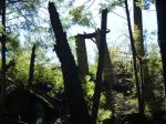
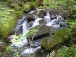
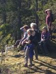
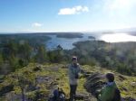
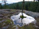
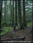
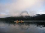
Section three. Where the trail seems to end, look left for an easy place to jump over the stream.  There was no flagging for this turn.  The trail then goes up the hill a bit to a more open forest and the big trees.  For a trail that has not been maintained in some time, there is less brush and blow-down than you might expect. The route is mostly well flagged, but there are a number of places where it would be easy to get lost.  GPS and map highly recommended, preferably already loaded with a route to follow.

Hiking Stramberg Trees 12 Feb 2014

(click on photos to view larger)

Trip Photos – Rousseau Ridge – 1 Jan 2014

Not every trip has fantastic weather, but often it’s worth going anyway.  This trip did not have a predetermined destination.  The decision in the parking lot was to go to Rousseau Ridge from the North Gowlland Road side.  This is a short walk to a rocky bluff with great views of Discovery Passage, when it’s clear.  There is a bit of scrambling to get to the top.  It didn’t even rain.

Hiking Quadra 1 Jan 2014

(click on photos to view larger)

Here’s a link to a nice photo on a nicer day (5 Jan 2011)
http://www.pbase.com/henryimages/image/131627675

Here’s a link to a trail description
http://www.trailpeak.com/trail-Heriots-Ridge-near-Campbell-River-BC-3072

Trip Photos – Maud Island – 16 Jan 2014

The weather was foggy with a bit of drizzle but warm for January.  From Mt. Lolo we had a good view of Menzies Bay but not much further.  While stopping for lunch on the cliffs of Maud Island we were able to watch sea lions below.  The round trip took four hours.

Hiking Maud Island 16 Jan 2014

(click on photos to view larger)

Trip Photos – Blindman’s Bluff – 18 Dec 2013

The weather was clear and breezy for the impromptu walk to Blindman’s Bluff.  This short walk through open forest and rocky, mossy bluffs provided excellent views.  The lunch stop was brief due to the cool temperature.  Only 2.5 km.

Peter Smith cartoon

(click on photos to view larger)

Trip Photos – Nugedzi – 4 Dec 2013

We took advantage of the weather for an impromptu hike up to Nugedzi.  The plan was to go to the Overlook, but the group was keen for more, so we continued up to the Lakes for lunch and then on to the Discovery Passage Overlook.  There were lots of unusual ice crystals on the lakes and ponds.  The full tour with lunch was four hours.


(click on photos to view larger)

Trip Photos – Beech Mtn – 20 Nov 2013

This trip to Beech’s Mountain was called on short notice because of a forecast for perfect weather.  For once the forecast was right and it was gorgeous.  The sun was warm, the air cold and still.  The group hiked up to the big overlook in a bit over an hour, where progress slowed for serious photo opportunities.  We continued on to the summit for views to the west and lunch.  Round trip from the Heriot Bay parking lot was four hours.

(click on photos to view larger)

Trip Photos – Kayaking Octopus Islands 21-23 Sept 2013

By Darcy Mitchell

A three day camping trip to the Octopus Islands Marine Park was thwarted by poor and deteriorating weather forecasts.  As the weekend approached, it looked as if Saturday and Monday would both be possible, but the day in between promised to be truly ghastly.  And it was.  In the end, two club members took a day paddle from the Discovery Islands Lodge through Whiterock Passage to North Rendezvous Island on the Saturday.  Conditions for paddling were excellent.  The narrow passage with range markers was interesting and views from the Rendezvous Islands toward the mainland inlets were awesome.  On the return, there were Pacific white-sided dolphins playing at the west end of the passage. (23 km; 5½ hours)

After waiting out the Sunday deluge, three of us spent the night at the Lodge to make the early morning slack at Surge Narrows.  We paddled through with no trouble at 7:45 and spent the next six hours in a delightful trip to, and around the Octopus Islands.  The weather was calm and sunny, and the area almost deserted.  Just us, one sailboat, two kayak campers, the birds, the leaping salmon, and the seals.  We explored a few campsite options for next season and visited “Wilson’s cabin” – a venerable wooden structure festooned with mementoes of visiting boaters, where we left an offering given to us by Beth, Lodge host (a gorilla sitting on a small boat labeled “Quadra” – created by whom, and why, who knows?). With the exception of one quick shower as we approached the narrows on our return, the weather was perfect and day a great success.  We’re sorry that some of the usual paddling suspects were hors de combat with injuries or otherwise unavailable, and look forward to a return visit next year (with camping!!). (25.5 km; 7 hours)

Kayaking Octopus Islands 21-23 Sept 2013


(click on photos to view larger)