Hike – Chinese Mountain – 22 Mar 2017

 POSTPONED

Activity Hiking
Destination South and North Chinese Mountain
Date 22 March 2017 Wednesday
Trip Coordinator Les Hand
Contact Info 285-2029.  Please contact the coordinator in advance of the trip.
Description We will go up the south side to South Chinese Mtn. and have lunch while enjoying the view. Then down the north path and up North Chinese Mtn. and back to the vehicles.
Meeting Place Heriot Bay Store parking lot for car pooling
Departure Time 10:30
Difficulty
Moderate, but up and down
Costs none
Trip limits none
Dogs? No, as trail is narrow in spots.
Notes: It is only 3.4 km around South Chinese so we will go up north as well. Not everybody has to do both.

Hiking – Thompson & B&B Trails Loop – 15 Mar 2017

Activity Hiking
Destination Thompson & B&B Trails Loop
Date 15 Mar 2017, Wednesday
Trip Coordinator Janis McLean
Contact Info 285-3614; please contact the coordinator in advance of the trip.
Description This hike will include official trails, flagged routes and unofficial trails.  The loop will pass over rocky bluffs with views, follow along creeks and travel through undulating forest.  There are a variety of options depending on the interests of the group, including Rousseau Ridge.
Meeting Place Trailhead for Thompson Trail on Thompson Rd.
Departure Time 9:30
Difficulty
moderate
Costs none
Trip limits none
Dogs? okay
Notes: Bring lunch, a pole and gear for weather


Hiking – Eagle Ridge Loop – 8 Mar 2017

Activity Hiking
Destination Eagle Ridge Loop
Date 8 March 2017, Wednesday
Trip Coordinator Norris Weimer
Contact Info 285-3710 or norris.weimer@ualberta.ca.  Please contact the coordinator in advance of the trip.
Description This hike will include the official trail to Eagle Ridge and an unmarked route descending the ridge and continuing on to the higher ridge to the north.  From there we will descend to the logging road and return to the vehicles. The descent from Eagle Ridge is very steep on mossy rocks.  There is no trail.
Meeting Place Heriot Bay store parking lot for car pooling.
Departure Time 10:00
Difficulty
The section up to Eagle Ridge is a maintained trail of moderate difficulty.  The descent from Eagle Ridge is challenging.  The segment to the next ridge and down to the logging road is on an  unmarked route through mostly open forest.
Costs none
Trip limits none
Dogs? Depends on the dog.  Would need to be completely controlled during the descent.
Notes: Bring lunch and gear for weather.

Hiking – Kay Dubois & Fox Main Loop – 1 Mar 2017

Activity Hiking
Destination Kay Dubois and Fox Main Loop
Date 1 March 2017, Wednesday
Trip Coordinator Julie Mellanby
Contact Info 285-3978.  Please contact the coordinator in advance of the trip.
Description This hike will be a loop including the Kay Dubois trail and some of the logging roads in Dick Whittington’s woodlot.  There are some hills and wet places, but mostly easy walking.
Meeting Place Kay Dubois trail head at the south end of Wa Wa Kie Rd
Departure Time 9:30
Difficulty
Easy
Costs none
Trip limits none
Dogs? okay
Notes: Bring gear for the weather and maybe a snack.

Trip Report – Mt Washington – 8 Feb 2017

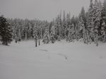
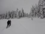
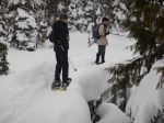
Three of us snow-shoed at Mt. Washington on Wednesday. The clouds were low, but the snow was excellent. It was absolutely a winter wonderland, with snow clinging to branches and bark in the forest. We crossed Paradise Meadows on the Old Cabin and Crooked Creek trails before taking the summer trail up to Battleship Lake. The trail had been well used, so it was easy to follow. It was completely quiet in the forest and we met very few people. We continued over the Lake and through the forest to Lake Helen Mackenzie. The steep descent was great in the deep powder. We crossed some of the Lake and then had lunch in a sheltered spot out of the wind. Around 1:00 it began to snow lightly. We returned to Paradise Meadows and completed the Old Cabin Loop. 8.1 km; 3 hours.

Debbie

(click on photos to view larger)

Snow – Mt Washington 8 Feb 2017

Natural History – Karst Formations – 22 February 2017

 Postponed to 5 April 2017

Activity Natural History
Destination Quadra’s karst formations
Date 5 April 22 February 2017, Wednesday
Trip Coordinator Norris Weimer
Contact Info 285-3710 or norris.weimer@ualberta.ca; please contact the coordinator by Sunday if you are interested in going
Description Visit some of Quadra’s Quatsino limestone formations, an area which contains karst sinkholes, intakes, resurgences and underground streams.   We will visit two or three areas, which involves a bit of driving on logging roads and bush walking.  We will not be walking in caves.
Meeting Place Heriot Bay store parking lot for car pooling. High clearance vehicles will be preferable.
Departure Time 9:30
Difficulty
Easy to moderate
Costs none
Trip limits none
Dogs? no
Notes: Bring lunch and gear appropriate for the weather.  Also, bring a flashlight to see into these geological formations.

Trip Report – Salmon Pt to Oyster River – 24 Jan 2017

Six of us met at Salmon Point Resort for lunch at noon. This is something we had not tried before but was a good social outing. If you have not tried this restaurant you should. It has a great view to Mitlenatch Island and the coastal mountains beyond. They have lunch specials. Their seafood chowder in a bread bowl as well as the calamari is delicious.

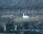
After lunch we walked from the resort to the Oyster River. This time of year the trail head can be covered with water but the resort lets the public go through the trailer park sites. Dogs must be leashed. The low land at the first of the walk is a great place to bird watch. We saw many birds, ducks and some trumpeter swans. Last summer much of the trail was moved closer to the ocean and covered with bark mulch. At the south end you go into the Oyster River Nature Park. It is only a 12 acre park but has many small trails. Be careful near the river as part of the path was eroded during the heavy rains. If it is a cold day or you want a break you can stop at the Fisherman’s Pub. We returned to the vehicles via the same route. It was about 6.5 km and took 2 hours.

Les

(click on photos to view larger)

Hiking – Salmon Pt to Oyster River – 24 Jan 2017

Hiking – Maud Island- 15 Feb 2017

 This trip is postponed to 25 Feb, Saturday

Activity Hiking
Destination Maud Island
Date 25 15 Feb 2017, Saturday Wednesday
Trip Coordinator Les Hand
Contact Info 285-2029.  Please contact the coordinator prior to the trip.
Description Hike to Maud Island to view Seymour Narrows at a 11.4 knot ebb tide at 10:07. We may go over Mt. Lolo on the way back and the lower route going in. Total distance about 10.5 km
Meeting Place Heriot Bay Store for car pooling
Departure Time 9:00 am
Difficulty
Moderate
Costs none
Trip limits none
Dogs? Only if they do not go back and forth among people.
Notes: Bring lunch.

Trip Report – Morte Lake & Dead Fish – 18 Jan 2017

The trip to Salmon Point was postponed due to rain, wind and fog on Wednesday morning. Having rained more than 50mm in the last two days, it was really wet out. However, five hardy souls decided to substitute a more sheltered walk and headed out. We walked to the eastern beach at Morte Lake. The trail was quite wet and has seen some erosion with the winter rains. All of the creeks and waterfalls were very active. The group was keen to continue so we walked around the east end of the Lake, hiking up Nirvana and Seven Deadly Sins to the open bluff. We had a watercolour view from there of nearby hills and Discovery Passage before heading down Dead Fish to make a loop returning to the vehicles. This is a lovely walk through open forest, including lakes, creeks and views. The rain diminished and there was a bit of blue sky by the time we finished. 7.3 km; 2½ hours.

Debbie

(click on photos to view larger)


Trip Report – Haskin’s Farm Loop – 11 Jan 2017


We had a beautiful, sunny, cold day for this hike to Haskin’s Farm. We had planned for a simple walk due to snow and ice on trails and roads. However, conditions near sea level were quite good. Seven of us improvised a bit on the plan. We started on the logging road which parallels the Haskin’s Farm Trail, making a nice alley through impressive trees, but skipping the farm. We visited the short Todd’s Loop Trail (a memorial to Todd Scharf), passing through a varied forest, and then continued on to the shoreline viewpoint. Everyone admired the view of Sutil Channel and mainland mountains, soaked up sunshine and warmth before continuing on the unofficial trail heading north along the shore to some excellent old growth Fir. We skirted the private homes and walked up to the golf course for some walking in open spaces with sunshine. 6.4 km; 2 hours.

Debbie

(click on photos to view larger)

Hiking – Haskin’s Farm Loop – 11 Jan 2017