by Will LaVigne (willlavigne@hotmail.com)
Is there such a thing as a perfect hike?
On any hike you can adjust to the people you are with, on any hike you can get away without eating for a couple of days but you need water constantly. This was a perfect hike for access to clean, delicious water. I used a 600 milliliter water bottle without it ever being empty even with the 33 Celsius temperatures.
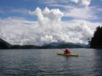
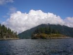
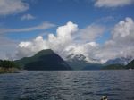
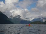
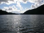
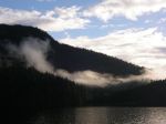
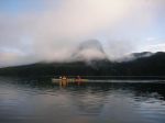
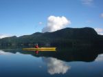
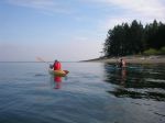
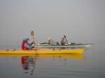
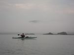
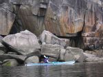
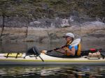
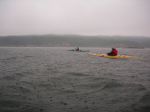
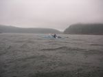
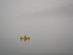
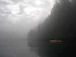
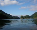
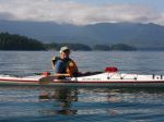
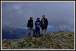
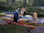
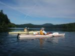
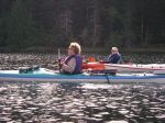
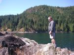
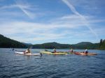
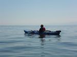
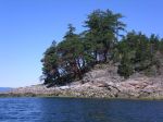
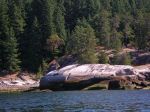
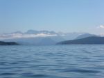
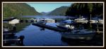
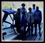
Debbie, Joyce, Norris and I met on the 6:15 am ferry to confer, confirm and congratulate each other for making the ferry to get a great start to our hiking adventure. We were heading to Port Alberni then north to Great Central Lake Marina and Resort to meet up with Ben Potter of Della Falls Watertaxi Services by 9am. We were joined by Mike from Nanaimo who booked at the last minute. It turned out he was a nice guy and a perfect compliment to our group for the rest of the adventure. Ben Potter took us up to the trailhead at the other end of the lake and over the one hour boat ride he gave us some tips and some history of the Della Falls trail. As well he showed us some of the highlights of Great Central Lake. A heads up to any fish-o-dites, good fishing on this lake.
Before I go any further I want to say that there is accurate and concise info on the internet and from other hikers about this hike. As well there are other routes that can be done. The Comox Valley Mountaineering Club went to Della Falls on the Aug. 5th weekend and Ken Rodonets wrote up a report that is posted on their webpage. Ken talked to me about Della Falls a month before and two days after his hike to Della Falls. This helped me a lot as it was a 15 km hike one way with an elevation gain of “300 meters”, Norris measured it at 500 meters gain on his GPS.
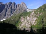
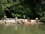
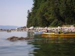
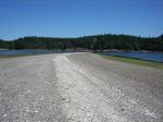
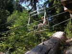
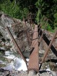
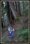
So…the dock at the trailhead is about 30 ft long and the walk up to the shore has you looking at about 12 or 14 tent pads spread out. Latrines, food cache, board maps, canoe/kayak rack and picnic tables, benches were there as well. We headed out along an old logging road that was in good condition for about 2 hours to Margaret Creek Campsite and bridge. The water was fast flowing down the middle, spectacular and with small, clear, sparkling pools on the side calling out to Mike to go for a dip. He did. We had lunch and decided to continue on rather then camp here as it was 12:30pm. We knew we had 2 hrs of hiking to the cable car crossing bringing us to about 11.3 km into the hike. For me this was the hardest part as it was very hot and the trail was a steady incline to the cable car. We were able to get to water on either side of the creek at this crossing, which to me was more like a small river and shade was found on either side of the crossing. The easy availability of water helped huge on this hot day. From here we had a little over a kilometer to get to two metal bridges. The terrain was varied from packed down trail to picking your way through dry creek beds and some of the trail being overgrown. Due to having detailed intel we knew that the campground was only 1.5 hrs away from the metal bridges, getting excited to drop the pack off my back. Through most of the hike I could hear the steady stream of Drinkwater Creek tumbling over the rocks. About 1 km from the first campsite there is a fantastic sandy campsite beside the creek with room for two-three tents. There are two perfectly spaced apart trees that calls for a hammock. 3/4’s of hour later some of us arrived at the lower campsite 7 hrs after starting from the lake and were joined by the remainder of the group within a half hour. The group snagged the last spot available as the next area is about a 10-15 minute hike away with no food cache or latrine.
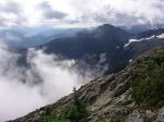
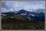
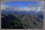
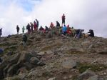
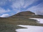
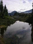
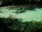
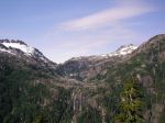
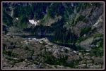
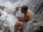
The next day, Aug. 10, we left for the view point of Della Falls along the Love Lake trail. It can be done within 1 1/4 hrs to 2 hrs. I thought the trail was pretty clear with about 8 blowdown trees to deal with and it was all switchbacks and steep but with a lighter pack it was good. Pole(s) or a stick works well coming back down. The view…well worth the journey and the best was yet to come. Twenty or so minutes away is Love Lake and what a surprise to see this little jewel tucked away out of sight. I was lucky enough to have it to myself for about 10 minutes, wherein I took a few dips into its cool embrace. Refreshing. Suddenly there were 13 other people arriving and a bunch headed to an 18ft boulder that was on the shoreline and proceeded to jump off it into the lake. Tres fun.
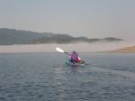
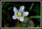
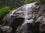
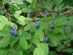
After getting back from that outing everyone went to the base of Della Falls on their own time. It is a twenty or so minute hike and you do pass the campsite that is closest to the base of the falls. Here there is a latrine and food cache. There is room for about 6 tents and worse case scenario a few more could go at the trail signage area. I did have one expectation for the base of the falls and that was to see a pool of water but instead it’s the start of Drinkwater Creek. There were wild flowers and berries. Around the campsites there were lots of huckleberries and no signs whatsoever of bears. The return trip was started between 7:30am and 8am with the group spread out. Amazingly the return was done in 5-5 1/2 hours. I think this was due to lower temperatures with overcast skies and be able to look up and around helped. Whereas going up the looking was at the ground most of the time. That was my experience. Two of the group went for swim before we took off at 3:30pm on Ben Potters boat.
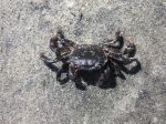
Birds seen by me: two adult and two juvenile grouse, chestnut backed chickadees, whiskey jacks and American dipper. On the trail: two old separate wolf scats and one fresh wolf scat, three slugs-two small black ones and large beige one, a couple of butterflies, bees on the wildflowers, wasps throughout the hike and there were moments of no black flies and mosquitos. There were 21 of us camping at the Della Falls area and two at the sandy beach. On our way down there were 18 people heading up. Most of the 21 were heading out on Sunday. This trail is popular and with that comes the variety that is the spice of life or hike.
Weather: Friday – hot, sunny. Saturday morning was sunny, hot and by afternoon it had cooled down, overcast and short period of drizzle of rain. Sunday – foggy, overcast, cool.
Would I do this hike again? Yes
Would I go with a group again? Yes
Would I recommend it? Yes
My favorite part was the water, drinking it and swimming in Love Lake.
cheers,
Will
Will has an album of photos from this trip. E-mail him and he will send you the link to it.
Backpacking Della Falls 9-12 Aug 2013
-
-
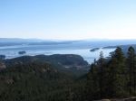
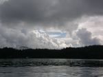
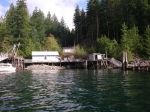
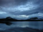
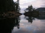
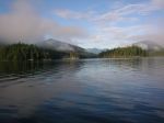
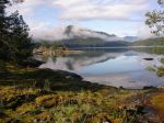
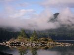
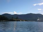
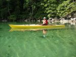
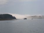
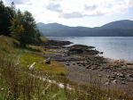
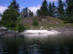
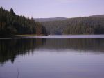
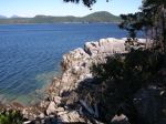
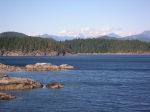
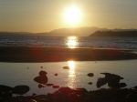
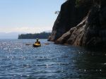
Great Central Lake marina
-

-
-
-
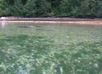
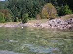
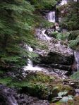
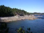
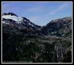
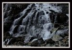
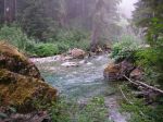
Drinkwater Creek
-
-
Margaret Creek
-
-
Cable Car
-
-
Metal Bridge
-
-
Love Lake trail
-
-
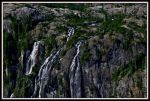
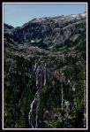
Della Falls
-
-
Della Falls
-
-
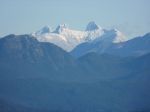
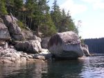
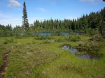
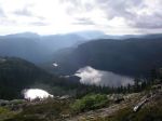
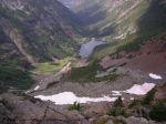
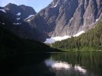
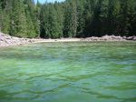
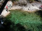
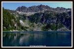
Della Lake
-
-
Della Falls
-
-
Della Falls
-
-
-
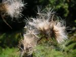
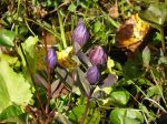
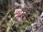
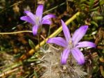
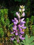
Lupin
-
-
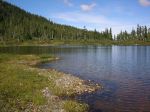
Love Lake
-
-
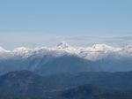
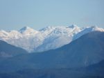
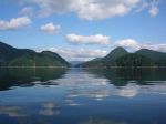
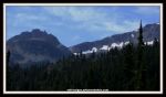
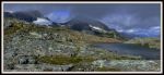
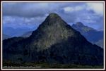
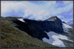
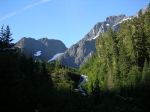
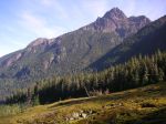
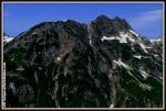
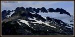
Nine Peaks
-
-
Della Falls
-
-
base of Della Falls
-
-
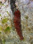
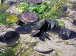
blueberries
-
-
Drinkwater Creek